Category:Turweston
Jump to navigation
Jump to search
English: Turweston is a village and also a civil parish within Aylesbury Vale district in Buckinghamshire, England. It is located in the north of the county, near the border with Oxfordshire and Northamptonshire, about a mile east of Brackley in the latter.
village and civil parish in Buckinghamshire, United Kingdom  | |||||
| Upload media | |||||
| Instance of | |||||
|---|---|---|---|---|---|
| Location | Buckinghamshire, South East England, England | ||||
| Population |
| ||||
| official website | |||||
 | |||||
Subcategories
This category has the following 2 subcategories, out of 2 total.
T
Media in category "Turweston"
The following 74 files are in this category, out of 74 total.
-
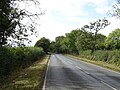
 A422 approaching Brackley - geograph.org.uk - 6283413.jpg 800 × 600; 177 KB
-
 A422 east approaching Grove Hill farm - geograph.org.uk - 2861943.jpg 640 × 522; 114 KB
-
 A422 towards Brackley - geograph.org.uk - 6283405.jpg 800 × 600; 144 KB
-
 A422 towards Brackley - geograph.org.uk - 6579347.jpg 1,024 × 684; 476 KB
-
 Another A43 roundabout - geograph.org.uk - 599133.jpg 640 × 378; 45 KB
-
 Approaching the bend in Ash Furlong Lane - geograph.org.uk - 4686605.jpg 1,024 × 768; 176 KB
-
 Barns by Oatley's farm - geograph.org.uk - 5912050.jpg 1,600 × 1,066; 321 KB
-
 Brackley-A422 - geograph.org.uk - 3027251.jpg 640 × 480; 88 KB
-
 Bridleway towards Turweston - geograph.org.uk - 6283403.jpg 800 × 600; 183 KB
-
 Cottage in Turweston - geograph.org.uk - 5646008.jpg 1,024 × 768; 264 KB
-
 County boundary on the Great Ouse - geograph.org.uk - 5917757.jpg 1,600 × 1,066; 510 KB
-

-
 Footbridge over the Great Ouse - geograph.org.uk - 6107008.jpg 1,600 × 1,066; 612 KB
-
 Footpath from Turweston to Whitfield - geograph.org.uk - 5645985.jpg 1,024 × 768; 197 KB
-
 Footpath through the solar farm - geograph.org.uk - 5912043.jpg 1,600 × 1,066; 389 KB
-
 Footpath to Grovehill Farm - geograph.org.uk - 6106988.jpg 1,600 × 1,066; 484 KB
-
 Footpath to Turweston - geograph.org.uk - 428370.jpg 640 × 480; 57 KB
-
 Footpath to Whitfield - geograph.org.uk - 5428864.jpg 1,024 × 768; 202 KB
-
 Footpath to Whitfield - geograph.org.uk - 5917841.jpg 1,600 × 1,066; 764 KB
-
 Footpath to Whitfield - geograph.org.uk - 5917858.jpg 1,600 × 1,066; 502 KB
-
 Footpath to Whitfield - geograph.org.uk - 5917866.jpg 1,600 × 1,066; 352 KB
-
 Former school and schoolmaster's house - geograph.org.uk - 4686835.jpg 1,024 × 768; 199 KB
-
 Gate on the footpath to Turweston - geograph.org.uk - 5645988.jpg 1,024 × 768; 334 KB
-
 Grazing horses at Turweston - geograph.org.uk - 5646017.jpg 1,024 × 768; 220 KB
-
 Grazing near Turweston - geograph.org.uk - 6283404.jpg 800 × 600; 112 KB
-
 Hawthorn in a brick box - geograph.org.uk - 5917851.jpg 1,600 × 1,066; 692 KB
-
 Hedge looking towards the airfield - geograph.org.uk - 5917861.jpg 1,600 × 1,066; 455 KB
-
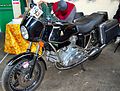 Hesketh V1000 black.jpg 2,607 × 1,970; 1.09 MB
-
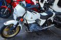 Hesketh V1000 white.jpg 2,804 × 1,864; 1.08 MB
-
 Hogpit Spinney - geograph.org.uk - 5912046.jpg 1,600 × 1,066; 406 KB
-
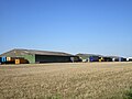
 Industrial units on Turweston airfield - geograph.org.uk - 5912051.jpg 1,600 × 1,066; 293 KB
-
 Industrial units, Turweston Airfield - geograph.org.uk - 4654788.jpg 1,024 × 768; 154 KB
-
 Industrial units, Turweston Airfield - geograph.org.uk - 4686595.jpg 1,024 × 768; 169 KB
-
 Industry meets leisure - geograph.org.uk - 2083843.jpg 2,048 × 1,536; 1.56 MB
-
 Leaving Brackley on A422 - geograph.org.uk - 2742913.jpg 640 × 446; 108 KB
-

-
 Oatleys Farm - geograph.org.uk - 4686723.jpg 1,024 × 768; 221 KB
-
 Overflying Whitfield - geograph.org.uk - 5503680.jpg 480 × 640; 78 KB
-

-
 Path along the course of the dismantled railway - geograph.org.uk - 6107016.jpg 1,600 × 1,066; 718 KB
-
 Path and stile - geograph.org.uk - 4686737.jpg 1,024 × 768; 425 KB
-
 Power lines across the fields - geograph.org.uk - 6106992.jpg 1,066 × 1,600; 350 KB
-
 Pylon by a path - geograph.org.uk - 5917854.jpg 1,600 × 1,066; 322 KB
-
 Pylons - geograph.org.uk - 428375.jpg 480 × 640; 51 KB
-
 Solar array, Turweston Airfield - geograph.org.uk - 4686590.jpg 1,024 × 768; 182 KB
-
 Solar Farm - geograph.org.uk - 5912042.jpg 1,600 × 1,066; 286 KB
-

-
 South Bank towards Turweston - geograph.org.uk - 6283411.jpg 640 × 480; 79 KB
-
 Spinney near Turweston - geograph.org.uk - 5912048.jpg 1,600 × 1,066; 406 KB
-
 Spinney north of Ash Furlong Lane - geograph.org.uk - 4686599.jpg 1,024 × 768; 205 KB
-
 St Mary's church - geograph.org.uk - 5917834.jpg 1,600 × 1,066; 421 KB
-
 St. Mary's church, Turweston - geograph.org.uk - 4686784.jpg 1,024 × 768; 185 KB
-
 Stile and ominous notice - geograph.org.uk - 4659410.jpg 1,024 × 768; 351 KB
-
 Stile and stables - geograph.org.uk - 4686767.jpg 1,024 × 768; 376 KB
-
 The beginning of a footpath to Whitfield - geograph.org.uk - 5646014.jpg 1,024 × 768; 290 KB
-
 The centre of the village, Turweston - geograph.org.uk - 5645997.jpg 1,024 × 768; 257 KB
-
 The Great Ouse - geograph.org.uk - 5917781.jpg 1,600 × 1,066; 711 KB
-
 The Stratton Arms - geograph.org.uk - 5917840.jpg 1,600 × 1,066; 440 KB
-
 CottagesTurweston(AndrewSmith)Mar2006.jpg 640 × 427; 112 KB
-
 Turweston - geograph.org.uk - 744578.jpg 609 × 640; 168 KB
-
 Turweston aerodrome - geograph.org.uk - 5912044.jpg 1,600 × 1,066; 307 KB
-
 Turweston House - geograph.org.uk - 4686826.jpg 1,024 × 768; 159 KB
-
 Turweston tower - geograph.org.uk - 5912045.jpg 1,600 × 1,066; 249 KB
-
 Turweston Village Hall - geograph.org.uk - 5917829.jpg 1,600 × 1,066; 440 KB
-
 Turweston-The Stratton Arms - geograph.org.uk - 3027234.jpg 640 × 480; 91 KB
-
 Westbury Circular Ride and a dismantled railway bridge - geograph.org.uk - 6106259.jpg 1,600 × 1,066; 582 KB
-
 Westbury Circular Ride crossing the Great Ouse - geograph.org.uk - 6107013.jpg 1,600 × 1,066; 637 KB
-
 Westbury Circular Ride heading north - geograph.org.uk - 6106983.jpg 1,600 × 1,066; 443 KB
-
 Footpath to Whitfield - geograph.org.uk - 428366.jpg 640 × 480; 78 KB
-
 Footpath to Whitfield - geograph.org.uk - 428385.jpg 480 × 640; 105 KB
-
 Footpath towards Turweston Airfield - geograph.org.uk - 464934.jpg 640 × 480; 125 KB
-
 Grovehill Farm entrance - geograph.org.uk - 441220.jpg 524 × 640; 102 KB
-
 Turweston Meadows - geograph.org.uk - 428384.jpg 480 × 640; 117 KB
-
 Turweston Meadows - geograph.org.uk - 428389.jpg 640 × 480; 118 KB


Mar2006.jpg)


