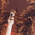
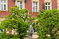
Category:Turkish Tenement House in Kraków
Jump to navigation
Jump to search
| Object location | | View all coordinates using: OpenStreetMap |
|---|
house in Kraków, Poland  | |||||
| Upload media | |||||
| Instance of | |||||
|---|---|---|---|---|---|
| Location | Kraków, Lesser Poland Voivodeship, Poland | ||||
| Architect | |||||
| Heritage designation |
| ||||
 | |||||
Polski: Dom Turecki w Krakowie
| Address |
|
| Address |
|
Media in category "Turkish Tenement House in Kraków"
The following 33 files are in this category, out of 33 total.
-
 Dom Turecki 01.jpg 2,448 × 3,264; 1.29 MB
-
 Dom Turecki 02.jpg 1,440 × 1,440; 202 KB
-
 Dom Turecki 03.jpg 1,440 × 1,440; 606 KB
-
 Dom Turecki 04.jpg 1,440 × 1,440; 410 KB
-
 Dom turecki po remoncie.png 808 × 566; 673 KB
-
 Dom Turecki w Krakowie.jpg 3,454 × 2,968; 1.89 MB
-
 DomTurecki-POL, Kraków.jpg 3,672 × 3,656; 3.76 MB
-
 DomTurecki-UlicaDługa-POL, Kraków.JPG 4,608 × 3,456; 3.52 MB
-
 DomTurecki-UlicaDługa31-POL, Kraków.jpg 4,000 × 3,400; 4.12 MB
-
 Krakow Dom Turecki.jpg 3,456 × 5,184; 8.78 MB
-
 Kraków - ul. Długa 31 - AL01.JPG 2,159 × 1,718; 1.06 MB
-
 Kraków - ul. Długa 31 - AL02.JPG 1,728 × 1,975; 758 KB
-
 Kraków - ul. Długa 31 - AL03.JPG 1,728 × 2,146; 958 KB
-
 Kraków - ul. Długa 31 - AL04.JPG 2,304 × 1,728; 646 KB
-
 Kraków - ul. Długa 31 - detal AL01.JPG 1,728 × 2,304; 649 KB
-
 Kraków - ul. Długa 38 - detal AL07.JPG 1,728 × 2,304; 819 KB
-
 Kraków, Długa 31, Pędzichów 2 (1).JPG 3,216 × 4,288; 2.8 MB
-
 Kraków, Długa 31, Pędzichów 2 (10).JPG 3,216 × 4,288; 3.28 MB
-
 Kraków, Długa 31, Pędzichów 2 (11).JPG 3,216 × 4,288; 2.74 MB
-
 Kraków, Długa 31, Pędzichów 2 (2).JPG 3,216 × 4,288; 3.01 MB
-
 Kraków, Długa 31, Pędzichów 2 (3).JPG 3,216 × 4,288; 3.37 MB
-
 Kraków, Długa 31, Pędzichów 2 (4).JPG 3,216 × 4,288; 2.71 MB
-
 Kraków, Długa 31, Pędzichów 2 (5).JPG 3,216 × 4,288; 3.46 MB
-
 Kraków, Długa 31, Pędzichów 2 (6).JPG 3,216 × 4,288; 2.9 MB
-
 Kraków, Długa 31, Pędzichów 2 (7).JPG 3,216 × 4,288; 3.29 MB
-
 Kraków, Długa 31, Pędzichów 2 (8).JPG 3,216 × 4,288; 3.03 MB
-
 Kraków, Długa 31, Pędzichów 2 (9).JPG 4,288 × 3,216; 3.14 MB
-
 Piasek Północ, Kraków, Poland - panoramio (12).jpg 3,264 × 4,928; 8.45 MB
-
 Piasek Północ, Kraków, Poland - panoramio (14).jpg 3,264 × 4,928; 6.63 MB
-
 Piasek Północ, Kraków, Poland - panoramio (15).jpg 4,928 × 3,264; 12.63 MB
-
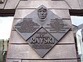 Tablica na domu przy ulicy Długiej w Krakowie.jpg 2,304 × 1,728; 772 KB
-
 Turkish House, 31 Dluga Street,Krakow,Poland.jpg 3,711 × 3,033; 4.51 MB
-
 UlicaDługa-WidokNaPółnocnyZachód-POL, Kraków.jpg 4,896 × 2,888; 3.83 MB


.JPG)
.JPG)
.JPG)
.JPG)
.JPG)
.JPG)
.JPG)
.JPG)
.JPG)
.JPG)
.JPG)
.jpg)
.jpg)
.jpg)


