Category:Tunstall, Suffolk
Jump to navigation
Jump to search
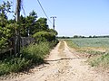
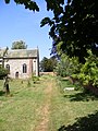
English: On an Ordnance Survey map of Suffolk, England, there are two settlements named Tunstall next to each other, north east of Woodbridge. However, these are not two separate villages but one, despite the gap between the main village and the hamlet known as Tunstall Common. Both lie within the parish of Tunstall.
village and civil parish in Suffolk, United Kingdom | |||||
| Upload media | |||||
| Instance of | |||||
|---|---|---|---|---|---|
| Location |
| ||||
| Population |
| ||||
 | |||||
Subcategories
This category has the following 10 subcategories, out of 10 total.
D
- Dunningworth Hall (7 F)
G
I
- Ivy Lodge, Rendlesham (9 F)
M
P
S
- Snape Bridge (12 F)
T
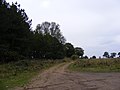
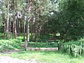
- Tunstall Forest (25 F)
V
Media in category "Tunstall, Suffolk"
The following 200 files are in this category, out of 303 total.
(previous page) (next page)-
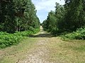
 A long straight track into Tunstall Forest - geograph.org.uk - 4056319.jpg 1,200 × 1,600; 313 KB
-
 Access Point No.31 - geograph.org.uk - 2667522.jpg 3,072 × 2,304; 1.48 MB
-
 Accident Repair Centre in Tunstall - geograph.org.uk - 4068889.jpg 1,536 × 1,151; 933 KB
-
 Arable land northwest of Iken Wood - geograph.org.uk - 3589884.jpg 3,648 × 2,736; 3.29 MB
-
 B1069 Bridge Road - geograph.org.uk - 2664132.jpg 3,072 × 2,304; 1.51 MB
-
 B1069 Snape Road - geograph.org.uk - 2423776.jpg 3,072 × 2,304; 1.48 MB
-
 B1069 Snape Road, Blaxhall - geograph.org.uk - 2663884.jpg 3,072 × 2,304; 1.36 MB
-
 B1069 Snape Road, Tunstall - geograph.org.uk - 2663873.jpg 3,072 × 2,304; 1.39 MB
-
 B1069 Snape Road, Tunstall - geograph.org.uk - 2663878.jpg 3,072 × 2,304; 1.23 MB
-
 B1069 Woodbridge Road - geograph.org.uk - 2423932.jpg 3,072 × 2,304; 1.32 MB
-
 B1069 Woodbridge Road - geograph.org.uk - 2423933.jpg 3,072 × 2,304; 1.43 MB
-
-
 B1069 Woodbridge Road ^ Post Office Woodbridge Road Postbox - geograph.org.uk - 2352450.jpg 3,072 × 2,304; 1.49 MB
-
 B1069 Woodbridge Road, Tunstall - geograph.org.uk - 5346147.jpg 4,608 × 3,072; 1.78 MB
-
 B1078 Ash Road, Tunstall - geograph.org.uk - 4253088.jpg 3,072 × 2,304; 1.67 MB
-
 B1078 Ash Road, Tunstall - geograph.org.uk - 4253136.jpg 3,072 × 2,304; 1.76 MB
-
 B1078 Ash Road, Tunstall - geograph.org.uk - 5345397.jpg 4,608 × 3,072; 1.79 MB
-
 B1078 Ash Road, Tunstall - geograph.org.uk - 5345402.jpg 4,608 × 3,072; 1.82 MB
-
 B1078 Ash Road, Tunstall - geograph.org.uk - 5346132.jpg 4,608 × 3,072; 1.8 MB
-
 B1078 at Tunstall, Suffolk - geograph.org.uk - 2955148.jpg 1,600 × 755; 287 KB
-
 B1078 near Tunstall Common - geograph.org.uk - 4361638.jpg 1,024 × 768; 349 KB
-
 B1078 Orford Road - geograph.org.uk - 2423145.jpg 3,072 × 2,304; 1.42 MB
-
 B1078 Orford Road - geograph.org.uk - 2668024.jpg 3,072 × 2,304; 1.3 MB
-
 B1078 Orford Road - geograph.org.uk - 2668474.jpg 3,072 × 2,304; 1.29 MB
-
 B1078 Orford Road Crossroads - geograph.org.uk - 2668478.jpg 3,072 × 2,304; 1.27 MB
-
 B1078 Orford Road ^ Entrance to The Old Rectory - geograph.org.uk - 2608071.jpg 3,072 × 2,304; 1.44 MB
-
 B1078 Orford Road ^ Roadsign - geograph.org.uk - 2423770.jpg 3,072 × 2,304; 1.5 MB
-
 B1078 Orford Road ^ Tunstall Common Postbox - geograph.org.uk - 2423735.jpg 3,072 × 2,304; 1.39 MB
-
 B1078 Orford Road, Tunstall - geograph.org.uk - 2423108.jpg 3,072 × 2,304; 1.41 MB
-
 B1078 Orford Road, Tunstall - geograph.org.uk - 2423114.jpg 3,072 × 2,304; 1.63 MB
-
 B1078 Orford Road, Tunstall - geograph.org.uk - 2423149.jpg 3,072 × 2,304; 1.63 MB
-
 B1078 Orford Road, Tunstall - geograph.org.uk - 2423753.jpg 3,072 × 2,304; 1.44 MB
-
 B1078 Orford Road, Tunstall - geograph.org.uk - 2423755.jpg 3,072 × 2,304; 1.49 MB
-
 B1078 Orford Road, Tunstall - geograph.org.uk - 2608088.jpg 3,072 × 2,304; 1.48 MB
-
 B1078 Orford Road, Tunstall - geograph.org.uk - 2608097.jpg 3,072 × 2,304; 1.42 MB
-
 B1078 Orford Road, Tunstall - geograph.org.uk - 2608099.jpg 3,072 × 2,304; 1.29 MB
-
 B1078 Orford Road, Tunstall - geograph.org.uk - 2608170.jpg 3,072 × 2,304; 1.26 MB
-
 B1078 traversing Tunstall Forest - geograph.org.uk - 4361679.jpg 1,024 × 768; 461 KB
-
 Baptist church, Tunstall - geograph.org.uk - 4145085.jpg 4,320 × 3,240; 3.16 MB
-
 Be aware of deer, sign in Tunstall Forest - geograph.org.uk - 4361651.jpg 1,024 × 768; 319 KB
-
 Bend in the River Alde, below Snape - geograph.org.uk - 6280074.jpg 1,600 × 1,064; 286 KB
-
 Birch woodland on Blaxhall Common - geograph.org.uk - 6371683.jpg 1,600 × 1,064; 656 KB
-
 Boardwalk and bridge over soggy ground - geograph.org.uk - 1886036.jpg 640 × 480; 120 KB
-
 Boat trip - geograph.org.uk - 3635643.jpg 2,048 × 1,536; 490 KB
-
 Boats on the River Alde - geograph.org.uk - 1970490.jpg 531 × 800; 88 KB
-
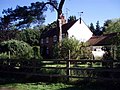
 Bracken Farm - geograph.org.uk - 1016352.jpg 640 × 480; 96 KB
-
 Bracken Farm Livery Yard sign - geograph.org.uk - 2668433.jpg 2,304 × 3,072; 1.15 MB
-
 Bracken Farm, Tunstall - geograph.org.uk - 6532159.jpg 1,600 × 1,064; 407 KB
-
 Bridleway on Blaxhall Heath - geograph.org.uk - 5863388.jpg 1,024 × 768; 276 KB
-

-

-
 Buildings at Dunningworth Hall - geograph.org.uk - 4145213.jpg 4,320 × 3,240; 4.56 MB
-
 Byway and farm track off the B1069 - geograph.org.uk - 4361641.jpg 1,024 × 768; 256 KB
-
 Church Farm Barn - geograph.org.uk - 2607871.jpg 3,072 × 2,304; 1.39 MB
-
 Church Farm Barns - geograph.org.uk - 2608032.jpg 3,072 × 2,304; 1.39 MB
-
 Church Farm Barns sign - geograph.org.uk - 2608037.jpg 3,072 × 2,304; 1.42 MB
-
 Contrasting buildings in Tunstall - geograph.org.uk - 4056368.jpg 1,536 × 1,024; 722 KB
-
 Cottage off Mill Lane - geograph.org.uk - 2668774.jpg 3,072 × 2,304; 1.42 MB
-
 Crossroads at Tunstall Common after the rain - geograph.org.uk - 4361635.jpg 1,024 × 768; 422 KB
-
 Crossroads with B1078 Orford Road ^ Mill Lane - geograph.org.uk - 2668762.jpg 3,072 × 2,304; 1.28 MB
-
 Cultivated fields off Orford Road - geograph.org.uk - 4409705.jpg 1,024 × 768; 245 KB
-
 Cultivated fields off Orford Road - geograph.org.uk - 4409709.jpg 1,024 × 768; 338 KB
-
 Dried up pond next to the B1069 Woodbridge Road - geograph.org.uk - 2423982.jpg 3,072 × 2,304; 1.62 MB
-
 Dunningworth Hall from a distance - geograph.org.uk - 4440341.jpg 1,024 × 768; 394 KB
-
 Electricity Sub-Station near Dunningworth Hall - geograph.org.uk - 2663786.jpg 3,072 × 2,304; 1.54 MB
-
 Entering Tunstall - geograph.org.uk - 4062470.jpg 1,024 × 768; 203 KB
-
 Entering Tunstall on the B1078 Ash Road - geograph.org.uk - 4253081.jpg 2,874 × 2,159; 1.46 MB
-
 Entering Tunstall on the B1078 Orford Road - geograph.org.uk - 2608586.jpg 3,072 × 2,304; 1.4 MB
-
 Entrance of Tunstall Community Centre - geograph.org.uk - 4253135.jpg 3,072 × 2,304; 1.9 MB
-
 Entrance to Tunstall Community Centre - geograph.org.uk - 4253090.jpg 3,072 × 2,304; 2.59 MB
-
 Equestrian Centre - geograph.org.uk - 1014453.jpg 640 × 480; 84 KB
-
 Farm and equestrian centre near Tunstall Forest - geograph.org.uk - 4056355.jpg 1,536 × 1,152; 870 KB
-
 Farm buildings at White Cross Farm, Tunstall - geograph.org.uk - 4361627.jpg 1,024 × 768; 320 KB
-
 Fenced in - geograph.org.uk - 543859.jpg 480 × 640; 94 KB
-
 Field access off Woodbridge Road, Tunstall - geograph.org.uk - 4409660.jpg 1,024 × 768; 302 KB
-
 Field entrance off the B1078 Orford Road - geograph.org.uk - 2608064.jpg 3,072 × 2,304; 1.32 MB
-
 Field entrance off the B1078 Orford Road - geograph.org.uk - 2608082.jpg 3,072 × 2,304; 1.25 MB
-
 Flying saucer by the Concert Hall - geograph.org.uk - 1886076.jpg 640 × 511; 137 KB
-
 Footpath along the Breakwater - geograph.org.uk - 2341568.jpg 2,304 × 3,072; 1.31 MB
-
 Footpath along the Breakwater - geograph.org.uk - 2341574.jpg 3,072 × 2,304; 1.46 MB
-
-
 Footpath and track to Tunstall - geograph.org.uk - 4056346.jpg 1,536 × 1,229; 1.09 MB
-
 Footpath by Snape Maltings - geograph.org.uk - 1886024.jpg 640 × 480; 148 KB
-
 Footpath in Tunstall Forest - geograph.org.uk - 5863390.jpg 768 × 1,024; 198 KB
-
 Footpath into Tunstall Forest - geograph.org.uk - 2667534.jpg 3,072 × 2,304; 1.68 MB
-
 Footpath into Tunstall Forest - geograph.org.uk - 4056343.jpg 1,536 × 1,152; 1.57 MB
-
 Footpath near Bentwaters Parks - geograph.org.uk - 4034066.jpg 3,648 × 2,736; 3.25 MB
-
 Footpath off Walk Farm Road - geograph.org.uk - 5347171.jpg 4,608 × 3,072; 1.83 MB
-
 Footpath On The Heath - geograph.org.uk - 4030198.jpg 1,024 × 768; 325 KB
-
 Footpath to B1078 at Tunstall - geograph.org.uk - 2667543.jpg 3,072 × 2,304; 1.26 MB
-
 Footpath to Ivy Lodge Road - geograph.org.uk - 2423931.jpg 3,072 × 2,304; 1.46 MB
-
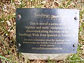
 Footpath to Sandlings Walk over Blaxhall Heath - geograph.org.uk - 2563756.jpg 2,304 × 3,072; 1.22 MB
-
 Footpath to Sandlings Walk over Blaxhall Heath - geograph.org.uk - 2563759.jpg 3,072 × 2,304; 1.5 MB
-
 Footpath to the B1069 Snape Road - geograph.org.uk - 2423132.jpg 3,072 × 2,304; 1.62 MB
-
 Footpath to the B1069 Snape Road - geograph.org.uk - 2423134.jpg 2,304 × 3,072; 1.52 MB
-
 Footpath to the B1069 Snape Road - geograph.org.uk - 2423135.jpg 2,304 × 3,072; 1.48 MB
-
 Footpath to the B1069 Woodbridge Road - geograph.org.uk - 2423113.jpg 3,072 × 2,304; 1.43 MB
-
 Footpath to the B1069 ^ B1078 Orford Road - geograph.org.uk - 2668754.jpg 3,072 × 2,304; 1.37 MB
-
 Footpath to the B1078 Ash Road - geograph.org.uk - 4253122.jpg 2,304 × 3,072; 2.96 MB
-
 Footpath to the B1078 at Tunstall - geograph.org.uk - 2663898.jpg 3,072 × 2,304; 1.27 MB
-
 Footpaths to the B1069 ^ Snape Road - geograph.org.uk - 2668027.jpg 3,072 × 2,304; 1.63 MB
-
 Forest Track - geograph.org.uk - 4030196.jpg 1,024 × 768; 354 KB
-
 Forest Track - geograph.org.uk - 4062430.jpg 1,024 × 768; 314 KB
-
 Forest Track - geograph.org.uk - 4494338.jpg 1,024 × 768; 245 KB
-
 Forestry access road into Tunstall Forest - geograph.org.uk - 4056314.jpg 1,536 × 1,152; 1.51 MB
-
 Forestry access road on Rimple Hill - geograph.org.uk - 4056335.jpg 1,536 × 1,152; 1.19 MB
-
 Forestry Operations Warning Notice - geograph.org.uk - 2563763.jpg 2,304 × 3,072; 1.5 MB
-
 Former goods station at Snape - geograph.org.uk - 2460073.jpg 3,648 × 2,736; 3.13 MB
-
 Former station house, Snape - geograph.org.uk - 4181831.jpg 640 × 427; 96 KB
-
 FRP 28, Tunstall Forest - geograph.org.uk - 4361661.jpg 1,024 × 768; 538 KB
-
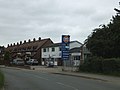 Gulf filling station, Tunstall - geograph.org.uk - 4052105.jpg 1,536 × 1,152; 867 KB
-
 Head of Navigation, River Alde - geograph.org.uk - 4567462.jpg 1,600 × 1,066; 285 KB
-
 Heading into Blaxhall Heath - geograph.org.uk - 5863387.jpg 768 × 1,024; 225 KB
-
 Heath Cottages, in Tunstall Forest - geograph.org.uk - 6683339.jpg 1,600 × 1,064; 579 KB
-
 Heath Cottages, Tunstall - geograph.org.uk - 923115.jpg 640 × 480; 100 KB
-
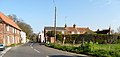
 Houses on Snape Road (B1069) in Tunstall - geograph.org.uk - 4056361.jpg 1,536 × 1,152; 814 KB
-
 Iken Road, Tunstall - geograph.org.uk - 2667538.jpg 3,072 × 2,304; 1.51 MB
-
 Ivy Lodge Road, Rendlesham - geograph.org.uk - 4409552.jpg 1,024 × 768; 354 KB
-
 Ivy Lodge Road, Rendlesham - geograph.org.uk - 4409553.jpg 1,024 × 768; 448 KB
-
 Large semi-detached house in Tunstall - geograph.org.uk - 4052114.jpg 1,536 × 1,155; 959 KB
-
 Long Reach - geograph.org.uk - 1884042.jpg 640 × 480; 48 KB
-
 Long way from home - geograph.org.uk - 1884049.jpg 640 × 480; 55 KB
-

-
 Looking down the Alde at Snape Bridge, low tide - geograph.org.uk - 6280059.jpg 1,600 × 1,064; 242 KB
-
-
 Looking towards Snape village from the Maltings - geograph.org.uk - 6277361.jpg 1,600 × 1,064; 245 KB
-
 Looking upstream from Snape Bridge, sunset - geograph.org.uk - 6608291.jpg 1,600 × 1,064; 308 KB
-
 Maize field off Walk Farm Road, Tunstall - geograph.org.uk - 6683270.jpg 1,600 × 1,064; 492 KB
-
 Maize field off Walk Farm Road, Tunstall - geograph.org.uk - 6683273.jpg 1,600 × 1,064; 483 KB
-
 Mill Lane - geograph.org.uk - 2668763.jpg 3,072 × 2,304; 1.49 MB
-
 Mill Lane sign - geograph.org.uk - 2668767.jpg 3,072 × 2,304; 1.46 MB
-
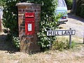 Mill Lane sign ^ Tunstall Common Postbox - geograph.org.uk - 2423742.jpg 3,072 × 2,304; 1.64 MB
-
 Mill Lane, Tunstall - geograph.org.uk - 2423743.jpg 3,072 × 2,304; 1.38 MB
-
 Mill Lane,Tunstall - geograph.org.uk - 2423764.jpg 3,072 × 2,304; 1.41 MB
-
 Mountain bike trail in Tunstall Forest - geograph.org.uk - 4361680.jpg 1,024 × 768; 597 KB
-
 Muck spreading - geograph.org.uk - 4361644.jpg 1,024 × 768; 357 KB
-
 Narrow path alongside the River Alde - geograph.org.uk - 1885989.jpg 640 × 480; 112 KB
-
 On the Suffolk Coast Path - geograph.org.uk - 5863398.jpg 1,024 × 768; 191 KB
-
 One of the many firebreaks in Tunstall Forest - geograph.org.uk - 4361656.jpg 1,024 × 768; 563 KB
-
 Onion field - geograph.org.uk - 1416220.jpg 471 × 640; 125 KB
-
 Orford Road sign - geograph.org.uk - 2423777.jpg 3,072 × 2,304; 1.42 MB
-
 Orford Road traversing Tunstall Forest - geograph.org.uk - 4361654.jpg 1,024 × 768; 507 KB
-
 Orford Road, Tunstall - geograph.org.uk - 6181361.jpg 6,000 × 4,000; 6.95 MB
-
 Path across Blaxhall Common - geograph.org.uk - 6371679.jpg 1,600 × 1,064; 717 KB
-

-
 Path along the river near Snape Maltings - geograph.org.uk - 2341578.jpg 3,072 × 2,304; 1.49 MB
-
 Path south of Snape Maltings - geograph.org.uk - 1886026.jpg 640 × 480; 152 KB
-
 Pathway into the forest at Tunstall - geograph.org.uk - 4361662.jpg 1,024 × 768; 528 KB
-
 Perceval - geograph.org.uk - 1886105.jpg 640 × 537; 123 KB
-
 Perceval and cart - geograph.org.uk - 1886108.jpg 640 × 480; 98 KB
-
-
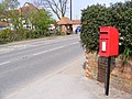
 Post Office Woodbridge Road Postbox - geograph.org.uk - 2352447.jpg 2,304 × 3,072; 1.47 MB
-
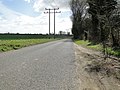
 Power Lines - geograph.org.uk - 4062441.jpg 1,024 × 768; 365 KB
-

-
 Quay downstream of Snape Bridge, evening - geograph.org.uk - 6279071.jpg 1,064 × 1,600; 199 KB
-
 Reaching the end of the path - geograph.org.uk - 1886013.jpg 640 × 480; 123 KB
-
 Reed beds south of the River Alde - geograph.org.uk - 5999891.jpg 1,064 × 1,600; 273 KB
-
 Reedbeds at Snape - geograph.org.uk - 2865138.jpg 1,600 × 1,067; 335 KB
-
 Reedbeds at Snape - geograph.org.uk - 6703970.jpg 1,600 × 1,064; 395 KB
-
 Reedbeds on the Alde estuary - geograph.org.uk - 6103359.jpg 6,000 × 4,000; 6.32 MB
-
 River Alde - geograph.org.uk - 3386364.jpg 640 × 480; 105 KB
-
 River Alde below Snape, evening light - geograph.org.uk - 6386599.jpg 1,600 × 1,064; 210 KB
-
 River Alde downstream of Snape - geograph.org.uk - 6277502.jpg 1,600 × 1,064; 291 KB
-
 River Alde downstream of Snape - geograph.org.uk - 6278253.jpg 1,600 × 1,064; 331 KB
-
 River Alde downstream of Snape - geograph.org.uk - 6857132.jpg 1,600 × 1,064; 218 KB
-
 River Alde downstream of Snape - geograph.org.uk - 6857133.jpg 1,600 × 1,064; 254 KB
-
 River Alde downstream of Snape - geograph.org.uk - 6857137.jpg 1,600 × 1,064; 192 KB
-
 River Alde, looking downriver towards Snape Warren - geograph.org.uk - 6277380.jpg 1,600 × 1,064; 278 KB
-
 River at Snape Maltings - geograph.org.uk - 2341572.jpg 3,072 × 2,304; 1.3 MB
-
 River Snape, IP17, Suffolk. - geograph.org.uk - 3486216.jpg 3,041 × 2,191; 1.38 MB
-

-
 Road to Iken - geograph.org.uk - 2663902.jpg 3,072 × 2,304; 1.18 MB
-
 Road to Iken - geograph.org.uk - 2667521.jpg 3,072 × 2,304; 1.55 MB
-
 Road to Iken ^ Access Point No.31 - geograph.org.uk - 2667516.jpg 3,072 × 2,304; 1.39 MB
-
 Roadsign on the B1069 Snape Road - geograph.org.uk - 2033897.jpg 2,304 × 3,072; 1.46 MB
-
 Roadsign on the B1069 Snape Road - geograph.org.uk - 2663891.jpg 2,304 × 3,072; 1.65 MB
-
 Roadsign on the B1069 Snape Road - geograph.org.uk - 2663895.jpg 2,304 × 3,072; 1.64 MB
-
 Roadsign on the B1078 Orford Road - geograph.org.uk - 2423773.jpg 2,304 × 3,072; 1.53 MB
-
 Roadsign on the B1078 Orford Road - geograph.org.uk - 2608189.jpg 2,304 × 3,072; 1.46 MB
-
 Roadsign ^ Tunstall Community Centre sign - geograph.org.uk - 4253142.jpg 2,048 × 2,734; 2.29 MB
-
 Roadsigns on the B1069 Woodbridge Road - geograph.org.uk - 2423780.jpg 3,072 × 2,304; 1.41 MB
-
 Sandlings Walk - geograph.org.uk - 2667530.jpg 2,304 × 3,072; 1.49 MB
-
 Sandlings Walk - geograph.org.uk - 2667531.jpg 2,304 × 3,072; 1.53 MB
-
 Sandlings Walk at Blaxhall Common, Suffolk - geograph.org.uk - 5620404.jpg 5,184 × 2,920; 6.87 MB
-
 Sandlings Walk in Tunstall Forest - geograph.org.uk - 4056341.jpg 1,152 × 1,536; 1.49 MB
-
 Sandlings Walk in Tunstall Forest - geograph.org.uk - 6300073.jpg 1,600 × 1,064; 418 KB
-
 Sandlings Walk onto Blaxhall Heath - geograph.org.uk - 2667528.jpg 3,072 × 2,304; 1.53 MB
-
 School Road, Tunstall - geograph.org.uk - 2478885.jpg 3,648 × 2,736; 3.31 MB
-
 School Road, Tunstall - geograph.org.uk - 5345833.jpg 4,608 × 3,072; 1.85 MB
-

-

-
 Sheppards Farm - geograph.org.uk - 2423927.jpg 3,072 × 2,304; 1.43 MB
-
 Sheppards Farm - geograph.org.uk - 4062461.jpg 1,024 × 768; 260 KB
-
 Signpost off School Road - geograph.org.uk - 5347182.jpg 2,618 × 3,942; 5.67 MB
-
 Silver birch trees in abundance - geograph.org.uk - 4361685.jpg 1,024 × 768; 455 KB
-
 Sluice near Snape Maltings - geograph.org.uk - 2341576.jpg 3,072 × 2,304; 1.28 MB
-

-
 Snape Bridge and the Maltings quayside - geograph.org.uk - 5770608.jpg 1,600 × 1,200; 325 KB
-
 Snape Bridge House - geograph.org.uk - 2663817.jpg 3,072 × 2,304; 1.44 MB
-
 Snape Bridge House sign - geograph.org.uk - 2663818.jpg 3,072 × 2,304; 1.38 MB


_in_Tunstall_-_geograph.org.uk_-_4056361.jpg)


