Category:Tunnels in Scotland
Jump to navigation
Jump to search
Council areas (municipalities) of Scotland: Aberdeen · East Ayrshire · East Dunbartonshire · Edinburgh · Falkirk · Fife · Inverclyde · North Lanarkshire · Renfrewshire · West Dunbartonshire ·
Wikimedia category | |||||
| Upload media | |||||
| Instance of | |||||
|---|---|---|---|---|---|
| Category combines topics | |||||
 | |||||
Subcategories
This category has the following 17 subcategories, out of 17 total.
- Tree tunnels in Scotland (7 F)
A
- Tunnels in Aberdeen (1 F)
- Auchendinny tunnel (3 F)
E
F
G
I
N
- Tunnels in North Lanarkshire (7 F)
R
- Tunnels in Renfrewshire (3 F)
W
Media in category "Tunnels in Scotland"
The following 40 files are in this category, out of 40 total.
-
 Access tunnel - geograph.org.uk - 678940.jpg 640 × 541; 71 KB
-
 Bridge over the River Kelvin - geograph.org.uk - 888092.jpg 480 × 640; 98 KB
-
 Contemplating the bridge - geograph.org.uk - 5657452.jpg 1,172 × 1,600; 295 KB
-
 Cowlairs incline - geograph.org.uk - 1171448.jpg 640 × 480; 118 KB
-
 Dundreggan Power Station - geograph.org.uk - 154406.jpg 640 × 480; 107 KB
-
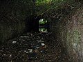
 ECP colliery tunnel.JPG 2,288 × 1,712; 1.43 MB
-
 Emerging from the Finnieston tunnel - geograph.org.uk - 6123686.jpg 1,600 × 1,251; 363 KB
-
 Finneston Tunnel , Northern Portal - geograph.org.uk - 311002.jpg 640 × 431; 78 KB
-

-
 FT27.jpg 1,024 × 768; 377 KB
-
 Gallowgate Central railway station (site), Glasgow (geograph 6072532).jpg 1,600 × 1,200; 776 KB
-
 Gibson Street railway bridge - geograph.org.uk - 4146202.jpg 480 × 640; 193 KB
-
 Grain Earth House chamber.jpg 1,024 × 768; 79 KB
-
 Grain Earth House tunnel.jpg 1,024 × 768; 77 KB
-
 Janefield Street - geograph.org.uk - 496860.jpg 640 × 424; 50 KB
-
 Kirriemuir In Scotland (3).jpg 1,200 × 900; 254 KB
-
 LochaberTunnel.jpg 600 × 443; 44 KB
-
 Looking northwards from within the catacombs in Grange Cemetery.png 386 × 462; 381 KB
-
 Neidpath Tunnel (30224478843).jpg 3,747 × 5,577; 21.37 MB
-
 North portal of the Mennock Hass Water Tunnel, Wanlockhead.jpg 1,920 × 1,080; 1.2 MB
-
 Queen Margaret Bridge - detail (geograph 6326106).jpg 1,024 × 768; 239 KB
-
 Queen Margaret Bridge - pedestrian tunnel (geograph 6326109).jpg 768 × 1,024; 104 KB
-
 Railway bridge under Pollokshaws Road - geograph.org.uk - 5301854.jpg 1,600 × 1,067; 404 KB
-
 Ravenscraig tunnel (geograph 4530271).jpg 1,024 × 683; 245 KB
-
 Seam of Coal, St Andrews Castle - geograph.org.uk - 1131291.jpg 640 × 480; 108 KB
-

-
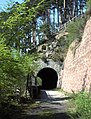
 The tunnel to Cove Harbour beach (6803212414).jpg 3,648 × 2,736; 6.25 MB
-
 Tunnel Brae - geograph.org.uk - 6555.jpg 488 × 640; 293 KB
-
 Tunnel entrance - geograph.org.uk - 1013788.jpg 640 × 475; 117 KB
-

-
 Tunnel portal at Strowan - geograph.org.uk - 4925375.jpg 1,280 × 960; 669 KB
-
 Tunnel through the cliff at Dysart - geograph.org.uk - 625436.jpg 640 × 480; 64 KB
-
 Tunnel under the Old Railway Track Bed - geograph.org.uk - 3426592.jpg 1,920 × 1,280; 1.87 MB
-
 Underpass, Hyndland Station - geograph.org.uk - 5824301.jpg 1,600 × 1,204; 425 KB
-
 Water Tunnel under Coire Cruachan - geograph.org.uk - 86322.jpg 429 × 640; 111 KB
-
 Kinleith Mill Currie Edinburgh - geograph.org.uk - 748569.jpg 640 × 427; 68 KB
-

-
 The end of the tunnel - geograph.org.uk - 571296.jpg 640 × 480; 71 KB
-
 Tramps' Tunnel - geograph.org.uk - 38964.jpg 640 × 480; 99 KB
-
 Tunnel Under Railway - geograph.org.uk - 375696.jpg 640 × 480; 213 KB


,_Glasgow_(geograph_6072532).jpg)


.jpg)


.jpg)

.jpg)
.jpg)

.jpg)


.jpg)


