Category:Tumulus Altrier
Jump to navigation
Jump to search
| Object location | | View all coordinates using: OpenStreetMap |
|---|
| Upload media | |||||
| Instance of | |||||
|---|---|---|---|---|---|
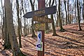
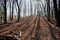
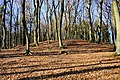
| Location | Altrier, Bech, Canton of Echternach, Luxembourg | ||||
 | |||||
Media in category "Tumulus Altrier"
The following 15 files are in this category, out of 15 total.
-
 Altrier Celtic Tumulus 20210509 144710.jpg 4,032 × 2,268; 5.01 MB
-
 Altrier Celtic Tumulus V BC - 51167422132.jpg 4,032 × 2,268; 5.4 MB
-
 Altrier Celtic Tumulus V BC - 51167422147.jpg 4,032 × 2,268; 5.3 MB
-
 Altrier Celtic Tumulus V BC - 51167498947.jpg 6,000 × 4,000; 10.21 MB
-
 Altrier Celtic Tumulus V BC - 51168400493.jpg 6,000 × 4,000; 10.35 MB
-
 Altrier Celtic Tumulus V BC - 51168874634.jpg 4,032 × 2,268; 5.39 MB
-
 Altrier Celtic Tumulus V BC - 51168949679.jpg 6,000 × 4,000; 10.4 MB
-
 Altrier Celtic Tumulus V BC - 51168949904.jpg 6,000 × 4,000; 10.82 MB
-
 Altrier Celtic Tumulus V BC - 51168950089.jpg 6,000 × 4,000; 9.63 MB
-
 Altrier Celtic Tumulus V BC - 51168950404.jpg 6,000 × 4,000; 10.13 MB
-
 Altrier Celtic Tumulus V BC.jpg 6,000 × 4,000; 10.83 MB
-
 Altrier, Tumulus (1).jpg 5,719 × 3,813; 3.61 MB
-
 Altrier, Tumulus (2).jpg 6,000 × 4,000; 8.8 MB
-
 Altrier, Tumulus (3).jpg 6,000 × 4,000; 11.75 MB
-
 Tumulus Altrier 2011-08.JPG 2,592 × 1,944; 2.54 MB


.jpg)
.jpg)
.jpg)
