Category:Tullymuck
Jump to navigation
Jump to search
Townland in County Tyrone, Northern Ireland  | |||||
| Upload media | |||||
| Instance of | |||||
|---|---|---|---|---|---|
| Location |
| ||||
 | |||||
Media in category "Tullymuck"
The following 96 files are in this category, out of 96 total.
-

-
 A gleaned field, Tullymuck - geograph.org.uk - 4064585.jpg 640 × 480; 176 KB
-
 An open field, Tullymuck - geograph.org.uk - 3935608.jpg 640 × 480; 162 KB
-
 An open field, Tullymuck - geograph.org.uk - 4081242.jpg 640 × 480; 168 KB
-
 Bridge along Dernalear Road - geograph.org.uk - 5277423.jpg 640 × 480; 149 KB
-
 Burn, Tullymuck - geograph.org.uk - 5159279.jpg 640 × 480; 170 KB
-
 Cairn Road, Tullymuck - geograph.org.uk - 5950493.jpg 1,024 × 685; 452 KB
-
 Cattle drive, Tullymuck - geograph.org.uk - 5926656.jpg 1,024 × 685; 361 KB
-
 Copse, Tullymuck - geograph.org.uk - 3935610.jpg 640 × 480; 162 KB
-
 Cottage, Tullymuck - geograph.org.uk - 1451396.jpg 640 × 479; 66 KB
-
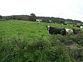 Cows, Tullymuck - geograph.org.uk - 1451406.jpg 640 × 479; 62 KB
-
 Daffodils along Leglands Road - geograph.org.uk - 3935594.jpg 640 × 480; 162 KB
-
 Damaged road sign, Leglands Road - geograph.org.uk - 4542156.jpg 640 × 480; 199 KB
-
 Dead end road, Legland - geograph.org.uk - 5950520.jpg 1,024 × 685; 430 KB
-
 Dernalear Road - geograph.org.uk - 4064841.jpg 640 × 480; 142 KB
-
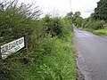
 Dernalear Road, Tullymuck - geograph.org.uk - 1451417.jpg 640 × 479; 42 KB
-
 Dernalear Road, Tullymuck - geograph.org.uk - 3935617.jpg 640 × 480; 146 KB
-
 Dernalear Road, Tullymuck - geograph.org.uk - 4064591.jpg 640 × 480; 162 KB
-
 Dernalear Road, Tullymuck - geograph.org.uk - 5159284.jpg 640 × 480; 161 KB
-
 Dernalear Road, Tullymuck - geograph.org.uk - 5277439.jpg 640 × 480; 149 KB
-
 Dernalear Road, Tullymuck - geograph.org.uk - 6285410.jpg 1,024 × 685; 388 KB
-
 Donkeys, Tullymuck - geograph.org.uk - 1451421.jpg 640 × 479; 70 KB
-
 Drumlegagh Road South - geograph.org.uk - 4081240.jpg 640 × 480; 174 KB
-
 Drumlegagh Road South - geograph.org.uk - 5950505.jpg 1,024 × 685; 476 KB
-
 Drumlegagh Road South, Dunteige - geograph.org.uk - 4065853.jpg 640 × 480; 155 KB
-
 Drumlegagh Road South, Legland - geograph.org.uk - 4542152.jpg 640 × 480; 169 KB
-
 Drumlegagh Road South, Legland - geograph.org.uk - 5950518.jpg 1,024 × 685; 436 KB
-
 Drumlegagh Road South, Tullymuck - geograph.org.uk - 4081236.jpg 640 × 480; 153 KB
-
 Drumlegagh Road South, Tullymuck - geograph.org.uk - 5950495.jpg 1,024 × 685; 463 KB
-
 Drumlegagh Road, Tullymuck - geograph.org.uk - 1451401.jpg 640 × 479; 87 KB
-
 Dunteige Road - geograph.org.uk - 4065874.jpg 640 × 480; 144 KB
-
 Dunteige Road, Tullymuck - geograph.org.uk - 4065865.jpg 640 × 480; 164 KB
-
 Dunteige Townland - geograph.org.uk - 4065870.jpg 640 × 480; 187 KB
-
 Fairy Water, Garvaghullion - Tullymuck - geograph.org.uk - 6285421.jpg 1,024 × 685; 423 KB
-
 Fairy Water, Tullymuck - Garvaghullion - geograph.org.uk - 3935598.jpg 640 × 480; 146 KB
-
 Frosty at Tullymuck - geograph.org.uk - 5277428.jpg 640 × 480; 138 KB
-
 Gate, Tullymuck - geograph.org.uk - 5950503.jpg 1,024 × 685; 501 KB
-
 Gates, Tullymuck - geograph.org.uk - 5950605.jpg 1,024 × 685; 500 KB
-
 Grasses, Dunteige - geograph.org.uk - 4064851.jpg 640 × 480; 161 KB
-
 Heap of stones, Tullymuck - geograph.org.uk - 5159295.jpg 640 × 480; 161 KB
-
 Inscribed stone, Tullymuck - geograph.org.uk - 4542154.jpg 640 × 480; 170 KB
-
 Lane, Tullymuck - geograph.org.uk - 1458924.jpg 640 × 479; 69 KB
-
 Lane, Tullymuck - geograph.org.uk - 4081231.jpg 640 × 480; 165 KB
-
 Legland Townland - geograph.org.uk - 3935640.jpg 640 × 480; 161 KB
-
 Leglands Road - geograph.org.uk - 3935602.jpg 640 × 480; 148 KB
-
 Leglands Road - geograph.org.uk - 3935614.jpg 640 × 480; 160 KB
-
 Leglands Road - geograph.org.uk - 3935631.jpg 640 × 480; 167 KB
-
 Leglands Road - geograph.org.uk - 4064589.jpg 640 × 480; 159 KB
-
 Leglands Road - geograph.org.uk - 4081333.jpg 640 × 480; 171 KB
-
 Leglands Road - geograph.org.uk - 5159294.jpg 640 × 480; 143 KB
-
 Leglands Road - geograph.org.uk - 5277441.jpg 640 × 480; 144 KB
-
 Leglands Road, Garvaghullion - geograph.org.uk - 3935590.jpg 640 × 480; 163 KB
-
 Leglands Road, Legland - geograph.org.uk - 3935633.jpg 640 × 480; 158 KB
-
 Leglands Road, Legland - geograph.org.uk - 5950515.jpg 1,024 × 685; 437 KB
-
 Leglands Road, Tullymuck - geograph.org.uk - 1451416.jpg 640 × 479; 47 KB
-
 Leglands Road, Tullymuck - geograph.org.uk - 3935612.jpg 640 × 480; 140 KB
-
 Leglands Road, Tullymuck - geograph.org.uk - 3935623.jpg 640 × 480; 147 KB
-
 Leglands Road, Tullymuck - geograph.org.uk - 4064583.jpg 640 × 480; 153 KB
-
 Leglands Road, Tullymuck - geograph.org.uk - 4081330.jpg 640 × 480; 170 KB
-
 Leglands Road, Tullymuck - geograph.org.uk - 4081336.jpg 640 × 480; 152 KB
-
 Leglands Road, Tullymuck - geograph.org.uk - 5159292.jpg 640 × 480; 148 KB
-
 Leglands Road, Tullymuck - geograph.org.uk - 5159306.jpg 640 × 480; 161 KB
-
 Leglands Road, Tullymuck - geograph.org.uk - 5277433.jpg 640 × 480; 134 KB
-
 Neighbourhood watch notice, Legland - geograph.org.uk - 5950522.jpg 1,024 × 685; 382 KB
-
 Plaque, Tullymuck National School - geograph.org.uk - 1458917.jpg 640 × 370; 63 KB
-
 Priests Bridge, Leglands Road - geograph.org.uk - 6285419.jpg 1,024 × 685; 466 KB
-
 Road at Tullymuck - geograph.org.uk - 103607.jpg 640 × 479; 136 KB
-
 Ruin,Tullymuck National School - geograph.org.uk - 1478416.jpg 640 × 479; 76 KB
-
 Sheep, Tullymuck - geograph.org.uk - 5159287.jpg 640 × 480; 155 KB
-
 Signs and notices, Tullymuck - geograph.org.uk - 4081246.jpg 640 × 480; 181 KB
-
 Small bridge along Dernalear Road - geograph.org.uk - 6285415.jpg 1,024 × 685; 361 KB
-

-
 Stone bridge along Leglands Road - geograph.org.uk - 5277448.jpg 640 × 480; 139 KB
-
 Tullymuck - geograph.org.uk - 103606.jpg 640 × 479; 148 KB
-
 Tullymuck - geograph.org.uk - 1451411.jpg 640 × 479; 45 KB
-
 Tullymuck - geograph.org.uk - 310339.jpg 639 × 480; 163 KB
-
 Tullymuck inscribed stone - geograph.org.uk - 5950514.jpg 1,024 × 685; 531 KB
-
 Tullymuck Townland - geograph.org.uk - 1451404.jpg 640 × 479; 60 KB
-
 Tullymuck Townland - geograph.org.uk - 1451405.jpg 640 × 479; 51 KB
-
 Tullymuck Townland - geograph.org.uk - 1451410.jpg 640 × 479; 46 KB
-
 Tullymuck Townland - geograph.org.uk - 1451412.jpg 640 × 479; 72 KB
-
 Tullymuck Townland - geograph.org.uk - 1451415.jpg 640 × 479; 60 KB
-
 Tullymuck Townland - geograph.org.uk - 1451419.jpg 640 × 479; 52 KB
-
 Tullymuck Townland - geograph.org.uk - 1458926.jpg 640 × 479; 60 KB
-
 Tullymuck Townland - geograph.org.uk - 1458931.jpg 640 × 479; 65 KB
-
 Tullymuck Townland - geograph.org.uk - 1458934.jpg 640 × 479; 58 KB
-
 Tullymuck Townland - geograph.org.uk - 3935620.jpg 640 × 480; 171 KB
-
 Tullymuck Townland - geograph.org.uk - 3935625.jpg 640 × 480; 173 KB
-
 Tullymuck Townland - geograph.org.uk - 4064595.jpg 640 × 480; 173 KB
-
 Tullymuck Townland - geograph.org.uk - 4064844.jpg 640 × 480; 157 KB
-
 Tullymuck Townland - geograph.org.uk - 4065863.jpg 640 × 480; 163 KB
-
 Tullymuck Townland - geograph.org.uk - 4081334.jpg 640 × 480; 169 KB
-
 Tullymuck Townland - geograph.org.uk - 5159275.jpg 640 × 480; 155 KB
-
 Tullymuck Townland - geograph.org.uk - 5159281.jpg 640 × 480; 166 KB
-
 Tullymuck Townland - geograph.org.uk - 5159290.jpg 640 × 480; 161 KB
-
 Wet ground, Tullymuck - geograph.org.uk - 6285412.jpg 1,024 × 685; 519 KB


