Category:Tullich kirkyard
Jump to navigation
Jump to search
|
This is a category about scheduled monument number 86
|
| Object location | | View all coordinates using: OpenStreetMap |
|---|
architectural structure in Aberdeenshire, Scotland, UK  | |||||
| Upload media | |||||
| Instance of | |||||
|---|---|---|---|---|---|
| Location |
| ||||
| Heritage designation |
| ||||
 | |||||
Media in category "Tullich kirkyard"
The following 9 files are in this category, out of 9 total.
-
 Tullich graveyard water supply - geograph.org.uk - 792968.jpg 480 × 640; 114 KB
-
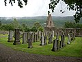 Tullich kirkyard 01.jpg 2,816 × 2,112; 1.46 MB
-
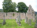 Tullich kirkyard 02.jpg 2,816 × 2,112; 1.46 MB
-
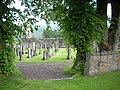 Tullich kirkyard 03.jpg 2,816 × 2,112; 1.48 MB
-
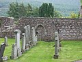
 Tullich kirkyard 04.jpg 2,816 × 2,112; 4.01 MB
-
 Tullich kirkyard 05.jpg 2,816 × 2,112; 4.39 MB
-
 Tullich kirkyard 06.jpg 2,816 × 2,112; 1.48 MB
-
 Tullich kirkyard 07.jpg 2,112 × 2,816; 1.47 MB
-
 Tullich old kirk - geograph.org.uk - 792972.jpg 640 × 480; 118 KB


