Category:Tsunami maps
Jump to navigation
Jump to search
Subcategories
This category has the following 5 subcategories, out of 5 total.
Media in category "Tsunami maps"
The following 20 files are in this category, out of 20 total.
-
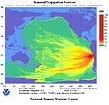
2010 Chile earthquake NOAA tsunami projection 2010-02-27.png 1,005 × 726; 159 KB
-
2014 Iquique earthquake NOAA tsunami projection 2014-04-01.jpg 1,166 × 1,114; 256 KB
-
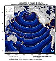
2019 Alaska Eq Tsunami Times.jpeg 900 × 983; 177 KB
-
Aerial view of the tsunami disaster (7596902364) (2).jpg 1,500 × 844; 2.44 MB
-
ECDM 20220117 Pacific Tsunami(2).pdf 2,479 × 1,754; 1.22 MB
-
Gisborne tsunami March 25th 1947.gif 1,103 × 1,341; 80 KB
-
Gisborne tsunami May 17th 1947.gif 1,103 × 1,341; 73 KB
-
Krakatoa Tsunami 1883.jpg 859 × 779; 329 KB
-
Lisbon 1755 tsunami travel times.jpg 859 × 1,200; 487 KB
-
Map-alaskatsunami.jpg 768 × 795; 143 KB
-
Samoa tsunami travel times.jpg 900 × 894; 154 KB
-
Thera impact on Nile delta.gif 800 × 600; 47 KB
-
Tsunami animation.gif 411 × 576; 104 KB
-
Tsunami en Constitución.svg 950 × 774; 111 KB
-
Tsunami Esquema.png 539 × 232; 30 KB
-
Tsunami travel time Valdivia 1960.jpg 859 × 800; 324 KB
-
Tsunami-worldpropagation2004b.jpg 700 × 398; 107 KB
-
Tttgrays.gif 1,280 × 1,024; 68 KB
-
USGS Tsunami Travel Time.gif 498 × 411; 52 KB


