Category:Tsukushi Plain
Jump to navigation
Jump to search
  | |||||
| Upload media | |||||
| Instance of | |||||
|---|---|---|---|---|---|
| Named after |
| ||||
| Location | Fukuoka Prefecture, Japan | ||||
| Located in or next to body of water | |||||
| Has part(s) |
| ||||
 | |||||
Subcategories
This category has the following 2 subcategories, out of 2 total.
P
- Polders in Saga, Saga (6 F)
Media in category "Tsukushi Plain"
The following 43 files are in this category, out of 43 total.
-
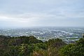 Chikugo Plains viewed from Zoyama Castle.jpg 6,016 × 4,000; 6.5 MB
-
 Daiju-garami skyline, wheat and barley fields in May 2019.jpg 5,456 × 1,364; 3.94 MB
-
 Fields on Shiroishi Plain and old reclamation dikes from Fukudomi Myland Park.jpg 4,842 × 3,632; 10.94 MB
-
 JA Saga South Refrigerated rice storage warehouses.jpg 4,842 × 3,632; 9.89 MB
-
 Kurume Panorama 01.jpg 2,592 × 1,398; 403 KB
-
 Kurume Panorama 02.jpg 2,592 × 1,492; 558 KB
-
 Land reclamated fields of Shiroishi Plain.jpg 5,456 × 2,728; 7.83 MB
-
 Meandering of lower Ushizu River.jpg 5,448 × 3,632; 8.43 MB
-
 Mino Mountains view from Chiyoda branch office tower.jpg 5,456 × 1,364; 3.55 MB
-
 Monument of Prince Chichibu's visit and Skyline of Saga Plain from Nan'nyo Shrine.jpg 5,400 × 1,800; 6.99 MB
-
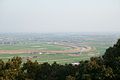
 Nagasaki Expressway from Mount Kawarake.jpg 4,842 × 3,632; 10.16 MB
-
 Paddy fields in August, in Kanoko, Honjo-machi, Saga.jpg 5,448 × 3,632; 11.04 MB
-
 Paddy fields in October, in Kanoko, Honjo-machi, Saga.jpg 5,448 × 3,632; 15.99 MB
-
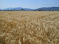 Preharvest two-rowed barley field in saga.jpg 4,608 × 3,456; 6.43 MB
-
 Saga Cityscape and Nagasaki Main Line from route 208 bridge 01.JPG 4,600 × 2,300; 1.03 MB
-
 Saga Cityscape and Nagasaki Main Line from route 208 bridge 02.JPG 4,608 × 3,456; 6.59 MB
-
 Saga cityscape eastward wide.JPG 4,608 × 3,456; 3.36 MB
-
 Saga cityscape northward wide.JPG 4,608 × 3,456; 3.36 MB
-
 Saga cityscape southeastward Saga Castle.JPG 4,608 × 3,456; 3.63 MB
-
 Saga cityscape southward wide.JPG 4,608 × 3,456; 3.26 MB
-
 Saga cityscape southwestward Saga University.JPG 4,608 × 3,456; 8.67 MB
-
 Saga plain reclamation dike blocks.JPG 3,900 × 2,600; 10.57 MB
-
 Saga plain reclamation dike.JPG 4,986 × 3,324; 12.01 MB
-
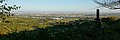
 Saga Plain wide view.jpg 4,500 × 1,500; 1.58 MB
-
 Sefuri Mountains and Tsukushi Plain from Mount Kawarake.jpg 5,456 × 2,728; 9.44 MB
-
 Shiroishi Plain from Mount Inuyama.jpg 5,456 × 2,728; 9.79 MB
-
 Tsukushi Plain Relief Map, SRTM-1.jpg 800 × 600; 485 KB
-
 View from Chiriku Hachiman Shrine.jpg 4,032 × 3,024; 4.4 MB
-
 View from Kora Hall in Kora Grand Shrine 1.jpg 3,957 × 2,968; 2.35 MB
-
 View from Kora Hall in Kora Grand Shrine 2.jpg 3,994 × 2,996; 2.04 MB
-
 View from Kora Hall in Kora Grand Shrine 3.jpg 3,958 × 2,969; 3 MB
-
 View from Kora Hall in Kora Grand Shrine 4.jpg 4,032 × 3,024; 1.52 MB
-
 View from Kora Hall in Kora Grand Shrine 5.jpg 4,003 × 3,002; 2.86 MB
-
 View from Mount Korasan (northwest) 2.jpg 4,032 × 3,024; 3.81 MB
-
 View from Mount Korasan (northwest).jpg 4,032 × 3,024; 3.74 MB
-
 View from Mount Korasan (west) 2.jpg 4,032 × 3,024; 3.38 MB
-
 View from Mount Korasan (west) 3.jpg 4,032 × 3,024; 2.41 MB
-
 View from Mount Korasan (west).jpg 4,032 × 3,024; 3.13 MB
-
 View of Kurume City from Chiriku Hachiman Shrine 1.jpg 4,032 × 3,024; 3.37 MB
-
 View of Kurume City from Chiriku Hachiman Shrine 2.jpg 3,978 × 2,983; 3.5 MB
-
 View of Kurume City from Chiriku Hachiman Shrine 3.jpg 3,974 × 2,980; 3.92 MB
-
 View of Kurume City.JPG 2,560 × 1,920; 975 KB
-
 View over Hokake Rock at Mount Kawarake.jpg 4,842 × 3,632; 10.15 MB


_2.jpg)
.jpg)
_2.jpg)
_3.jpg)
.jpg)


