Category:Trysull
Jump to navigation
Jump to search
English: Trysull is a village situated in Staffordshire, England. It is situated within the South Staffordshire District, having been part of Seisdon Rural District until 1974.
village in United Kingdom  | |||||
| Upload media | |||||
| Instance of | |||||
|---|---|---|---|---|---|
| Location | Trysull and Seisdon, South Staffordshire, Staffordshire, West Midlands, England | ||||
| official website | |||||
 | |||||
Subcategories
This category has the following 2 subcategories, out of 2 total.
A
T
Media in category "Trysull"
The following 56 files are in this category, out of 56 total.
-
 All Saints CE School - geograph.org.uk - 687660.jpg 640 × 480; 79 KB
-

-
 Blackhill Quarry - geograph.org.uk - 291531.jpg 600 × 450; 188 KB
-
 Bridge over Smestow Brook, Trysull.jpg 1,600 × 1,200; 509 KB
-
 Bridleway to Trysull, Staffordshire - geograph.org.uk - 680118.jpg 479 × 640; 134 KB
-

-
 Feiashill Road Smestow - geograph.org.uk - 687600.jpg 640 × 480; 82 KB
-
 Gorse Lane - geograph.org.uk - 687523.jpg 640 × 480; 71 KB
-
 Grazing Land near Trysull, Staffordshire - geograph.org.uk - 365988.jpg 640 × 480; 161 KB
-
 Grazing near Wombourne, Staffordshire - geograph.org.uk - 629003.jpg 640 × 476; 139 KB
-
 Grazing north of Smestow, Staffordshire - geograph.org.uk - 680129.jpg 640 × 459; 110 KB
-

-
 Sandstone Quarry - geograph.org.uk - 366745.jpg 640 × 484; 159 KB
-
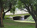
 Smestow Bridge - geograph.org.uk - 291520.jpg 600 × 450; 173 KB
-
 Smestow Brook - geograph.org.uk - 291508.jpg 500 × 375; 219 KB
-
 Smestow Brook - geograph.org.uk - 363023.jpg 640 × 444; 125 KB
-
 Smestow Brook - geograph.org.uk - 364729.jpg 450 × 600; 293 KB
-
 Smestow Brook 11 Trysull.JPG 2,736 × 3,648; 1.22 MB
-
 Smestow Brook Trysull - geograph.org.uk - 370852.jpg 480 × 640; 144 KB
-

-
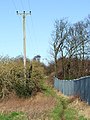
 Smestow Path - geograph.org.uk - 687613.jpg 640 × 480; 84 KB
-
 The Bell, Trysull - geograph.org.uk - 368359.jpg 640 × 480; 102 KB
-

-
 Towards Smestow Brook, Trysull - geograph.org.uk - 368784.jpg 640 × 480; 103 KB
-
 Trysull Bridge.JPG 4,000 × 3,000; 7.79 MB
-
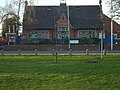
 Trysull Football Ground - geograph.org.uk - 687669.jpg 640 × 480; 91 KB
-
 Trysull Green - geograph.org.uk - 997164.jpg 640 × 480; 99 KB
-
 Trysull Haystack - geograph.org.uk - 990219.jpg 640 × 480; 80 KB
-
 Trysull Mill - geograph.org.uk - 365825.jpg 640 × 480; 175 KB
-
 Trysull Mill.JPG 4,000 × 3,000; 6.08 MB
-
 Trysull Plough Inn.JPG 4,000 × 3,000; 5.35 MB
-
 Trysull Red House.JPG 4,000 × 3,000; 5.69 MB
-
 View to Bratch Common Road - geograph.org.uk - 431809.jpg 640 × 480; 93 KB
-
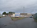
 Village Hall Car Park - geograph.org.uk - 997175.jpg 640 × 480; 91 KB
-
 Wombourne View - geograph.org.uk - 687581.jpg 640 × 480; 85 KB
-

-

-
 Bratch Lock Keepers house Wombourne - geograph.org.uk - 365820.jpg 640 × 480; 75 KB
-
 Bratch Locks, Wombourne - geograph.org.uk - 360164.jpg 640 × 512; 119 KB
-

-
 Farmhouse, Manor Farm, Trysull - geograph.org.uk - 368368.jpg 640 × 480; 72 KB
-
 Fast delivery to Pudding Cottage - geograph.org.uk - 293222.jpg 600 × 450; 201 KB
-
 Footbridge over the Smestow Brook - geograph.org.uk - 296983.jpg 600 × 450; 295 KB
-

-
 Former chapel - geograph.org.uk - 293220.jpg 600 × 450; 215 KB
-

-
 Leaving the Bratch - geograph.org.uk - 424393.jpg 640 × 480; 134 KB
-
 Path over Smestow Brook - geograph.org.uk - 365809.jpg 640 × 480; 127 KB
-
 Path to Trysull - geograph.org.uk - 365765.jpg 480 × 640; 138 KB
-
 Reinstated Footpath - geograph.org.uk - 365728.jpg 640 × 480; 136 KB
-
 Road Crossing - geograph.org.uk - 687634.jpg 480 × 640; 102 KB
-
 Road to Church - geograph.org.uk - 365753.jpg 640 × 480; 156 KB
-
 The Bratch Locks at Wombourne - geograph.org.uk - 360148.jpg 640 × 480; 137 KB
-
 The Plough - geograph.org.uk - 687683.jpg 640 × 480; 49 KB
-

-


