Category:Trowse
Jump to navigation
Jump to search
English: Trowse, also called Trowse with Newton, is a village in South Norfolk which lies about and had a population of 479 in 233 households as of the 2001 census.
Norsk bokmål: Trowse er en landsby i distriktet South Norfolk i England. Trowse ligger omtrent 2 km sørøst for Norwich ved elvebredden av elven Yare, og er en model village for nabobyen. Den ble på 1800-tallet laget av Colman, grunnleggeren av sennepsprodusenten Colman's, slik at arbeiderne på fabrikkene hans kunne ha en plass å bo i nærheten av arbeidsplassen.
village in Norfolk, UK  | |||||
| Upload media | |||||
| Instance of | |||||
|---|---|---|---|---|---|
| Location | Trowse with Newton, South Norfolk, Norfolk, East of England, England | ||||
| Area |
| ||||
 | |||||
Subcategories
This category has the following 7 subcategories, out of 7 total.
A
- St Andrew's, Trowse (24 F)
C
F
- Footpaths in Trowse (1 F)
N
- Norfolk Snowsports Club (12 F)
S
- Trowse swing bridge (7 F)
T
- Trowse railway station (9 F)
- Trowse village sign (4 F)
Media in category "Trowse"
The following 84 files are in this category, out of 84 total.
-

-
 Access road to Whitlingham Hall - geograph.org.uk - 1387193.jpg 640 × 480; 71 KB
-
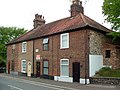 Alburgh Cottages, Trowse - geograph.org.uk - 1290300.jpg 640 × 480; 97 KB
-
 Barn conversion, Trowse - geograph.org.uk - 117816.jpg 640 × 480; 211 KB
-
 Bishy Barney Bee on old fence post - geograph.org.uk - 1391546.jpg 480 × 640; 142 KB
-
 Block Hill Cottages, Kirby Road, Trowse - geograph.org.uk - 1290357.jpg 640 × 480; 111 KB
-
-
 Block Hill Cottages, Kirby Road, Trowse - geograph.org.uk - 1290368.jpg 640 × 480; 102 KB
-
 Boudica's Way - From Trowse to Lakenham - geograph.org.uk - 1391528.jpg 640 × 480; 146 KB
-

-
 Bridge over a drain - geograph.org.uk - 1670630.jpg 640 × 480; 155 KB
-
 Bridge over the A47 - geograph.org.uk - 1387189.jpg 640 × 480; 88 KB
-

-
 Converted Barn, The Street, Trowse - geograph.org.uk - 1290410.jpg 640 × 480; 61 KB
-

-
 Cottages in The Street - geograph.org.uk - 1670613.jpg 640 × 460; 98 KB
-
 County hall - geograph.org.uk - 1269168.jpg 640 × 480; 56 KB
-
-
 Cycleway to Kirby Road - geograph.org.uk - 1387180.jpg 640 × 480; 90 KB
-
 Cycleway to Kirby Road - geograph.org.uk - 1387216.jpg 640 × 480; 84 KB
-
 Cycleway to Trowse Newton - geograph.org.uk - 1387227.jpg 640 × 480; 91 KB
-
 E.T. Daniell - Trowse Hythe.jpg 1,280 × 921; 278 KB
-

-
 Electricity sub-station in Trowse - geograph.org.uk - 1391730.jpg 480 × 640; 93 KB
-
 Electricity sub-station in Trowse - geograph.org.uk - 1391734.jpg 640 × 536; 93 KB
-
 Electricity sub-station in Trowse - geograph.org.uk - 1391736.jpg 640 × 583; 88 KB
-
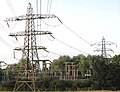 Electricity sub-station in Trowse - geograph.org.uk - 1391737.jpg 640 × 493; 91 KB
-

-
 Entrance to Trowse Church Meadow - geograph.org.uk - 1670608.jpg 480 × 640; 127 KB
-
 Flint faced cottages, Kirby Road, Trowse - geograph.org.uk - 1290348.jpg 640 × 480; 111 KB
-
 Flooded pasture in Trowse - geograph.org.uk - 1670626.jpg 640 × 480; 115 KB
-
 Flooded pasture south of Bracondale - geograph.org.uk - 1670628.jpg 640 × 480; 139 KB
-
 Footpath along drain - geograph.org.uk - 1670635.jpg 640 × 458; 139 KB
-
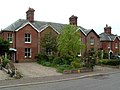
 Former School House, Trowse - geograph.org.uk - 1290236.jpg 640 × 480; 138 KB
-

-
 Heron Island, Trowse Millgate - geograph.org.uk - 1290418.jpg 640 × 480; 96 KB
-
 Hudson Crescent, Trowse - geograph.org.uk - 1290308.jpg 640 × 480; 51 KB
-
 Loddon 9 - geograph.org.uk - 1500286.jpg 480 × 640; 125 KB
-

-
 Meadow Close Bungalows, Trowse - geograph.org.uk - 1290280.jpg 640 × 480; 106 KB
-
 Mill House, Trowse - geograph.org.uk - 1290430.jpg 640 × 480; 137 KB
-
 New houses, Trowse - geograph.org.uk - 117805.jpg 640 × 480; 194 KB
-
 Newton Cottage, The Street, Trowse - geograph.org.uk - 1290289.jpg 640 × 480; 52 KB
-
 Old Houses with Wisteria, Trowse Mill - geograph.org.uk - 1290427.jpg 640 × 480; 119 KB
-
 Old Milestone - geograph.org.uk - 1500293.jpg 640 × 480; 102 KB
-
 Pub and trough, Trowse - geograph.org.uk - 117802.jpg 640 × 480; 212 KB
-
 Pumping station in Trowse - geograph.org.uk - 1670624.jpg 640 × 487; 156 KB
-

-
 Railway bridge on the Breckland line - geograph.org.uk - 1269118.jpg 640 × 480; 96 KB
-
 River Yare at Trowse Newton - geograph.org.uk - 153325.jpg 592 × 400; 113 KB
-
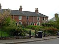
 Russell Terrace, Trowse - geograph.org.uk - 1290247.jpg 640 × 480; 66 KB
-
 Snowsports Club in Trowse, Norwich with real snow (40482004822).jpg 2,400 × 1,602; 2.31 MB
-
 Start of a footpath - geograph.org.uk - 1670633.jpg 640 × 480; 158 KB
-
 Stile to Whitlingham Lane - geograph.org.uk - 1671067.jpg 640 × 480; 193 KB
-
 Thatched Cottage, The Street, Trowse - geograph.org.uk - 1290382.jpg 640 × 480; 134 KB
-
 The A146 into Norwich - geograph.org.uk - 1269133.jpg 640 × 480; 39 KB
-
 The A146 road bridge - geograph.org.uk - 1269153.jpg 640 × 480; 67 KB
-
 The A146 road bridge - geograph.org.uk - 1270016.jpg 640 × 480; 45 KB
-
 The Great Eastern Mainline - geograph.org.uk - 1326320.jpg 640 × 480; 53 KB
-

-
 The Old Manor, Trowse - geograph.org.uk - 1290296.jpg 640 × 480; 73 KB
-

-
 The Street in Trowse - geograph.org.uk - 1670612.jpg 640 × 480; 100 KB
-
 The White Horse Inn, Trowse - geograph.org.uk - 1290251.jpg 640 × 480; 87 KB
-
 Trowse Aggregate works - geograph.org.uk - 1322046.jpg 640 × 480; 49 KB
-
 Trowse Church Hall - geograph.org.uk - 1290207.jpg 640 × 480; 107 KB
-
 Trowse Church Meadow - geograph.org.uk - 1670611.jpg 640 × 480; 164 KB
-
 Trowse mill - geograph.org.uk - 1270001.jpg 640 × 480; 86 KB
-
 Trowse Mill - geograph.org.uk - 153344.jpg 640 × 479; 98 KB
-
 Trowse Mill 1818.jpg 2,664 × 1,841; 833 KB
-
 Trowse Mill Cottages - geograph.org.uk - 1290421.jpg 640 × 480; 93 KB
-
 Trowse mill from a distance - geograph.org.uk - 1269179.jpg 640 × 480; 41 KB
-
 Trowse road bridge - geograph.org.uk - 1321956.jpg 640 × 480; 62 KB
-
 Trowse Swing bridge - geograph.org.uk - 1322067.jpg 640 × 480; 96 KB
-
 Trowse Swingbridge - geograph.org.uk - 1322053.jpg 480 × 640; 52 KB
-
 Trowse Village Primary School - geograph.org.uk - 1290228.jpg 640 × 480; 71 KB
-
 Trowse Village Shop - geograph.org.uk - 1290214.jpg 640 × 480; 88 KB
-
 Trowse village shop in The Street - geograph.org.uk - 1670614.jpg 566 × 600; 129 KB
-
 View across The Street in Trowse - geograph.org.uk - 1670607.jpg 480 × 640; 95 KB
-
 View north-west along Bracondale - geograph.org.uk - 1670619.jpg 640 × 481; 89 KB
-
 Village green, Trowse - geograph.org.uk - 117792.jpg 640 × 480; 297 KB
-
 Vulcan Cottages, the Street, Trowse - geograph.org.uk - 1290291.jpg 640 × 480; 63 KB
-
 White Horse Inn, Trowse, Annexe - geograph.org.uk - 1290257.jpg 640 × 480; 79 KB
-
 Martineau Lane - geograph.org.uk - 706368.jpg 640 × 468; 130 KB


.jpg)


_-_geograph.org.uk_-_674433.jpg)


