Category:Trolleybus maps
Jump to navigation
Jump to search
See also:
- Category:Public transport maps for all kind of public transport maps
- Category:Rapid transit maps for Metro and light rail maps
- Category:Tram maps for tramway maps
- Category:Bus maps for bus maps
- Category:Rail transport maps for railway maps
Subcategories
This category has the following 2 subcategories, out of 2 total.
C
Media in category "Trolleybus maps"
The following 51 files are in this category, out of 51 total.
-
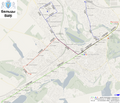
Balti - Schemу of trolleybus routes.png 2,048 × 1,760; 2.29 MB
-
DerbyTrolleybus.jpg 3,616 × 2,911; 3.9 MB
-
Karte Metro-, Tram- und Obussysteme.svg 1,736 × 2,326; 4.65 MB
-
Karte ÖPNV-Netze Deutschland.svg 1,736 × 2,326; 4.64 MB
-
Harta retea transport URBIS.svg 2,245 × 1,587; 409 KB
-
Harta retea troleibuz URBIS.svg 1,052 × 744; 94 KB
-
Harta retea troleibuze URBIS.svg 2,245 × 1,587; 146 KB
-
Harta traseu troleibuz 50 URBIS.svg 2,245 × 1,587; 62 KB
-
Harta traseu troleibuz 54 URBIS.svg 2,245 × 1,587; 124 KB
-
Karte der ÖPNV-Systeme in den Staaten der ehemaligen Sowjetunion.png 1,571 × 3,027; 1.44 MB
-
Karte der ÖPNV-Systeme in den USA.png 2,204 × 1,353; 440 KB
-
Karte der ÖPNV-Systeme in Deutschland 2008.png 1,535 × 2,257; 456 KB
-
Karte der ÖPNV-Systeme in Lateinamerika.png 1,371 × 1,575; 356 KB
-
Karte der ÖPNV-Systeme in Nordafrika.png 2,493 × 1,287; 239 KB
-
Karte ÖPNV-Systeme in der Türkei.png 3,656 × 1,750; 300 KB
-
Karte ÖPNV-Systeme in Italien.png 2,260 × 1,551; 355 KB
-
Map of trolleybus system in Aachen.svg 2,160 × 1,900; 84 KB
-
Map of World's Trolleybus Countries.png 1,330 × 606; 37 KB
-
Map of World's Trolleybus Countries.svg 2,756 × 1,399; 861 KB
-
NGT - Leeds.jpg 704 × 559; 47 KB
-
Oberleitungsbus-Naryn.png 4,167 × 2,104; 597 KB
-
OBusStEtienne1995.png 737 × 1,300; 82 KB
-
OePNVSystemeDeutschlandJanuar2003.jpg 1,260 × 1,877; 205 KB
-
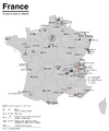
OePNVSystemeFrankreich-fr.png 1,204 × 1,445; 236 KB
-
OePNVSystemeFrankreich.png 1,204 × 1,445; 165 KB
-
OePNVSystemeJapanJanuar2003.png 1,503 × 2,223; 413 KB
-
OePNVSystemePolenMai2007.png 1,500 × 1,836; 245 KB
-
Public transport system map of the USA.png 2,204 × 1,353; 440 KB
-
Public transport systems of Italy.png 1,298 × 1,551; 251 KB
-
Rail networks USA map.svg 959 × 593; 124 KB
-
Réseaux de trolleybus en France.png 2,221 × 2,879; 530 KB
-
Sarajevo trolleybus - Network map.png 1,599 × 1,242; 2.48 MB
-
Sarajevo trolleybus - Network map.svg 1,538 × 1,195; 5.69 MB
-
Schema seti trolleybusa.svg 744 × 1,052; 129 KB
-
Solingen Trolleybus map.png 960 × 720; 25 KB
-
Map of the Timișoara tramway and trolleybus routes.png 3,108 × 2,574; 3.91 MB
-
Transports urbains de France.png 1,072 × 811; 190 KB
-
Trol rs n.png 405 × 415; 70 KB
-
Trolleybus line 51, Aachen.svg 2,160 × 1,900; 5 KB
-
Trolleybus map of Babrujsk.png 1,294 × 1,823; 2.29 MB
-
Trolleybus map of Brest, Belarus (in Russian).png 2,087 × 1,539; 3.46 MB
-
Trolleybus map of Mahilioŭ, Belarus (in Belarusian).png 1,468 × 2,160; 3.12 MB
-
Trolleybus map of Mahilioŭ, Belarus (in Russian).png 1,468 × 2,160; 3.09 MB
-
Trolleynet-Arnhem.png 1,199 × 848; 137 KB
-
TrolleynetArnhem.png 870 × 650; 24 KB
-
TrolleynetNijmegen.png 380 × 365; 10 KB
-
ÖPNV-System in den Benelux-Staaten.png 961 × 1,253; 146 KB
-
ÖPNV-Systeme auf den Britischen Inseln.png 1,845 × 2,715; 512 KB
-
ÖPNV-Systeme in China.png 3,176 × 2,560; 1.25 MB
-
ÖPNV-Systeme in Korea.png 1,638 × 2,644; 633 KB
-
ÖPNV-Systeme in Südosteuropa.png 1,721 × 1,917; 444 KB


