Category:Trinity Creek
Jump to navigation
Jump to search
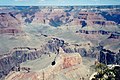
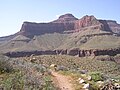
English: The Trinity Creek (dry creek), is a 5-mile long, south-flowing watershed of North Rim, Grand Canyon, at the southwest of the en:Kaibab Plateau, (southwest of Tiyo Point). Its southeast region contains the uplifted en:horst, with the Isis Temple prominence, and geologic units at its base of the Grand Canyon Supergroup, (the 5-unit en:Unkar Group). (4--Shinumo Quartzite, 3--Diabase Sill, 2--Hakatai Shale, 1--Bass Limestone)
Landforms, east, and west flank of watershed:
|
|
Shiva Temple is a flat-topped (mesa-like or en:Tepui-like) landform (1.0-mi-by-0.4-mi, and lower spur ridge to Claude Birdseye Point), at 7,570 feet (2,307 m), (north perimeter), Tiyo Point (on Kaibab), 7,752 feet (2,363 m), (2.0-mi northeast); Isis Temple is about 2.0-mi southeast.
Bright Angel Canyon and Creek is 4 miles east. Trinity Creek is due-north of Hopi Point, South Rim, just west of en:Grand Canyon Village, Arizona, (East Rim Road).Subcategories
This category has the following 2 subcategories, out of 2 total.
O
S
Media in category "Trinity Creek"
The following 13 files are in this category, out of 13 total.
-
 091-5R - RIGHT - TRINITY CREEK (16185712594).jpg 3,000 × 1,979; 3.14 MB
-
 1 Grandcanyon2 panoram 2010.jpg 6,285 × 2,336; 9.7 MB
-
 Arizona. LOC 99446124-3.jpg 6,534 × 8,020; 11.28 MB
-
 Arizona. LOC 99446126-2.jpg 5,014 × 6,252; 6.24 MB
-
 Arizona.USA. - panoramio (7).jpg 1,712 × 1,135; 459 KB
-
 Gc stella 017 Grand Canyon.jpg 3,264 × 2,448; 1.32 MB
-
 Grand Canyon (1).jpg 3,000 × 2,000; 2.64 MB
-
 Grand Canyon February 2012 33.JPG 4,000 × 3,000; 2.28 MB
-
 Grand Canyon Rim Trail 2019 8.jpg 4,928 × 3,264; 9.63 MB
-
 Storm Coming, Grand Canyon, AZ 2015 (29642717421).jpg 2,800 × 2,725; 2.56 MB
-
 Tonto-trail.jpg 2,288 × 1,712; 854 KB
-
 USA 09847 Grand Canyon Luca Galuzzi 2007.jpg 2,000 × 1,333; 2.16 MB
-
 Vue aérienne du Grand Canyon (9028804356).jpg 4,282 × 2,848; 10.31 MB
.jpg)


.jpg)

.jpg)


.jpg)


.jpg)