Category:Treyford
Jump to navigation
Jump to search
English: Treyford is a hamlet in the Chichester district of West Sussex, England. It lies within the civil parish of Elsted and Treyford. The hamlet sits on the Elsted to Bepton Road 4 miles (6.5km) southwest of Midhurst.
village in West Sussex, England, UK | |||||
| Upload media | |||||
| Instance of |
| ||||
|---|---|---|---|---|---|
| Location | Elsted and Treyford, Chichester, West Sussex, South East England, England | ||||
 | |||||
Subcategories
This category has the following 5 subcategories, out of 5 total.
Media in category "Treyford"
The following 43 files are in this category, out of 43 total.
-

-
 Bridleway changes direction in Treyford - geograph.org.uk - 2690074.jpg 1,024 × 768; 289 KB
-
 Bridleway to the west at Treyford - geograph.org.uk - 2690077.jpg 768 × 1,024; 156 KB
-
 Bridleway, Treyford - geograph.org.uk - 1340479.jpg 480 × 640; 204 KB
-
 Climbing hill out of Treyford - geograph.org.uk - 1722163.jpg 1,024 × 768; 332 KB
-
 Climbing hill out of Treyford - geograph.org.uk - 1722194.jpg 800 × 601; 223 KB
-
 Climbing hill out of Treyford - geograph.org.uk - 1722244.jpg 600 × 800; 193 KB
-
 Cyclist heading through Treyford - geograph.org.uk - 1933616.jpg 640 × 480; 122 KB
-
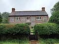 Elsted and Treyford - Brook House - 20230805142651.jpg 4,000 × 3,000; 3.79 MB
-
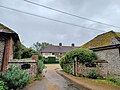 Elsted and Treyford - Treyford Manor Farmhouse - 20230805142950.jpg 4,000 × 3,000; 3.15 MB
-
 Elsted and Treyford - Treyford Manor Farmhouse - 20230805142958.jpg 4,000 × 3,000; 3.88 MB
-

-
 Farmyard at Treyford - geograph.org.uk - 1933644.jpg 640 × 480; 77 KB
-
 Field to the north of Treyford - geograph.org.uk - 2192499.jpg 800 × 600; 100 KB
-
 Footpath arrives at lane in Treyford - geograph.org.uk - 2690054.jpg 1,024 × 768; 310 KB
-
 Footpath at stream east of Treyford - geograph.org.uk - 2690049.jpg 1,024 × 768; 363 KB
-
 House on downland road - geograph.org.uk - 1049033.jpg 640 × 480; 140 KB
-
 Junction of bridleway with footpath in Treyford - geograph.org.uk - 2690073.jpg 1,024 × 768; 301 KB
-

-
 Lane going south in Treyford - geograph.org.uk - 2690057.jpg 768 × 1,024; 228 KB
-
 Lane in centre of Treyford - geograph.org.uk - 1722144.jpg 1,024 × 768; 382 KB
-
 Lane up the South Downs from Treyford - geograph.org.uk - 1722171.jpg 640 × 480; 128 KB
-
 Lane up the South Downs from Treyford - geograph.org.uk - 1722203.jpg 800 × 600; 208 KB
-
 Lane up the South Downs from Treyford - geograph.org.uk - 1722217.jpg 800 × 600; 229 KB
-
 Looking up to the downs at Treyford - geograph.org.uk - 1933649.jpg 640 × 480; 125 KB
-
 Manor Farm House at Treyford - geograph.org.uk - 2690069.jpg 1,024 × 768; 183 KB
-
 Manor Farm, Treyford - geograph.org.uk - 3103581.jpg 640 × 480; 119 KB
-
 Northern end of Treyford cemetery - geograph.org.uk - 3190414.jpg 4,000 × 3,000; 3.49 MB
-
 Path down to the stream east of Treyford - geograph.org.uk - 2690046.jpg 768 × 1,024; 296 KB
-
 Postbox, Treyford - geograph.org.uk - 1340475.jpg 640 × 482; 202 KB
-
 Sluice gate at Treyford - geograph.org.uk - 1933622.jpg 640 × 480; 161 KB
-
 Spring stream running through Treyford - geograph.org.uk - 3190296.jpg 4,000 × 3,000; 3.65 MB
-
 Stream reaching road at Treyford - geograph.org.uk - 1049008.jpg 640 × 480; 173 KB
-
 Thatched garage at Treyford - geograph.org.uk - 3190301.jpg 4,000 × 3,000; 3.49 MB
-
 The centre of Treyford - geograph.org.uk - 1933665.jpg 640 × 480; 97 KB
-
 Treyford cemetery - geograph.org.uk - 3190536.jpg 4,000 × 3,000; 3.35 MB
-
 Treyford from the south - geograph.org.uk - 1049041.jpg 640 × 480; 79 KB
-
 View from the downs above Treyford - geograph.org.uk - 1722394.jpg 800 × 600; 214 KB
-
 View of Treyford - geograph.org.uk - 1722230.jpg 800 × 600; 209 KB
-
 Welcome to Treyford - geograph.org.uk - 1933640.jpg 640 × 480; 117 KB
-
 Field to the West of Monkton - geograph.org.uk - 341675.jpg 640 × 462; 124 KB
-
 Pointing the way, Treyford - geograph.org.uk - 358426.jpg 640 × 480; 160 KB
-
 Pointing the way, Treyford - geograph.org.uk - 358430.jpg 640 × 480; 157 KB


