Category:Treshnish Isles
Jump to navigation
Jump to search
archipelago of small islands and skerries, lying west of Mull, in Scotland   | |||||
| Upload media | |||||
| Instance of | |||||
|---|---|---|---|---|---|
| Part of | |||||
| Location | Argyll and Bute, Scotland | ||||
| Located in or next to body of water |
| ||||
| Owned by |
| ||||
| Has part(s) | |||||
| Highest point |
| ||||
| Population |
| ||||
| official website | |||||
 | |||||
The Treshnish Isles is an archipelago of small islands and skerries, lying west of the Isle of Mull.
Subcategories
This category has the following 9 subcategories, out of 9 total.
C
- Cairn na Burgh Beg (8 F)
- Cairn na Burgh More (14 F)
- Coll and Tiree (1903) (78 F)
F
- Fladda, Treshnish Isles (9 F)
L
S
- Sgeir an Eirionnaich (1 F)
- Sgeir an Fheòir, Argyll (1 F)
Media in category "Treshnish Isles"
The following 40 files are in this category, out of 40 total.
-
 Admiralty Chart No 2652 Loch Tuath Scotland (8209X5405), Published 1959.jpg 8,209 × 5,405; 5.31 MB
-
 Beacon, Cairn na Burgh More - geograph.org.uk - 2455409.jpg 640 × 456; 163 KB
-
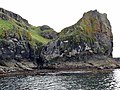
 Cairn na Burgh Beg (Beag) - Eastern tip - geograph.org.uk - 5834067.jpg 1,755 × 1,000; 1.22 MB
-
 Cairn na Burgh More (Mòr) - geograph.org.uk - 5840644.jpg 1,500 × 1,000; 1.08 MB
-
 Cairn na Burgh More ^ Cairn na Burgh Beg - geograph.org.uk - 5840610.jpg 3,034 × 1,000; 2.3 MB
-
 Cairnburgh Castle - geograph.org.uk - 5840681.jpg 1,144 × 1,000; 885 KB
-
 Dùn Cruit - geograph.org.uk - 2586321.jpg 640 × 480; 105 KB
-
 Gloomy Treshnish Isles.jpg 3,909 × 2,606; 818 KB
-
 Lunga - geograph.org.uk - 1456548.jpg 640 × 480; 65 KB
-
 Nesting Puffin on Lunga, Treshnish Isles (Side On Profile).jpg 1,440 × 1,440; 284 KB
-
 Nesting Puffin on Lunga, Treshnish Isles (Straight On Profile).jpg 1,440 × 1,440; 315 KB
-
 Ordnance Survey One-Inch Sheet 44 Coll & Tiree, Published 1955.jpg 8,897 × 10,702; 14.29 MB
-
 Ordnance Survey One-Inch Sheet 52 Coll & Tiree, Published 1947.jpg 12,164 × 9,298; 7.81 MB
-
 Oystercatchers, Sgeir an Fheòir - geograph.org.uk - 2454011.jpg 640 × 359; 215 KB
-
 Rocks off Cairn na Burgh Beg - geograph.org.uk - 2455393.jpg 640 × 359; 217 KB
-
 Ruins on Lunga, Treshnish Isles - geograph.org.uk - 3993109.jpg 427 × 640; 53 KB
-
 Sea canoes at Corran Lunga - geograph.org.uk - 2586417.jpg 640 × 480; 57 KB
-
 Sea cliffs near Haunn - geograph.org.uk - 270325.jpg 640 × 480; 92 KB
-
 Sgeir an Eirionnaich - geograph.org.uk - 2452769.jpg 640 × 359; 209 KB
-
 Sgeir an Eirionnaich - geograph.org.uk - 2452774.jpg 640 × 359; 205 KB
-
 Sgeir an Eirionnaich - geograph.org.uk - 2454009.jpg 640 × 359; 232 KB
-
 Sgeir na h-Iolaire - geograph.org.uk - 2454022.jpg 640 × 359; 203 KB
-
 Sgeirean Mòr - geograph.org.uk - 2453319.jpg 640 × 480; 290 KB
-
 Sgeirean na Giusaich - geograph.org.uk - 2452778.jpg 640 × 263; 131 KB
-
 Skerry, Cairn na Burgh islands - geograph.org.uk - 2455456.jpg 640 × 359; 206 KB
-
 Skerry, Treshnish Islands - geograph.org.uk - 2454014.jpg 640 × 359; 205 KB
-
 Sound between the Cairn na Burgh islands - geograph.org.uk - 2455450.jpg 640 × 300; 151 KB
-
 Southern end of Sgeir an Eirionnaich - geograph.org.uk - 2586423.jpg 640 × 480; 65 KB
-
 Sròn Urraidh - geograph.org.uk - 2454018.jpg 640 × 359; 191 KB
-
 Swell breaking over Tighchoie - geograph.org.uk - 2453781.jpg 640 × 343; 148 KB
-
 The Burghs, Treshnish Isles - geograph.org.uk - 6239760.jpg 1,024 × 768; 156 KB
-
 The Isles of Loch na Keal.jpg 4,080 × 3,072; 3.58 MB
-
 Tighcoie - geograph.org.uk - 2452763.jpg 640 × 359; 204 KB
-
 Treshnish Isles (31107985657).jpg 5,184 × 3,888; 9.05 MB
-
 Treshnish Isles (32175945718).jpg 5,184 × 3,888; 9.17 MB
-
 Treshnish Isles - Unnamed islets NW of Bogha Ruadh - geograph.org.uk - 5834106.jpg 3,183 × 1,000; 2.03 MB
-
 Treshnish Isles from above Port Haunn - geograph.org.uk - 270321.jpg 640 × 333; 50 KB
-
 Treshnish Isles from above Port Haunn.jpg 610 × 294; 27 KB
-
 Treshnisheast.JPG 1,024 × 768; 419 KB
-
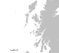 UK Treshnish.PNG 648 × 584; 20 KB
,_Published_1959.jpg)
_-_Eastern_tip_-_geograph.org.uk_-_5834067.jpg)
_-_geograph.org.uk_-_5840644.jpg)


.jpg)
.jpg)


.jpg)
.jpg)

