Category:Treicol
Jump to navigation
Jump to search
| Object location | | View all coordinates using: OpenStreetMap |
|---|
 | |||||
| Upload media | |||||
| Instance of | |||||
|---|---|---|---|---|---|
| Location | Beaufort, canton of Beaufort | ||||
| Located in or next to body of water | |||||
| Mountain range | |||||
| Elevation above sea level |
| ||||
 | |||||
Media in category "Treicol"
The following 9 files are in this category, out of 9 total.
-
 Cascade pétrifiante @ Treicol.jpg 5,184 × 3,888; 10.1 MB
-
 House in Treicol.jpg 4,608 × 3,456; 9.06 MB
-
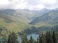
 Lac de Roselend - img 44763.jpg 5,616 × 3,744; 9.4 MB
-
 Lac de Roselend D20120904 e.jpg 4,416 × 3,312; 1.49 MB
-
 Treicol - img 44711.jpg 5,616 × 3,744; 7.02 MB
-
 Treicol.jpg 4,608 × 3,456; 8.17 MB
-
 Tufière Treicol.jpg 4,608 × 3,456; 9.66 MB
-
 Vallon de Treicol Pierra Menta.jpg 4,608 × 3,456; 7.33 MB
-
 Vallon de Treicol Presset.jpg 4,608 × 3,456; 4.51 MB


