Category:Tredegar
Jump to navigation
Jump to search
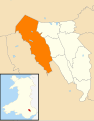
town in Blaenau Gwent, Wales, UK   | |||||
| Upload media | |||||
| Instance of | |||||
|---|---|---|---|---|---|
| Location | Blaenau Gwent County Borough, Wales | ||||
| Population |
| ||||
| Area |
| ||||
| Different from | |||||
 | |||||

Subcategories
This category has the following 14 subcategories, out of 14 total.
A
B
D
- James J. Davis (politician) (269 F)
K
R
- Rhymney Hill (4 F)
S
- St George's Church, Tredegar (5 F)
T
- Tredegar Town Clock (14 F)
- Tredegar Post Office (3 F)
- Tredegar Town Hall (4 F)
Media in category "Tredegar"
The following 200 files are in this category, out of 988 total.
(previous page) (next page)-
 -WWPW2014 Richmond Folk Festival 2014 -19 (15323086828).jpg 4,267 × 3,414; 14.1 MB
-

-
 2 Queens Square, Tredegar - geograph.org.uk - 1821683.jpg 497 × 640; 88 KB
-
 20 zone along Waundeg, Tredegar - geograph.org.uk - 3960078.jpg 800 × 685; 142 KB
-
 2010 Wales Blaenau Gwent Community Tredegar map.svg 512 × 655; 233 KB
-
 2024 Wales Blaenau Gwent Community Tredegar map.svg 512 × 655; 238 KB
-

-
 A footbridge over the Sirhowy River - geograph.org.uk - 3678800.jpg 640 × 480; 136 KB
-
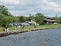
 A lake south of Tredegar - geograph.org.uk - 3998147.jpg 1,600 × 934; 295 KB
-
 A reminder of Tredegar's history - geograph.org.uk - 3135228.jpg 441 × 640; 112 KB
-
 A splash of yellow, Bryn Bach Park - geograph.org.uk - 3374391.jpg 640 × 480; 177 KB
-
 A stile about to be removed - geograph.org.uk - 3166057.jpg 640 × 480; 157 KB
-

-
 A view of the Nine Arches Viaduct - geograph.org.uk - 3166066.jpg 640 × 480; 110 KB
-
 A weir on the River Sirhowy - geograph.org.uk - 3166012.jpg 640 × 480; 122 KB
-
 A4047 Beaufort Road - geograph.org.uk - 2751183.jpg 640 × 453; 50 KB
-

-

-
 A4048 approaches Tredegar from the SE - geograph.org.uk - 3543101.jpg 800 × 623; 165 KB
-

-
 A4048 direction sign, Tredegar - geograph.org.uk - 5425089.jpg 800 × 605; 130 KB
-
 A4048 direction signs, Tredegar - geograph.org.uk - 6120657.jpg 1,024 × 962; 250 KB
-
 A4048 directions signs, Tredegar - geograph.org.uk - 6234026.jpg 1,600 × 1,275; 454 KB
-
 A4048 heads south away from Tredegar - geograph.org.uk - 3543081.jpg 800 × 608; 149 KB
-
 A4048 looking north - geograph.org.uk - 2751119.jpg 640 × 453; 38 KB
-
 A4048 New Road looking north - geograph.org.uk - 2751129.jpg 640 × 480; 43 KB
-
 A4048 pelican crossing, Tredegar - geograph.org.uk - 6233952.jpg 2,278 × 2,342; 1.19 MB
-
 A4048 pssing Tredegar - geograph.org.uk - 2751150.jpg 640 × 480; 37 KB
-
 A4048 roundabout near Ashvale, Tredegar - geograph.org.uk - 6235206.jpg 1,600 × 958; 316 KB
-

-
 A4048-A4047 roundabout at Sirhowy - geograph.org.uk - 2751153.jpg 640 × 480; 43 KB
-

-
 A465 at Duke's Meadow - geograph.org.uk - 2951720.jpg 640 × 481; 44 KB
-
 A465 crossing Sirhowy valley - geograph.org.uk - 2498695.jpg 800 × 599; 333 KB
-
 A465 improvements - geograph.org.uk - 3652909.jpg 640 × 480; 95 KB
-
 A465 improvements looking eastwards - geograph.org.uk - 3751349.jpg 640 × 480; 123 KB
-
 A465 improvements, Dukestown (1) - geograph.org.uk - 3751335.jpg 640 × 480; 90 KB
-
 A465 improvements, Dukestown (2) - geograph.org.uk - 3819825.jpg 640 × 480; 122 KB
-
 A465 improvements, Dukestown (3) - geograph.org.uk - 3820103.jpg 640 × 480; 132 KB
-
 A465 improvements, Dukestown (4) - geograph.org.uk - 3880338.jpg 640 × 480; 114 KB
-
 A465 improvements, Dukestown (5) - geograph.org.uk - 3937610.jpg 640 × 480; 92 KB
-
 A465 improvements, Dukestown (6) - geograph.org.uk - 3938527.jpg 640 × 480; 105 KB
-

-

-

-

-
 A465 north of Dukestown - geograph.org.uk - 2951722.jpg 640 × 480; 40 KB
-
 Above Parc Brynbach - geograph.org.uk - 3178264.jpg 640 × 480; 70 KB
-

-
 Access road to Lidl Tredegar - geograph.org.uk - 5426471.jpg 800 × 493; 80 KB
-

-

-

-
 Admiring the new Nye Bevan mural.jpg 1,200 × 800; 220 KB
-

-
 Agricultural building near Mountain Air Gate - geograph.org.uk - 5236729.jpg 4,000 × 3,000; 4.42 MB
-
 Alligator teeth, Tredegar - geograph.org.uk - 1821806.jpg 640 × 387; 59 KB
-
 Along Maple Avenue, Tredegar - geograph.org.uk - 6232882.jpg 1,600 × 1,156; 332 KB
-
 Alongside the A4048, Tredegar - geograph.org.uk - 5350565.jpg 5,179 × 3,451; 5.4 MB
-

-

-
 An out of the way telephone box, Trefil - geograph.org.uk - 3137079.jpg 640 × 480; 187 KB
-

-

-
 Aneurin Bevan plaque detail, Tredegar - geograph.org.uk - 5402078.jpg 800 × 600; 216 KB
-

-
 Aneurin Bevan Plaque, Tredegar - geograph.org.uk - 3136538.jpg 640 × 640; 133 KB
-
 Aneurin Rise, Tredegar - geograph.org.uk - 3614752.jpg 800 × 571; 122 KB
-
 Aneurin Rise, Tredegar - geograph.org.uk - 5412199.jpg 800 × 522; 116 KB
-

-
 Approaching Lower Farm from the north - geograph.org.uk - 3547023.jpg 800 × 586; 138 KB
-
 Arqiva telecoms mast, Bedwellty Pits - geograph.org.uk - 3546755.jpg 719 × 800; 136 KB
-
 Arson Alert notice in Tredegar - geograph.org.uk - 5402951.jpg 800 × 651; 163 KB
-

-
 Ashleigh Court, Church Street, Tredegar - geograph.org.uk - 5414140.jpg 800 × 657; 127 KB
-
 Ashvale bus stop and shelter, Tredegar - geograph.org.uk - 6235192.jpg 1,600 × 1,221; 357 KB
-
 Ashvale houses, Tredegar - geograph.org.uk - 3617116.jpg 800 × 600; 133 KB
-
 Ashvale Stores, 69-71 Ashvale, Tredegar - geograph.org.uk - 6215160.jpg 1,600 × 1,281; 472 KB
-
 Ashvale Stores, Tredegar - geograph.org.uk - 3617124.jpg 800 × 681; 142 KB
-
 Ashvale Supper Bar, Tredegar - geograph.org.uk - 6215108.jpg 1,024 × 850; 179 KB
-

-
 Bandstand, Bedwellty Park, Tredegar - geograph.org.uk - 3488515.jpg 640 × 640; 228 KB
-
 Bank of daffodils in Princetown - geograph.org.uk - 6121743.jpg 853 × 1,024; 349 KB
-
 Bank strengthening near Bedwellty Pits - geograph.org.uk - 3546914.jpg 800 × 600; 181 KB
-
 Barclays Bank Tredegar - geograph.org.uk - 5404106.jpg 800 × 628; 103 KB
-
 Barclays Bank, Tredegar - geograph.org.uk - 3640985.jpg 800 × 677; 119 KB
-
-

-
 Beaufort Road, Rhoslan - geograph.org.uk - 3999658.jpg 1,600 × 1,190; 593 KB
-
 Bedwellty Bandstand Light and Shade.jpg 5,184 × 3,456; 7.51 MB
-

-
 Bedwellty House Welsh Flag.jpg 5,184 × 3,456; 6 MB
-
 Bedwellty House Young Workers.jpg 5,184 × 3,456; 7.69 MB
-
 Bedwellty House, Tredegar - geograph.org.uk - 3208999.jpg 640 × 480; 182 KB
-

-
 Bedwellty Park Bowls Club, Tredegar - geograph.org.uk - 3640643.jpg 800 × 680; 184 KB
-
 Bedwellty Park fountain, Tredegar - geograph.org.uk - 3639326.jpg 800 × 600; 201 KB
-

-
 Bedwellty Park, Tredegar - geograph.org.uk - 3639649.jpg 800 × 600; 172 KB
-
 Bedwellty Pits bus shelters - geograph.org.uk - 3546861.jpg 800 × 742; 226 KB
-
 Bedwelty house tredegar.jpg 3,264 × 2,448; 1.73 MB
-
 Beech tree on the edge of Manmoel Common - geograph.org.uk - 5948413.jpg 5,179 × 3,451; 4.87 MB
-
 Belle Vue Inn, Dukestown, Tredegar - geograph.org.uk - 3196336.jpg 640 × 480; 108 KB
-
 Big Boys Toys in Tredegar - geograph.org.uk - 3640787.jpg 800 × 735; 159 KB
-
 Bilingual Ashvale name sign, Tredegar - geograph.org.uk - 6235179.jpg 1,600 × 1,227; 556 KB
-
 Bilingual name sign on a Nantybwch corner in Tredegar - geograph.org.uk - 6121804.jpg 1,004 × 1,024; 430 KB
-

-

-
 Bilingual street name sign, Charles Street, Tredegar - geograph.org.uk - 6232156.jpg 1,600 × 1,200; 514 KB
-

-
 Bill Harry Court, Charles Street, Tredegar - geograph.org.uk - 6234131.jpg 1,423 × 1,229; 380 KB
-
 Blaenau Gwent boundary on the A465 - geograph.org.uk - 2951709.jpg 640 × 481; 34 KB
-
-

-
 Boarded-up house, Merthyr Road, Ashvale, Tredegar - geograph.org.uk - 6215175.jpg 1,600 × 1,544; 408 KB
-
 Bon Appetit in Tredegar - geograph.org.uk - 3640200.jpg 799 × 800; 156 KB
-

-
 Boundary Stone - geograph.org.uk - 6698477.jpg 666 × 1,024; 253 KB
-
 Bournville Terrace, Tredegar - geograph.org.uk - 3614780.jpg 800 × 600; 131 KB
-
 Bournville Terrace, Tredegar - geograph.org.uk - 5412191.jpg 800 × 567; 97 KB
-
 Brecon Terrace, Tafarnaubach - geograph.org.uk - 6120599.jpg 1,024 × 892; 220 KB
-
 Brick semis, Charles Street, Tredegar - geograph.org.uk - 6234480.jpg 1,600 × 1,009; 289 KB
-
 Bridge and farmhouse - geograph.org.uk - 1124178.jpg 640 × 480; 117 KB
-
 Bridge at Tafarnaubach over A465 - geograph.org.uk - 2498690.jpg 640 × 480; 55 KB
-

-

-
 Brompton Place, Tredegar - geograph.org.uk - 3542914.jpg 800 × 560; 130 KB
-
 Bryn Amlwg Close, Princetown - geograph.org.uk - 6121169.jpg 1,024 × 696; 134 KB
-
 Bryn Bach Park Lake - geograph.org.uk - 3531592.jpg 640 × 480; 168 KB
-
 Bryn Bach Park Lake - geograph.org.uk - 3531636.jpg 640 × 480; 91 KB
-
 Bryn Bach Park, Tredegar - geograph.org.uk - 3002874.jpg 640 × 480; 122 KB
-

-
 Bryn Bach Primary School, Merthyr Road, Tredegar - geograph.org.uk - 6120828.jpg 1,024 × 787; 275 KB
-
 Bryn Rhosyn bus stop, Tredegar - geograph.org.uk - 6122593.jpg 1,024 × 710; 176 KB
-
 Bryn Rhosyn, Tredegar - geograph.org.uk - 6121772.jpg 1,024 × 636; 126 KB
-
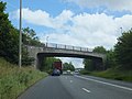 Bryn-Serth Road bridge over A465 - geograph.org.uk - 2498705.jpg 800 × 600; 361 KB
-
 Bryn-Serth Road go over the Heads of the Valleys road - geograph.org.uk - 4014689.jpg 1,600 × 1,036; 343 KB
-
 BT phonebox on an Ashvale corner, Tredegar - geograph.org.uk - 6215464.jpg 1,024 × 975; 203 KB
-

-
 Bungalow, Charles Street, Tredegar - geograph.org.uk - 6234483.jpg 1,600 × 1,220; 305 KB
-
 Bungalows and bus stops, Tredegar - geograph.org.uk - 3615076.jpg 800 × 520; 114 KB
-
 Bus stop and shelter, Merthyr Road, Ashvale, Tredegar - geograph.org.uk - 6215152.jpg 1,411 × 1,091; 352 KB
-
 Bus stop for Bedwellty Pits - geograph.org.uk - 5951046.jpg 5,184 × 3,456; 6.93 MB
-

-
 Bush Bach bus stop, Llwyn Helyg, Tredegar - geograph.org.uk - 6214135.jpg 1,600 × 1,477; 484 KB
-
 Bush Bach, Nant-y-bwch - geograph.org.uk - 3626450.jpg 800 × 536; 126 KB
-
 Bush Bach, Tredegar - geograph.org.uk - 6214079.jpg 1,600 × 1,075; 272 KB
-
 Bush hotel, Park Row, Tredegar - geograph.org.uk - 1187417.jpg 640 × 480; 92 KB
-
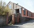
 Business units - geograph.org.uk - 914394.jpg 640 × 480; 88 KB
-

-
 Cairn on Carn Stwpa - geograph.org.uk - 6075996.jpg 5,184 × 3,888; 5.58 MB
-
 Calvary Pentecostal Church, Tredegar - geograph.org.uk - 3616215.jpg 800 × 488; 88 KB
-
 Canada Geese grazing at Bryn Bach Park - geograph.org.uk - 3375421.jpg 480 × 640; 145 KB
-

-

-

-

-

-
 Canada Goose, Bryn Bach Park - geograph.org.uk - 3375652.jpg 640 × 480; 177 KB
-

-

-
 Castle Street Church - geograph.org.uk - 568290.jpg 640 × 480; 166 KB
-
 Castle Street Church, Tredegar - geograph.org.uk - 3641006.jpg 800 × 575; 130 KB
-
 Castle Street Church, Tredegar - geograph.org.uk - 5404163.jpg 762 × 800; 140 KB
-
 Castle Street Dental Practice, Tredegar - geograph.org.uk - 3640929.jpg 800 × 562; 110 KB
-
 Castle Street, Tredegar - geograph.org.uk - 1821592.jpg 480 × 640; 64 KB
-
 Castle Street, Tredegar - geograph.org.uk - 3580737.jpg 640 × 480; 84 KB
-
 Caution Private Road - geograph.org.uk - 4560318.jpg 2,560 × 1,920; 2.44 MB
-
 Central Baptist Church, Tredegar (geograph 7723932).jpg 4,032 × 3,024; 2.62 MB
-
 Central Baptist Church, Tredegar - geograph.org.uk - 1821586.jpg 640 × 534; 88 KB
-
 Central Chambers for sale, Tredegar - geograph.org.uk - 3640621.jpg 800 × 560; 106 KB
-
 Central Fish Bar, Tredegar - geograph.org.uk - 3641132.jpg 800 × 700; 136 KB
-
 Central Fish Bar, Tredegar - geograph.org.uk - 5412238.jpg 774 × 800; 165 KB
-
 Central Surgery inscription, Tredegar - geograph.org.uk - 6231848.jpg 1,356 × 505; 125 KB
-
 Charles Street flats, Tredegar - geograph.org.uk - 6234153.jpg 1,600 × 1,036; 305 KB
-
 Charles Street from Church Street, Tredegar - geograph.org.uk - 6233938.jpg 1,260 × 1,070; 272 KB
-
 Charles Street traffic lights, Tredegar - geograph.org.uk - 6233982.jpg 1,600 × 1,479; 532 KB
-
 Charles Street, Tredegar - geograph.org.uk - 6232168.jpg 1,600 × 1,138; 290 KB
-
 Checkpoint 9A at Bedwellty House, Tredegar - geograph.org.uk - 4013524.jpg 1,600 × 1,064; 555 KB
-
 Checkpoint 9B on the Valleys 100 - geograph.org.uk - 4015249.jpg 1,600 × 1,064; 521 KB
-
 Checkpoint 9B, Georgetown, Tredegar - geograph.org.uk - 3997885.jpg 1,600 × 1,064; 552 KB
-
 Checkpoint 9B, Georgetown, Tredegar - geograph.org.uk - 3997888.jpg 1,600 × 1,064; 571 KB
-
 Cheveux Hair ^ Beauty Spot, Tredegar - geograph.org.uk - 3617195.jpg 800 × 512; 110 KB
-

-

-
 Chop Suey House in Tredegar town centre - geograph.org.uk - 5412246.jpg 719 × 800; 104 KB
-
 Church Street, Tredegar - geograph.org.uk - 1821176.jpg 640 × 566; 94 KB
-
 Church Street, Tredegar.jpg 1,200 × 800; 160 KB
-
 Citadel Close, Tredegar - geograph.org.uk - 5425825.jpg 800 × 632; 137 KB
-
 Clos Bryn Brith, Princetown - geograph.org.uk - 6121172.jpg 1,024 × 682; 101 KB
-
 ClubqueryWConwayBevan2.jpg 441 × 243; 35 KB
-
 Coach ^ Horses in Tredegar - geograph.org.uk - 6231651.jpg 1,600 × 1,294; 352 KB
-
 Coach ^ Horses name sign, Charles Street, Tredegar - geograph.org.uk - 6231695.jpg 1,318 × 1,470; 329 KB
-
 Coed Fedwgwaith near Hollybush - geograph.org.uk - 3548766.jpg 800 × 648; 158 KB
-
 Colourful house, Market Street, Tredegar - geograph.org.uk - 5405311.jpg 672 × 800; 116 KB
-
 Commercial Street, Tredegar - geograph.org.uk - 3135218.jpg 640 × 480; 123 KB
-
 Commercial Street, Tredegar - geograph.org.uk - 3580596.jpg 640 × 480; 102 KB
-

-
 Conifers above Troedrhiwgwair - geograph.org.uk - 5949382.jpg 5,184 × 3,456; 7.76 MB
-

.jpg)


_-_geograph.org.uk_-_3751335.jpg)
_-_geograph.org.uk_-_3819825.jpg)
_-_geograph.org.uk_-_3820103.jpg)
_-_geograph.org.uk_-_3880338.jpg)
_-_geograph.org.uk_-_3937610.jpg)
_-_geograph.org.uk_-_3938527.jpg)
_-_geograph.org.uk_-_3890120.jpg)
_-_geograph.org.uk_-_3504029.jpg)
_-_geograph.org.uk_-_3586761.jpg)
_-_geograph.org.uk_-_3825338.jpg)


_-_geograph.org.uk_-_3884659.jpg)


,_Bryn_Bach_Park_-_geograph.org.uk_-_3375661.jpg)
,_Bryn_Bach_Park_-_geograph.org.uk_-_3375664.jpg)
,_Bryn_Bach_Park_-_geograph.org.uk_-_3375669.jpg)
,_Bryn_Bach_Park_-_geograph.org.uk_-_3375678.jpg)


_in_Tredegar_town_centre_-_geograph.org.uk_-_5404122.jpg)


.jpg)


