Category:Trawden Forest
Jump to navigation
Jump to search

civil parish in Lancashire, UK  | |||||
| Upload media | |||||
| Instance of | |||||
|---|---|---|---|---|---|
| Location | Pendle, Lancashire, North West England, England | ||||
| Population |
| ||||
 | |||||
Polski: Trawden Forest – wieś w Anglii, w hrabstwie Lancashire, w dystrykcie Pendle. Leży 43 km na północ od miasta Manchester i 293 km na północny zachód od Londynu. (→Trawden Forest)
Subcategories
This category has the following 10 subcategories, out of 10 total.
B
C
- Cottontree (2 F)
- Crow Hill, Pendle (1 F)
L
- Lower Coldwell Reservoir (7 F)
T
- Trawden Brook (7 F)
W
- Watersheddles Reservoir (2 F)
- Winewall (21 F)
Media in category "Trawden Forest"
The following 200 files are in this category, out of 634 total.
(previous page) (next page)-
-

-
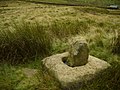
 'Socketed' stone, Boulsworth Hill - geograph.org.uk - 3982701.jpg 640 × 480; 112 KB
-
 A mowing challenge at Copy House Farm - geograph.org.uk - 6521959.jpg 1,024 × 768; 330 KB
-
 A path to Lowlands Farm - geograph.org.uk - 2965817.jpg 800 × 600; 96 KB
-
 A singular shed - geograph.org.uk - 3987605.jpg 640 × 480; 121 KB
-
 Abbot Stone - geograph.org.uk - 1733148.jpg 2,272 × 1,712; 936 KB
-
 Abbot Stone - geograph.org.uk - 2877048.jpg 2,816 × 2,112; 1.95 MB
-
 Access Drive to Alderbarrow Farm - geograph.org.uk - 2877274.jpg 4,320 × 3,240; 5.03 MB
-
 Access Lane from Pasture Springs Farm - geograph.org.uk - 1939954.jpg 2,816 × 2,112; 1.86 MB
-
 Access Lane from Spoutley Lumb - geograph.org.uk - 1943001.jpg 2,816 × 2,112; 2.08 MB
-
 Access Lane leading to Great Thorn Edge - geograph.org.uk - 1947017.jpg 2,816 × 2,112; 2.39 MB
-
 Access Lane to Dean House - geograph.org.uk - 1943938.jpg 2,816 × 2,112; 2.12 MB
-
 Along the boundary at Whitewall - geograph.org.uk - 3936860.jpg 1,600 × 1,200; 517 KB
-
 Ancient boundary stone next to Bronte Way - geograph.org.uk - 2004780.jpg 1,600 × 1,198; 495 KB
-
 Approaching Beaver Farm - geograph.org.uk - 3983870.jpg 640 × 480; 81 KB
-
 Approaching Brink Ends Moor - geograph.org.uk - 6143778.jpg 1,024 × 683; 151 KB
-
 Approaching Lad Law - geograph.org.uk - 2877059.jpg 4,320 × 3,240; 3.56 MB
-
 Approaching Peter Laithe - geograph.org.uk - 1939941.jpg 2,816 × 2,112; 2.15 MB
-
 Approaching the stile near Great Saucer Stones - geograph.org.uk - 3936849.jpg 1,600 × 1,200; 469 KB
-
 Artwork in wood near Little Moss - geograph.org.uk - 2004596.jpg 1,600 × 1,198; 754 KB
-
 Ash Street - Lanehouse - geograph.org.uk - 5036838.jpg 640 × 455; 75 KB
-
 Ash Street, Trawden - geograph.org.uk - 3411802.jpg 640 × 480; 137 KB
-
 At Ratten Clough Bridge - geograph.org.uk - 4213398.jpg 3,648 × 2,736; 3.42 MB
-

-
 Atom, Panopticon for Pendle - geograph.org.uk - 2537485.jpg 1,280 × 960; 771 KB
-
 Ball grove Park - geograph.org.uk - 2536298.jpg 1,280 × 964; 758 KB
-
 Ball Grove Park Lake - geograph.org.uk - 2536250.jpg 1,280 × 965; 934 KB
-
 Ball Grove Park Lake - geograph.org.uk - 2536301.jpg 1,280 × 960; 611 KB
-
 Ball Grove Park, car park - geograph.org.uk - 6521972.jpg 1,024 × 768; 218 KB
-
 Ball Grove Park, former mill goit - geograph.org.uk - 6521971.jpg 1,024 × 768; 400 KB
-
 Ball Grove Park, green flag - geograph.org.uk - 6521973.jpg 1,024 × 768; 169 KB
-
 Ball Grove Park, lower lake - geograph.org.uk - 6521967.jpg 1,024 × 768; 156 KB
-
 Ball Grove Park, picnic area - geograph.org.uk - 6521984.jpg 1,024 × 768; 228 KB
-
 Ball Grove Park, playground - geograph.org.uk - 6521976.jpg 1,024 × 768; 229 KB
-
 Ball Grove Park, river and fields - geograph.org.uk - 6521981.jpg 1,024 × 768; 326 KB
-
 Ball Grove Park, road alongside the lake - geograph.org.uk - 6521978.jpg 1,024 × 768; 398 KB
-
 Ball Grove Park, Spring Garden - geograph.org.uk - 6521982.jpg 1,024 × 768; 357 KB
-
 Ball Grove Park, view across the lake - geograph.org.uk - 6521969.jpg 1,024 × 768; 210 KB
-
 Barn at Lumb Laithe Farm - geograph.org.uk - 3175548.jpg 4,320 × 3,240; 4.77 MB
-
 Barn west of Boulsworth Dyke - geograph.org.uk - 2755591.jpg 3,072 × 2,304; 1.1 MB
-
 Beaver - geograph.org.uk - 1943003.jpg 2,816 × 2,112; 1.55 MB
-
 Beaver Farm - geograph.org.uk - 1237483.jpg 640 × 427; 75 KB
-
 Beaver Farm - geograph.org.uk - 4940559.jpg 5,184 × 2,971; 1.74 MB
-
 Beaver Scar - geograph.org.uk - 1237488.jpg 640 × 427; 60 KB
-
 Beaver Scar - geograph.org.uk - 1237511.jpg 640 × 426; 48 KB
-
 Beaver Scar - geograph.org.uk - 1243185.jpg 640 × 426; 60 KB
-
 Beck - Skipton Road - geograph.org.uk - 5037277.jpg 640 × 480; 112 KB
-
 Beck - Skipton Road - geograph.org.uk - 5037584.jpg 640 × 480; 130 KB
-
 Becks Crossings, Trawden - geograph.org.uk - 3451319.jpg 640 × 480; 125 KB
-
 Beckside Close - Skipton Road - geograph.org.uk - 5037573.jpg 640 × 480; 82 KB
-
 Bedding Hill Moor - geograph.org.uk - 1733125.jpg 2,272 × 1,712; 916 KB
-
 Below the summit - geograph.org.uk - 3175523.jpg 4,320 × 3,240; 4.61 MB
-
 Bench mark on the boundary stone near Brink Ends - geograph.org.uk - 2755054.jpg 3,072 × 2,304; 1.2 MB
-
 Bendy road ahead - geograph.org.uk - 2495620.jpg 3,872 × 2,592; 5.15 MB
-
 Bit of a deep snow drift on Burnley Road - geograph.org.uk - 3398921.jpg 640 × 480; 121 KB
-

-
 Bottoms Bridge and the old schoolhouse, Trawden - geograph.org.uk - 4253195.jpg 1,600 × 1,200; 513 KB
-
 Bough Gap Farm - geograph.org.uk - 2576540.jpg 3,872 × 2,592; 4.39 MB
-
 Bough Gap Farm - geograph.org.uk - 4940504.jpg 3,329 × 4,245; 1.71 MB
-
 Boulder in Wycoller Beck - geograph.org.uk - 2537240.jpg 1,280 × 960; 757 KB
-
 Boulsworth Dyke - geograph.org.uk - 1239947.jpg 640 × 427; 83 KB
-
 Boulsworth Dyke - geograph.org.uk - 1243061.jpg 640 × 426; 55 KB
-
 Boulsworth Dyke - geograph.org.uk - 4940300.jpg 4,830 × 3,011; 1.98 MB
-
 Boulsworth Dyke Farm - geograph.org.uk - 1175248.jpg 640 × 471; 93 KB
-
 Boulsworth Dyke Farm - geograph.org.uk - 1237463.jpg 640 × 427; 61 KB
-
 Boulsworth Dyke Farm - geograph.org.uk - 2307889.jpg 640 × 425; 262 KB
-
 Boulsworth Dyke Farm - geograph.org.uk - 3719870.jpg 1,600 × 1,200; 423 KB
-
 Boulsworth Dyke Farm - geograph.org.uk - 4940309.jpg 5,184 × 3,456; 2.02 MB
-
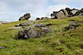
 Boulsworth Hill - geograph.org.uk - 5961198.jpg 1,024 × 768; 193 KB
-
 Boulsworth trig point - geograph.org.uk - 3936228.jpg 1,600 × 1,200; 493 KB
-
 Boundary - geograph.org.uk - 4940252.jpg 5,113 × 2,486; 1.56 MB
-
 Boundary Line at Whitewall looking North East - geograph.org.uk - 4868246.jpg 1,600 × 1,067; 659 KB
-
 Boundary Line at Whitewall looking South West - geograph.org.uk - 4868260.jpg 1,600 × 1,067; 656 KB
-
 Boundary stone near Brink Ends - geograph.org.uk - 2307881.jpg 425 × 640; 330 KB
-
 Boundary stone near Watersheddles - geograph.org.uk - 2755007.jpg 1,600 × 1,200; 734 KB
-
 Boundary stone on Will Moor - geograph.org.uk - 2755643.jpg 3,072 × 2,304; 2.86 MB
-
 Bowlsworth Dyke cottages - geograph.org.uk - 2004761.jpg 1,600 × 1,198; 362 KB
-
 Bridge and ford near Wycoller - geograph.org.uk - 2755028.jpg 1,600 × 1,200; 726 KB
-
 Bridge in Smithy Clough - geograph.org.uk - 2312064.jpg 2,048 × 1,536; 1.17 MB
-
 Bridge over Turnhole Clough - geograph.org.uk - 1175398.jpg 640 × 480; 120 KB
-
 Bridge over Turnhole Clough - geograph.org.uk - 2307884.jpg 640 × 425; 360 KB
-
 Bridge over Turnhole Clough. - geograph.org.uk - 198975.jpg 640 × 480; 112 KB
-
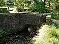
 Bridge, Skipton Road, Trawden - geograph.org.uk - 1946102.jpg 1,632 × 1,224; 482 KB
-
 Bridleway and Bridge crossing Turnhole Clough - geograph.org.uk - 5571545.jpg 4,000 × 3,000; 3.69 MB
-
 Bridleway and path beside Saucer Hill Clough - geograph.org.uk - 5571550.jpg 4,000 × 3,000; 3.32 MB
-
 Bridleway Bridge over Turnhole Clough - geograph.org.uk - 1282353.jpg 1,024 × 683; 168 KB
-

-
 Bridleway crossing Will Moor Clough - geograph.org.uk - 1175015.jpg 640 × 478; 127 KB
-
 Bridleway junction near Beaver - geograph.org.uk - 2755069.jpg 3,072 × 2,304; 1.08 MB
-
 Bridleway towards Boulsworth Dyke - geograph.org.uk - 1237407.jpg 640 × 426; 75 KB
-
 Bridleway towards Winewall - geograph.org.uk - 4253089.jpg 1,600 × 1,200; 490 KB
-
 Bridleway track approaching Lumb Laithe - geograph.org.uk - 5571554.jpg 4,000 × 3,000; 3.06 MB
-
 Bridleway track approaching Upper Coldwell Reservoir - geograph.org.uk - 5571564.jpg 4,000 × 3,000; 2.8 MB
-
 Bridleway track down Smithy Clough - geograph.org.uk - 1257191.jpg 640 × 480; 74 KB
-
 Bridleway track near Antley Gate and Will Moor Clough - geograph.org.uk - 5571560.jpg 4,000 × 3,000; 3.64 MB
-
 Bright Street - geograph.org.uk - 1394176.jpg 640 × 480; 81 KB
-
 Bronte Way - geograph.org.uk - 1817546.jpg 640 × 480; 124 KB
-
 Bronte Way - geograph.org.uk - 4940323.jpg 5,184 × 3,254; 1.59 MB
-
 Bronte Way - geograph.org.uk - 5961201.jpg 1,024 × 768; 171 KB
-
 Bronte Way above Saucer Hill Clough - geograph.org.uk - 1175387.jpg 640 × 480; 112 KB
-
 Bronte Way above Trawden - geograph.org.uk - 1175253.jpg 640 × 480; 122 KB
-
 Bronte Way near Brink Ends - geograph.org.uk - 1175392.jpg 480 × 640; 100 KB
-
 Brontë Way - geograph.org.uk - 2537611.jpg 1,280 × 960; 709 KB
-
 Brown grouse over grassland - geograph.org.uk - 6521870.jpg 1,024 × 768; 126 KB
-
 Brown Hill Moor - geograph.org.uk - 4940307.jpg 5,184 × 3,001; 2.02 MB
-
 Burnley Road - geograph.org.uk - 3398913.jpg 640 × 480; 98 KB
-
 Burnley Road - geograph.org.uk - 3398928.jpg 640 × 480; 134 KB
-
 Burnley Road - viewed from Lanehouse - geograph.org.uk - 5036836.jpg 640 × 480; 79 KB
-
 Burnley Road by New Laith - geograph.org.uk - 5555325.jpg 1,500 × 1,125; 169 KB
-
 Burnley Road by Will o' th' Moon farm - geograph.org.uk - 5555333.jpg 1,500 × 1,125; 122 KB
-
 Burnley Road heading to Nelson - geograph.org.uk - 5555398.jpg 1,500 × 1,125; 149 KB
-
 Burnley Road near New Laithe - geograph.org.uk - 3398929.jpg 640 × 480; 152 KB
-
 Buttock Laithe Farm - geograph.org.uk - 1939940.jpg 2,790 × 2,111; 1.65 MB
-
 Carr Head, Trawden - geograph.org.uk - 3411731.jpg 640 × 480; 156 KB
-
 Cattle grid on the track to Beaver - geograph.org.uk - 2312084.jpg 1,600 × 1,200; 320 KB
-
 Chinook above Wycoller - geograph.org.uk - 6521863.jpg 1,024 × 768; 111 KB
-
 Church Street in Whitby Trawden - geograph.org.uk - 5546661.jpg 1,500 × 1,094; 162 KB
-
 Church Street, Trawden - geograph.org.uk - 3411791.jpg 640 × 480; 125 KB
-
 Clam Bridge - geograph.org.uk - 3864371.jpg 640 × 480; 157 KB
-
 Clam Bridge - geograph.org.uk - 4248719.jpg 3,648 × 2,736; 4.93 MB
-
 Clam Bridge and Ford over Wycoller Beck - geograph.org.uk - 2537229.jpg 1,280 × 956; 938 KB
-
 Clam Bridge Ford - geograph.org.uk - 5763158.jpg 4,032 × 3,024; 6.1 MB
-
 Clam Bridge Wycollar - geograph.org.uk - 5486267.jpg 1,024 × 755; 507 KB
-
 Clam bridge. Wycoller. - geograph.org.uk - 6143781.jpg 1,024 × 683; 301 KB
-
 Clapper Bridge over Wycoller Beck - geograph.org.uk - 2537320.jpg 1,280 × 960; 914 KB
-
 Clapper Bridge over Wycoller Beck - geograph.org.uk - 3004918.jpg 640 × 480; 133 KB
-
 Clapper Bridge over Wycoller Beck - geograph.org.uk - 5851596.jpg 5,152 × 3,864; 7.02 MB
-
 Clapper Bridge Wycollar - geograph.org.uk - 5486234.jpg 1,013 × 768; 472 KB
-
 Clarence Street, Trawden - geograph.org.uk - 3411807.jpg 480 × 640; 67 KB
-
 Clogg Heads, Trawden - geograph.org.uk - 3451317.jpg 640 × 480; 146 KB
-
 Close up of the fireplace in the hall of Wycoller Hall - geograph.org.uk - 5975904.jpg 4,000 × 3,000; 4.91 MB
-
 Clough Valley - geograph.org.uk - 5853996.jpg 1,024 × 683; 479 KB
-
 Cobbled pathway and play area in Ball Grove Park - geograph.org.uk - 5867312.jpg 4,000 × 3,000; 3.5 MB
-
 Colne and Trawden Light Railway - geograph.org.uk - 3451311.jpg 480 × 640; 95 KB
-
 Colne Road - viewed from Lanehouse - geograph.org.uk - 5036835.jpg 640 × 480; 97 KB
-
 Colne Water - geograph.org.uk - 2536209.jpg 1,280 × 960; 825 KB
-
 Colne Water - geograph.org.uk - 2536236.jpg 1,280 × 960; 1.05 MB
-
 Colne Water - geograph.org.uk - 2536267.jpg 1,280 × 960; 880 KB
-
 Colne Water - geograph.org.uk - 2536270.jpg 1,280 × 950; 912 KB
-
 Colne Water - geograph.org.uk - 6141488.jpg 4,290 × 2,769; 5.71 MB
-
 Combe Hill Cross - geograph.org.uk - 933470.jpg 640 × 480; 106 KB
-
 Coming down off Boulsworth Hill - geograph.org.uk - 3983866.jpg 640 × 480; 88 KB
-
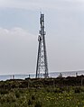
 Communications Mast at Draught Gates - geograph.org.uk - 4917723.jpg 4,000 × 3,000; 2.11 MB
-
 Copy House Bridge - geograph.org.uk - 2537227.jpg 1,280 × 960; 966 KB
-
 Copy House Farm - geograph.org.uk - 6521955.jpg 1,024 × 768; 154 KB
-
 Cottage at Little Moss - geograph.org.uk - 2004608.jpg 1,600 × 1,198; 530 KB
-
 Cottages at Beaver - geograph.org.uk - 2312088.jpg 1,024 × 768; 118 KB
-
 Cotton Tree Lane in Colne - geograph.org.uk - 5546645.jpg 1,500 × 1,116; 163 KB
-
 Cotton Tree Methodist Colne - geograph.org.uk - 2619470.jpg 3,648 × 2,736; 1.81 MB
-
 Cross Bent - geograph.org.uk - 4940243.jpg 5,184 × 2,991; 2.03 MB
-
 Crow Hill Beck - geograph.org.uk - 3936891.jpg 1,600 × 1,200; 805 KB
-
 Crow Hill Beck - geograph.org.uk - 3936896.jpg 1,600 × 1,200; 760 KB
-
 Crow Hill Wague - geograph.org.uk - 4868228.jpg 1,600 × 1,067; 569 KB
-
 Cut bench mark on gatepost near Beaver Farm - geograph.org.uk - 2755489.jpg 3,072 × 2,304; 2.52 MB
-
 Cut bench mark on the house at Boulsworth Dyke Farm - geograph.org.uk - 2755577.jpg 3,072 × 2,304; 1.4 MB
-
 Cut bench mark on Wycoller Hall - geograph.org.uk - 2755037.jpg 3,072 × 2,304; 1.2 MB
-
 Dark block of rock in the Dove Stones, Trawden Forest - geograph.org.uk - 6209843.jpg 2,000 × 1,500; 941 KB
-
 Dean House Farm - geograph.org.uk - 3719823.jpg 1,600 × 1,200; 338 KB
-
 Dean Street - Skipton Road - geograph.org.uk - 5037283.jpg 640 × 480; 64 KB
-
 Descending off Boulsworth Hill - geograph.org.uk - 2877124.jpg 4,320 × 3,240; 5.6 MB
-
 Descent from Boulsworth - geograph.org.uk - 3175534.jpg 4,320 × 3,240; 4.67 MB
-
 Dove Stones (1) - geograph.org.uk - 4565218.jpg 1,600 × 1,067; 582 KB
-
 Dove Stones (2) - geograph.org.uk - 4565224.jpg 1,600 × 1,067; 715 KB
-
 Dove Stones - geograph.org.uk - 4196625.jpg 5,400 × 3,600; 2.54 MB
-
 Dove Stones - geograph.org.uk - 4196643.jpg 5,400 × 3,600; 2.24 MB
-
 Dove Stones, Northern end - geograph.org.uk - 5435616.jpg 5,184 × 3,888; 2.8 MB
-
 Down to Wycoller - geograph.org.uk - 5129073.jpg 5,152 × 3,864; 7.58 MB
-
 Draught Gates - geograph.org.uk - 4940554.jpg 3,187 × 4,086; 1.48 MB
-
 Dry stone wall above Turnhole Clough - geograph.org.uk - 2312067.jpg 2,048 × 1,536; 1.2 MB
-
 Ducks Wycoller - geograph.org.uk - 6088496.jpg 1,024 × 768; 354 KB
-
 East View, Trawden - geograph.org.uk - 3411797.jpg 640 × 480; 132 KB
-

-

-
 Enclosed footpath south of Wycoller - geograph.org.uk - 2312099.jpg 1,600 × 1,200; 355 KB
-
 End of the track at Hey Slacks Clough - geograph.org.uk - 3936220.jpg 1,600 × 1,200; 531 KB
-
 Entering Pendle - geograph.org.uk - 2965668.jpg 800 × 600; 71 KB
-
 Entrance to Beaver Farm - geograph.org.uk - 1175800.jpg 640 × 432; 97 KB
-
 Farm building near Boulsworth Dyke - geograph.org.uk - 1239911.jpg 640 × 426; 69 KB
-
 Farm Track above Saucer Hill Clough. - geograph.org.uk - 198885.jpg 640 × 480; 78 KB
-
 Farm track to Alder Hurst Head - geograph.org.uk - 3175481.jpg 4,320 × 3,240; 4.97 MB
-
 Fat sheep above Trawden - geograph.org.uk - 2494414.jpg 3,872 × 2,592; 4.68 MB
-
 Featureless Moor to the East of Crow Hill - geograph.org.uk - 4868118.jpg 1,600 × 1,067; 522 KB
-
 Fence line on Boulsworth Hill - geograph.org.uk - 4196573.jpg 5,400 × 3,600; 2.91 MB
-
 Ferndean Way in Wycoller - geograph.org.uk - 6131877.jpg 2,700 × 2,025; 598 KB
-
 Ferndean Way in Wycoller - geograph.org.uk - 6131878.jpg 2,700 × 2,025; 536 KB
-
 Ferndean Way near the Pump House - geograph.org.uk - 5122598.jpg 5,152 × 3,864; 7.72 MB
-
 Fields towards Stunstead Farm - geograph.org.uk - 2576561.jpg 3,872 × 2,592; 3.94 MB
-
 Float Bridge Beck - geograph.org.uk - 1942984.jpg 2,816 × 2,112; 1.94 MB
-
 Footbridge near Trawden - geograph.org.uk - 5961212.jpg 1,024 × 768; 364 KB
-
 Footbridge over Smithy Clough at Parson Lee - geograph.org.uk - 2004482.jpg 1,600 × 1,198; 737 KB
-
 Footbridge over Wycoller Beck - geograph.org.uk - 1254261.jpg 640 × 480; 137 KB
-
 Footpath - Skipton Road - geograph.org.uk - 5037561.jpg 480 × 640; 88 KB
-
 Footpath - Skipton Road - geograph.org.uk - 5037564.jpg 480 × 640; 128 KB
-
 Footpath - Skipton Road - geograph.org.uk - 5037570.jpg 640 × 480; 71 KB
-
 Footpath - Skipton Road - geograph.org.uk - 5037576.jpg 480 × 640; 99 KB
-
 Footpath - Skipton Road - geograph.org.uk - 5037580.jpg 640 × 480; 92 KB
-
 Footpath above Turnhole Clough - geograph.org.uk - 3987600.jpg 800 × 600; 145 KB
-

-
 Footpath from Winewall to Bough Gap Farm - geograph.org.uk - 1892327.jpg 640 × 480; 137 KB


_-_geograph.org.uk_-_4565218.jpg)
_-_geograph.org.uk_-_4565224.jpg)


