Category:Travel maps of Virginia
Jump to navigation
Jump to search
States of the United States: Alabama · Alaska · Arizona · Arkansas · California · Colorado · Delaware · Florida · Georgia · Hawaii · Idaho · Illinois · Indiana · Iowa · Kansas · Kentucky · Louisiana · Maine · Maryland · Massachusetts · Michigan · Minnesota · Mississippi · Missouri · Montana · Nebraska · Nevada · New Hampshire · New Jersey · New Mexico · New York · North Carolina · North Dakota · Ohio · Oklahoma · Oregon · Pennsylvania · Rhode Island · South Carolina · South Dakota · Tennessee · Texas · Utah · Virginia · Washington · Wisconsin · Wyoming – Washington, D.C.
American Samoa · Guam · Northern Mariana Islands · Puerto Rico
American Samoa · Guam · Northern Mariana Islands · Puerto Rico
Subcategories
This category has the following 5 subcategories, out of 5 total.
Media in category "Travel maps of Virginia"
The following 13 files are in this category, out of 13 total.
-
 George Washington Memorial Parkway - Reference Map.jpg 8,310 × 6,462; 5.87 MB
-
 Historic Triangle Virginia.jpg 2,923 × 1,944; 526 KB
-
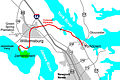
 Northern Virginia map.png 640 × 936; 889 KB
-
 Northern Virginia map.svg 641 × 939; 5.26 MB
-
 Northern Virginia Region.png 1,179 × 1,733; 2.23 MB
-
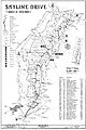
 Skyline Drive - Map 1 - North District.jpg 4,475 × 6,610; 7.16 MB
-
 Skyline Drive - Map 2 - Central District.jpg 4,476 × 6,648; 8.74 MB
-
 Skyline Drive - Map 3 - South District.jpg 4,440 × 6,653; 7.94 MB
-
 Travel Regions of Virginia.png 1,280 × 608; 371 KB
-
 Varegions.jpg 360 × 169; 8 KB
-
 Varegions.png 360 × 169; 13 KB
-
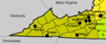 VirginiaSW.png 626 × 259; 76 KB
-
 Wikivoyage Richmond Map PNG.png 617 × 540; 64 KB


