Category:Travel maps of Scotland
Jump to navigation
Jump to search
Media in category "Travel maps of Scotland"
The following 31 files are in this category, out of 31 total.
-
Aberdeenshire map.png 1,194 × 1,009; 23 KB
-
Argyll and Bute map.png 820 × 1,394; 40 KB
-
Arran map.png 840 × 660; 16 KB
-
Ayrshire map.png 676 × 953; 18 KB
-
Berneray map.png 1,193 × 888; 42 KB
-
Berneray.svg 398 × 296; 71 KB
-
Central belt map.png 1,200 × 904; 172 KB
-
Central Belt WV regions map EN.jpg 2,000 × 1,414; 174 KB
-
Clydesdale map.png 803 × 1,084; 25 KB
-
Clydeside map.png 1,373 × 1,127; 43 KB
-
Dumfries and Galloway map.png 1,411 × 882; 33 KB
-
Fife map.png 1,146 × 769; 24 KB
-
Glencoe Map.jpg 1,084 × 966; 295 KB
-
Hebrides map.png 1,200 × 2,864; 354 KB
-
Highland map.png 945 × 1,114; 35 KB
-
Highlands map.png 1,200 × 2,131; 232 KB
-
Inner Hebrides map.png 649 × 1,487; 55 KB
-
Lothians map.png 1,128 × 487; 18 KB
-
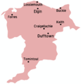
Moray map.png 868 × 904; 19 KB
-
North Coast 500, Scotland.svg 742 × 482; 4.24 MB
-
North East Scotland map.png 1,200 × 1,265; 167 KB
-
Orkney map.png 1,200 × 968; 153 KB
-
Scottish Borders map.png 900 × 905; 88 KB
-
Scottish Highlands WV region map EN.png 1,600 × 2,697; 1.53 MB
-
Shetland map.png 1,200 × 1,869; 199 KB
-
South West Scotland map.png 1,200 × 1,089; 184 KB
-
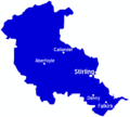
Stirlingshire map.png 1,020 × 916; 19 KB
-
The Malt Whisky Trail Map.jpg 9,921 × 7,016; 3.42 MB
-
Unst travel map 01.svg 1,095 × 1,647; 945 KB
-
Unst travel map 02.png 1,448 × 2,178; 858 KB
-
Unst.png 1,676 × 2,353; 259 KB


