Category:Travel maps of San Diego, California
Jump to navigation
Jump to search
Subcategories
This category has the following 2 subcategories, out of 2 total.
M
P
Media in category "Travel maps of San Diego, California"
The following 20 files are in this category, out of 20 total.
-
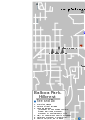
 Balboa park hillcrest map.png 1,394 × 1,965; 723 KB
-
 Balboa park hillcrest map.svg 744 × 1,052; 514 KB
-
 Downtown sandiego map.PNG 1,804 × 1,601; 849 KB
-
 Downtown sandiego map.svg 744 × 1,052; 619 KB
-
 La jolla village map.PNG 945 × 794; 247 KB
-
 La jolla village map.svg 744 × 1,052; 386 KB
-
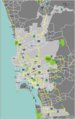
 Missionbeach pacificbeach sandiego.png 1,769 × 1,594; 978 KB
-
 Missionbeach pacificbeach sandiego.svg 744 × 1,052; 1.2 MB
-
 Missionvalley sandiego map.PNG 1,662 × 408; 355 KB
-
 Missionvalley sandiego map.svg 744 × 1,052; 443 KB
-
 Oldtown sandiego map.PNG 1,111 × 1,153; 456 KB
-
 Oldtown sandiego map.svg 744 × 1,052; 350 KB
-
 Pointloma oceanbeach map.PNG 882 × 1,402; 467 KB
-
 Pointloma oceanbeach map.svg 940 × 1,498; 502 KB
-
 San Diego commuter rail map.png 683 × 1,049; 123 KB
-
 San Diego Freeway.svg 1,152 × 640; 276 KB
-
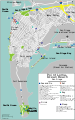
 San Diego Map.PNG 1,323 × 2,107; 733 KB
-
 San diego map.PNG 1,323 × 2,107; 932 KB
-
 San diego map.svg 744 × 1,052; 1.54 MB
-
 San Diego printable tourist attractions map.jpg 1,488 × 2,105; 1.1 MB


