Category:Travel maps of Niigata prefecture
Jump to navigation
Jump to search
| Prefectures of Japan 旅行地図 (Travel maps) | |||
|---|---|---|---|
|

| ||
Media in category "Travel maps of Niigata prefecture"
The following 5 files are in this category, out of 5 total.
-
 Japan Niigata Pref Map.svg 973 × 985; 291 KB
-
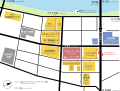 Map of NiigataBandaiCity.svg 2,037 × 1,537; 460 KB
-
 Map of NiigataFurumachi.svg 1,761 × 2,411; 535 KB
-
 SadoIsland map.png 1,191 × 1,683; 336 KB
-
 Sadoisland map.svg 744 × 1,052; 89 KB


