Category:Travel maps of New Orleans
Jump to navigation
Jump to search
Media in category "Travel maps of New Orleans"
The following 29 files are in this category, out of 29 total.
-
 7th, 8th, and Upper 9th Wards map.png 3,008 × 1,709; 1.85 MB
-
 7th, 8th, and Upper 9th Wards map.svg 936 × 974; 1.53 MB
-
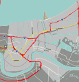
 Algiers NOLA map.png 3,008 × 1,709; 1.74 MB
-
 Algiers NOLA map.svg 2,066 × 1,788; 2.32 MB
-
 Bywater map.png 3,008 × 1,709; 1,004 KB
-
 Bywater map.svg 2,171 × 1,268; 925 KB
-
 Central City map.png 1,709 × 3,008; 1.63 MB
-
 Central City map.svg 1,173 × 1,139; 753 KB
-
 Eastern New Orleans expanded map.png 3,008 × 1,709; 1.77 MB
-
 Eastern New Orleans expanded map.svg 468 × 266; 6.98 MB
-
 Eastern New Orleans map.png 3,008 × 1,709; 1.58 MB
-
 Eastern New Orleans map.svg 762 × 434; 1,000 KB
-
 French Quarter map.svg 1,070 × 1,708; 2.56 MB
-
 Lakeview and Lakefront map.png 3,008 × 1,709; 1.92 MB
-
 Lakeview and Lakefront map.svg 651 × 461; 1.62 MB
-
 Lower Ninth Ward map.png 1,709 × 3,008; 1.36 MB
-
 Lower Ninth Ward map.svg 963 × 1,200; 674 KB
-
 Marigny map.svg 1,980 × 1,118; 1 MB
-
 Mid-City New Orleans map.png 3,008 × 1,709; 3.09 MB
-
 Mid-City New Orleans map.svg 558 × 318; 2.2 MB
-
 New Orleans districts map grouped.svg 936 × 974; 3.64 MB
-
 New Orleans districts map.svg 936 × 974; 3.54 MB
-
 New Orleans map.svg 936 × 974; 3.85 MB
-
 St Roch-Florida map.png 3,008 × 1,709; 1.74 MB
-
 St Roch-Florida map.svg 936 × 974; 1.51 MB
-
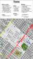 Treme map.png 1,709 × 3,008; 1.55 MB
-
 Treme map.svg 1,385 × 1,446; 761 KB
-
 Uptown New Orleans map.png 2,458 × 1,709; 1.99 MB
-
 Uptown New Orleans map.svg 1,759 × 1,131; 1.16 MB


