Category:Travel maps of Los Angeles
Jump to navigation
Jump to search
Subcategories
This category has only the following subcategory.
Media in category "Travel maps of Los Angeles"
The following 35 files are in this category, out of 35 total.
-
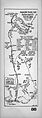 Automobile touring route from Los Angeles to Placerita Canyon, 1912 (AAA-SM-004615).jpg 2,191 × 6,152; 2.49 MB
-

-
 Automobile road map from Los Angeles to Topanga Canon and return, 1915 (AAA-SM-004587).jpg 6,237 × 2,198; 2.55 MB
-
-
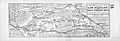
 Automobile road map from Los Angeles to San Fernando Valley, 1917 (AAA-SM-000310v).jpg 2,195 × 6,244; 2.31 MB
-

-

-
 Automobile road from Los Angeles to Redondo, 1921 (AAA-SM-005232).jpg 2,110 × 6,177; 3.06 MB
-
 Automobile road from Los Angeles to Redondo, 1921 (AAA-SM-005232v).jpg 2,160 × 6,201; 2.37 MB
-

-
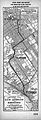
 Central Los Angeles WV map.png 456 × 520; 173 KB
-
 Automobile road from Los Angeles to Turnbull Canyon and return, 1919 (AAA-SM-004709).jpg 6,200 × 2,172; 2.65 MB
-

-
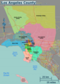
 LA County Wikivoyage Map.png 1,035 × 1,443; 753 KB
-
 LA districts map.png 2,150 × 2,996; 1.95 MB
-
 LA districts map.svg 518 × 723; 9.75 MB
-
 La gatewaycities map.svg 744 × 1,052; 2.2 MB
-
 LA gatewaycities wikivoyage map.png 1,249 × 1,468; 879 KB
-
 La sanfernando valley wikivoyage map.png 2,016 × 1,036; 726 KB
-
 La sanfernando valley wikivoyage proposal.png 1,814 × 1,036; 522 KB
-
 LA sanfernandovalley map.svg 1,008 × 518; 1.18 MB
-
 La sangabrielvalley map.svg 1,017 × 658; 2.45 MB
-
 La sangabrielvalley wikivoyage map.png 1,017 × 658; 475 KB
-
 La santaclaritavalley map.svg 1,120 × 991; 564 KB
-
 La santaclaritavalley wikivoyage map.png 815 × 810; 181 KB
-
 LA south bay wikivoyage map.png 1,081 × 1,888; 661 KB
-
 LA southbay wikivoyage map.svg 681 × 915; 1.57 MB
-
 LA westside wikivoyage map.png 2,164 × 1,161; 673 KB
-
 La westside wikivoyage.svg 1,082 × 580; 1.83 MB
-
 Automobile road map from Los Angeles to San Fernando Valley, 1917 (AAA-SM-000310).jpg 5,952 × 2,046; 2.25 MB
-

-
-

-

-

_(14801447943).jpg)


.jpg)
.jpg)
.jpg)
.jpg)
.jpg)
.jpg)
.jpg)
.jpg)
.jpg)
.jpg)
.jpg)
.jpg)
.jpg)
.jpg)
.jpg)
.jpg)
.jpg)