Category:Travel maps of Germany
Jump to navigation
Jump to search
Subcategories
This category has the following 9 subcategories, out of 9 total.
Media in category "Travel maps of Germany"
The following 27 files are in this category, out of 27 total.
-
 Baden-Wuerttemberg travel map EN.png 2,000 × 2,261; 1.28 MB
-
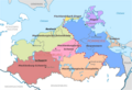
 Central Germany Regions 01.png 1,500 × 1,788; 626 KB
-

-
 Eastern Germany Regions 01.png 1,653 × 1,969; 1,001 KB
-

-
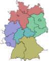 German Lander.png 940 × 1,140; 73 KB
-
 Germany Region (ru).png 1,965 × 2,407; 1.26 MB
-
 Germany Regions 02.png 503 × 600; 221 KB
-
 Germany Regions 02.svg 744 × 1,052; 3.8 MB
-
 Germany Regions Routes.png 2,041 × 2,434; 1.3 MB
-
 Germany Regions Routes.svg 744 × 1,052; 3.49 MB
-
 GEW Übersichtskarte.jpg 796 × 814; 442 KB
-
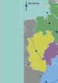
 MV Wikivoyage.png 1,129 × 775; 313 KB
-
 North Germany Regions 01.png 1,653 × 1,969; 1,001 KB
-
 Northrhinewestphalia-regions.png 1,996 × 2,085; 1.39 MB
-
 Northrhinewestphalia-regions.svg 619 × 647; 2.16 MB
-
 NRW Reiseregionen.png 620 × 648; 304 KB
-
 Rhinelandpalatinate-regions.png 2,000 × 2,582; 1.11 MB
-
 Rhinelandpalatinate-regions.svg 566 × 731; 325 KB
-
 Southern Germany Regions 01.png 1,653 × 1,969; 999 KB
-
 Tourist Density Germany by States 2017.png 1,008 × 1,208; 212 KB
-
 Tourist Density in Selected Cities in Germany.png 1,000 × 1,185; 791 KB
-
 Tourist Density Northeastern Germany by Districts.png 1,770 × 1,663; 1.03 MB
-
 Tourist Density Southwestern Germany by District.png 2,254 × 2,312; 1.92 MB
-
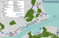 Travemünde travel map.png 3,000 × 1,921; 1.09 MB
-
 Travemünde travel map1.svg 791 × 506; 2.52 MB
-
 Western Germany Regions 01.png 1,653 × 1,969; 999 KB


_%E2%80%94_Mattes_2022-10-23.jpg)

.png)


