Category:Travel maps of Brazil
Jump to navigation
Jump to search
Subcategories
This category has the following 2 subcategories, out of 2 total.
V
- Visa maps of Brazil (14 F)
Media in category "Travel maps of Brazil"
The following 47 files are in this category, out of 47 total.
-
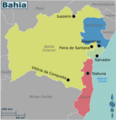
Bahia travel map en.voy.png 3,000 × 3,108; 774 KB
-
Bahia travel map.svg 886 × 918; 533 KB
-
Bahia WV travel map 2023 EN.png 2,000 × 2,072; 642 KB
-
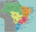
Brazil regions map (cs).png 1,920 × 1,736; 1.08 MB
-
Brazil regions.png 1,566 × 1,378; 414 KB
-
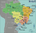
BrazilMap (fr).png 2,048 × 1,852; 1.09 MB
-
BrazilMap.png 1,994 × 1,803; 1.04 MB
-
BrazilMap.svg 744 × 1,052; 2.58 MB
-
BrazilNorth.png 3,452 × 2,271; 1.32 MB
-
BrazilNorth.svg 744 × 1,052; 2.57 MB
-
BrazilSouth.svg 744 × 1,052; 2.53 MB
-
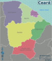
Ceara travel map.png 3,000 × 3,541; 727 KB
-
Central West travel map.png 3,000 × 3,242; 989 KB
-
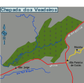
Chapada dos Veadeiros.png 964 × 884; 171 KB
-
Francisco de Orellana Amazon River voyage (1541-1542).svg 800 × 368; 1.5 MB
-
Image-Brazil regions (fr).png 780 × 688; 172 KB
-
Image-Brazil regions(pt).png 1,479 × 1,302; 448 KB
-
Image-Brazil regions.svg 780 × 687; 607 KB
-
Map of Chapada dos Veadeiros.svg 354 × 350; 147 KB
-
Mapa de viagem por todas as capitais do Brasil.png 2,900 × 3,339; 1.96 MB
-
Northeast Brazil 2.svg 715 × 809; 748 KB
-
NortheastBrazil.png 2,707 × 2,927; 1.32 MB
-
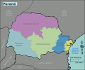
Paraná regions map.png 3,906 × 3,255; 822 KB
-
Paraná regions map.svg 750 × 625; 3.59 MB
-
Pernambuco travel map.svg 989 × 502; 510 KB
-
Regions of Espirito Santo (pt).png 670 × 980; 172 KB
-
Regions of Espirito Santo.png 672 × 980; 199 KB
-
Regions of Espirito Santo.svg 677 × 986; 1.02 MB
-
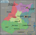
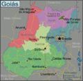
Regions of Goias (pt).png 707 × 690; 261 KB
-
Regions of Goias.png 707 × 690; 261 KB
-
Regions of Goias.svg 710 × 693; 1.16 MB
-
Regions of Parana (pt).png 1,538 × 989; 561 KB
-
Regions of Parana.png 1,538 × 989; 562 KB
-
Regions of Parana.svg 1,540 × 990; 1.63 MB
-
Regions of Rio Grande do Sul-pt.png 713 × 686; 155 KB
-
Regions of Rio Grande do Sul.png 713 × 686; 152 KB
-
Regions of Rio Grande do Sul.svg 718 × 691; 1.12 MB
-
Regions of RJ (pt).png 959 × 686; 299 KB
-
Regions of RJ.png 3,008 × 2,152; 1.19 MB
-
Regions of RJ.svg 960 × 691; 1.03 MB
-
Regions of SP state.svg 1,020 × 638; 2.12 MB
-
Rio de Janeiro travel map.svg 748 × 383; 1.4 MB
-
SouthBrazil.png 2,205 × 2,557; 734 KB
-
SoutheastBrazil.png 3,056 × 2,382; 1.07 MB
-
SoutheastBrazil.svg 744 × 1,052; 2.53 MB
-
SP Mock 1.png 2,747 × 1,723; 1.47 MB
-
São Paulo travel map.svg 1,192 × 1,776; 757 KB
