Category:Transport maps of the Soviet Union
Jump to navigation
Jump to search
Media in category "Transport maps of the Soviet Union"
The following 18 files are in this category, out of 18 total.
-
 Karte der Stalinbahn, blank.png 1,000 × 508; 794 KB
-
 Karte der Stalinbahn, English.png 1,000 × 508; 851 KB
-
 Karte der Stalinbahn, Russian.png 1,000 × 508; 826 KB
-
 Karte der Stalinbahn.png 1,000 × 508; 874 KB
-
 M1 karte SU.jpg 1,352 × 946; 138 KB
-
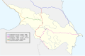
 Main Roads Armenia 1982-1996.svg 2,657 × 1,736; 566 KB
-
 Main Roads Azerbaijan 1982-2000.svg 2,657 × 1,736; 562 KB
-
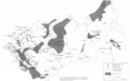
 Main Roads Caucasus region USSR 1960-1982.svg 2,657 × 1,736; 251 KB
-
 Main Roads Georgia 1982-1996.svg 2,657 × 1,736; 561 KB
-
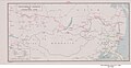
 Major Soviet Maritime Ports, Airports, and Sea Routes, 1986.png 1,386 × 901; 745 KB
-
 Major Soviet Petroleum Deposits and Pipelines, 1982.png 1,450 × 910; 332 KB
-
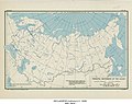
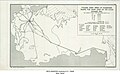
 Major Soviet Roads, 1981.png 1,362 × 898; 180 KB
-
 Mineralogical and railway map of Siberia - (Signé - Colonel G. de Metz) - btv1b53209892h.jpg 12,284 × 9,311; 21.25 MB
-
-
 Trans-Siberian Railroad and Connecting Lines - DPLA - 79edee0d174071e79a3490b12a0d6975.jpg 6,401 × 3,330; 1.93 MB
-

-
 Ussr-terrain and transportation-1974.jpg 5,120 × 3,351; 3.19 MB
-


_-_btv1b53209892h.jpg)
_-_DPLA_-_46f58d0b813f254daf1f790439ef53da.jpg)
_Principal_Roads_-_DPLA_-_01e24fff3e539b661a2be42d0ef0ac51.jpg)
_1946_-_DPLA_-_7af7a6bd2422a78083cbe5753737468a.jpg)