Category:Transport maps of Hauts-de-Seine
Jump to navigation
Jump to search
Subcategories
This category has the following 2 subcategories, out of 2 total.
Media in category "Transport maps of Hauts-de-Seine"
The following 5 files are in this category, out of 5 total.
-
 92-RéseauRN.png 3,507 × 2,480; 1.49 MB
-
 Railway map of France - 75 - animated - fr.gif 1,252 × 2,266; 8.1 MB
-
 Railway map of France - Paris agglo - animated - fr.gif 1,733 × 1,452; 31.88 MB
-
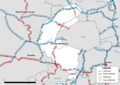
 Transport map of France - 75-92-93-94.svg 1,488 × 1,453; 16.16 MB
-
 Transport map of France - 92.svg 709 × 992; 6.95 MB


