Category:Transport maps of Harz
Jump to navigation
Jump to search
Media in category "Transport maps of Harz"
The following 13 files are in this category, out of 13 total.
-
 Continental atlas deutschland 1932 26 Harz.jpg 5,467 × 3,448; 9.17 MB
-
 Karte Harzer Schmalspurbahnen.png 1,204 × 990; 1.1 MB
-
 Karte Rübelandbahn.png 2,655 × 1,829; 1.31 MB
-
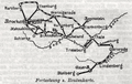
 Karte Südharz-Eisenbahn-Gesellschaft.jpg 1,234 × 1,687; 682 KB
-
 Kleinbahn in St. Andreasberg Blatt 1.png 7,513 × 2,000; 26.01 MB
-
 Kleinbahn in St. Andreasberg Blatt 2.png 7,467 × 2,000; 24 MB
-
 Liebenow-Ravensteins Verkehrs-Rad-Autokarte 13.jpg 3,916 × 2,399; 4.42 MB
-
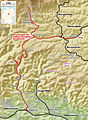
 Oberharzbahn.png 3,565 × 3,130; 2.08 MB
-
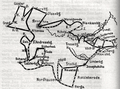
 Reisepläne durch den Harz 2.png 746 × 472; 534 KB
-
 Reisepläne durch den Harz.png 1,006 × 746; 1.3 MB
-
 Special Karte vom Ober- und Unter-Harz von Henry Lange (8).jpg 1,889 × 1,180; 1.44 MB
-
 St. Andreasberger Kleinbahn.png 2,828 × 2,065; 1.3 MB
-
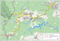
 Strecke Scharzfeld-Sankt Andreasberg.jpg 304 × 264; 20 KB


.jpg)

