Category:Transport maps of Finland
Jump to navigation
Jump to search
Subcategories
This category has the following 7 subcategories, out of 7 total.
*
A
M
P
R
W
Media in category "Transport maps of Finland"
The following 12 files are in this category, out of 12 total.
-
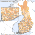
2 digit postcode finland.png 885 × 885; 177 KB
-
Baanakartta-nimilla-2017.gif 800 × 755; 138 KB
-
BK Page 02 ren.jpg 1,563 × 2,274; 1.47 MB
-
Drive time isochrones airports northern Finland.png 3,507 × 2,480; 4.35 MB
-
Etelä-Suomen kuntien suuntanumerot.png 975 × 670; 36 KB
-
Finland.telephone.areacodes.svg 1,850 × 3,220; 162 KB
-
Lapin liikenne.png 1,107 × 1,416; 140 KB
-
Postvagen Stockholm Abo.jpg 924 × 692; 436 KB
-
Päijännetunneli.png 402 × 586; 16 KB
-
Päijännetunneli.svg 402 × 586; 262 KB
-
Road and Railway Map of Finland - DPLA - 40216747ec095e9ef096c5f136523c56.jpg 4,612 × 6,131; 1.4 MB


