Category:Transport maps of Baia Mare
Jump to navigation
Jump to search
Media in category "Transport maps of Baia Mare"
The following 20 files are in this category, out of 20 total.
-
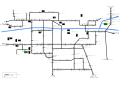 Harta retea autobuz URBIS.svg 1,052 × 744; 267 KB
-
 Harta retea autobuze URBIS.svg 2,245 × 1,587; 374 KB
-
 Harta retea transport URBIS.svg 2,245 × 1,587; 409 KB
-
 Harta retea transport Zona Metropolitana Baia Mare.svg 2,245 × 1,587; 41 KB
-
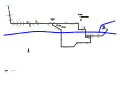
 Harta retea troleibuz URBIS.svg 1,052 × 744; 94 KB
-
 Harta retea troleibuze URBIS.svg 2,245 × 1,587; 146 KB
-
 Harta trasee URBIS.svg 1,052 × 744; 304 KB
-
 Harta trasee Zona Metropolitana Baia Mare.svg 1,052 × 744; 65 KB
-
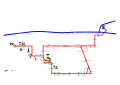
 Harta traseu autobuz 3 11 URBIS.svg 2,245 × 1,587; 85 KB
-
 Harta traseu autobuz 4 URBIS.svg 2,245 × 1,587; 133 KB
-
 Harta traseu autobuz 40 URBIS.svg 2,245 × 1,587; 140 KB
-
 Harta traseu autobuz 5 URBIS.svg 2,245 × 1,587; 117 KB
-
 Harta traseu autobuz 9 URBIS.svg 2,245 × 1,587; 110 KB
-
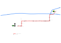 Harta traseu troleibuz 50 URBIS.svg 2,245 × 1,587; 62 KB
-
 Harta traseu troleibuz 54 URBIS.svg 2,245 × 1,587; 124 KB
-
 Liniile de cale ferata Baia Mare Nord.svg 2,980 × 2,105; 21 KB
-
 Liniile de cale ferata Baia Mare Sud.svg 2,980 × 2,105; 25 KB
-
 Liniile de cale ferata din Gara Baia Mare.svg 2,980 × 2,105; 63 KB
-
 Overlay map Baia Mare 1 calea ferata veche.svg 1,490 × 1,073; 9 KB
-
 Overlay map Baia Sprie 1 calea ferata veche.svg 1,397 × 1,006; 5 KB


