Category:Transport in Saltash
Jump to navigation
Jump to search
Subcategories
This category has the following 7 subcategories, out of 7 total.
Media in category "Transport in Saltash"
The following 79 files are in this category, out of 79 total.
-
 A38 - geograph.org.uk - 4987689.jpg 640 × 426; 58 KB
-
 A38 - geograph.org.uk - 5672915.jpg 640 × 426; 67 KB
-
 A38 and Saltash Tunnel - geograph.org.uk - 4847756.jpg 1,600 × 1,200; 313 KB
-
 A38 approaching Notter Bridge - geograph.org.uk - 3697028.jpg 1,920 × 1,054; 302 KB
-
 A38 approaching Notter Bridge - geograph.org.uk - 3697112.jpg 1,920 × 1,328; 511 KB
-
 A38 at Notter Bridge - geograph.org.uk - 3697116.jpg 1,920 × 1,353; 631 KB
-
 A38 Eastbound Saltash Services Ahead - geograph.org.uk - 4667853.jpg 640 × 480; 64 KB
-

-
 A38 entrance to Saltash Tunnel - geograph.org.uk - 2857935.jpg 800 × 600; 304 KB
-

-
 A38 on the edge of Saltash - geograph.org.uk - 2341443.jpg 640 × 480; 71 KB
-
 A38 Tunnel - geograph.org.uk - 5678109.jpg 640 × 426; 72 KB
-
 A38, Saltash bypass - geograph.org.uk - 5226099.jpg 640 × 426; 60 KB
-
 A38, Saltash bypass - geograph.org.uk - 5566805.jpg 640 × 426; 73 KB
-
 A38, Saltash bypass - geograph.org.uk - 5662227.jpg 640 × 426; 49 KB
-
 A38, Saltash bypass - geograph.org.uk - 5662228.jpg 640 × 426; 46 KB
-
 A38, Saltash bypass - geograph.org.uk - 5768471.jpg 640 × 363; 58 KB
-
 A388 - geograph.org.uk - 5672901.jpg 640 × 426; 76 KB
-
 A388 at Carkeel - geograph.org.uk - 1826317.jpg 640 × 480; 94 KB
-
 A388, Carkeel, Saltash - geograph.org.uk - 66923.jpg 640 × 427; 268 KB
-
 B3271 - geograph.org.uk - 5678045.jpg 640 × 426; 54 KB
-
 B3271, New Rd - geograph.org.uk - 5678040.jpg 640 × 426; 76 KB
-
 Bridging the Tamar 1969 - geograph.org.uk - 2218188.jpg 2,549 × 1,615; 1.05 MB
-
 Cornish Main Line - geograph.org.uk - 5001154.jpg 640 × 426; 105 KB
-
 Cornish main line nr Shillingham - geograph.org.uk - 2197753.jpg 640 × 404; 69 KB
-
 Cornwall , The A38 - geograph.org.uk - 4612483.jpg 4,288 × 2,848; 4.93 MB
-
 Crossing the Lynher - geograph.org.uk - 2788151.jpg 640 × 409; 85 KB
-

-
 Entering Cornwall - geograph.org.uk - 5136593.jpg 3,648 × 2,432; 2.48 MB
-
 Get your dosh ready - geograph.org.uk - 4623530.jpg 4,000 × 2,664; 5.2 MB
-
 GWR train on The Royal Albert Bridge - geograph.org.uk - 5004502.jpg 640 × 426; 62 KB
-
 GWR train on The Royal Albert Bridge - geograph.org.uk - 5004518.jpg 640 × 426; 58 KB
-
 Hatt service station, Saltash, Cornwall - geograph.org.uk - 178831.jpg 640 × 427; 235 KB
-
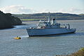
 HMS Brecon - geograph.org.uk - 1091912.jpg 640 × 480; 81 KB
-
 HMS Brecon in the Lynher (2004).jpg 4,288 × 2,848; 4.83 MB
-
 HMS Brecon in the Lynher (2008).jpg 4,288 × 2,848; 4.12 MB
-
 HMS Brecon in the Lynher (3136).jpg 4,288 × 2,848; 6.57 MB
-
 HMS Brecon in the Lynher (3140).jpg 4,288 × 2,848; 6.14 MB
-
 HMS Brecon in the Lynher (6489).jpg 4,288 × 2,848; 6.28 MB
-
 HMS Brecon in the Lynher (9374).jpg 4,288 × 2,848; 5.59 MB
-
 HMS Brecon in the Lynher.jpg 3,156 × 2,355; 2.11 MB
-
 HMS Brecon on the Lynher.jpg 5,556 × 2,730; 6.55 MB
-
 HMS Defiance. (50278306231) (cropped).jpg 3,098 × 1,385; 388 KB
-
 HMS Defiance. (50278306231).jpg 4,000 × 2,402; 961 KB
-

-
 Joining The Tamar Bridge Eastbound - geograph.org.uk - 4667861.jpg 640 × 480; 62 KB
-
 Junction on A38 - geograph.org.uk - 3696914.jpg 1,920 × 1,371; 658 KB
-
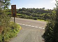
 Lane junction, Notter - geograph.org.uk - 3695801.jpg 1,920 × 1,274; 588 KB
-

-
 Lay-by for eastbound traffic by A38 - geograph.org.uk - 2857959.jpg 800 × 601; 394 KB
-

-
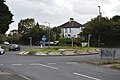
 Mini-roundabout, St Stephen's Rd - geograph.org.uk - 4968047.jpg 640 × 426; 70 KB
-
 Pedestrian and Cycle route - geograph.org.uk - 3990833.jpg 4,000 × 3,000; 2.96 MB
-
 Porsche and Waitrose - geograph.org.uk - 5880396.jpg 1,600 × 1,200; 736 KB
-
 Road Junction - geograph.org.uk - 3957037.jpg 3,357 × 2,478; 5.2 MB
-
 Road off A38 - geograph.org.uk - 5566796.jpg 640 × 426; 53 KB
-
 Road sign to Trematon - geograph.org.uk - 5662256.jpg 640 × 426; 56 KB
-
 Roundabout, A38 - geograph.org.uk - 5001117.jpg 640 × 426; 46 KB
-
 Roundabout, A388 - geograph.org.uk - 5672906.jpg 640 × 425; 39 KB
-
 Roundabout, B3271 - geograph.org.uk - 5672922.jpg 640 × 426; 62 KB
-
 Roundabout, Callington Rd - geograph.org.uk - 5226108.jpg 640 × 426; 56 KB
-
 Roundabout, Callington Road - geograph.org.uk - 3540938.jpg 640 × 411; 53 KB
-
 Saltash , Carkeel Roundabout - geograph.org.uk - 4612487.jpg 4,288 × 2,848; 6.52 MB
-
 Saltash , The A38 - geograph.org.uk - 4612484.jpg 4,288 × 2,848; 4.57 MB
-
 Saltash , The A38 - geograph.org.uk - 4612485.jpg 4,288 × 2,848; 4.18 MB
-
 Saltash , The A38 - geograph.org.uk - 4612486.jpg 4,288 × 2,848; 4.27 MB
-
 Saltash , The A38 - geograph.org.uk - 4612488.jpg 4,288 × 2,848; 4.22 MB
-
 Saltash , The A38 - geograph.org.uk - 4612490.jpg 4,288 × 2,848; 4.96 MB
-
 Saltash , The A38 - geograph.org.uk - 4612498.jpg 4,288 × 2,848; 5.46 MB
-
 Saltash roundabout - geograph.org.uk - 3957035.jpg 4,000 × 2,664; 5.97 MB
-
 Saltash Roundabout, A38 - geograph.org.uk - 5226098.jpg 640 × 426; 55 KB
-
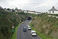
 Saltash Tunnel A38 - geograph.org.uk - 2962288.jpg 800 × 591; 145 KB
-
 Saltash Tunnel East portal.jpg 640 × 427; 268 KB
-
 Saltash Tunnel West portal.jpg 640 × 427; 214 KB
-
 Saltash Tunnel.jpg 3,840 × 2,664; 5.02 MB
-
 St Stephen's Rd - geograph.org.uk - 4968076.jpg 640 × 426; 59 KB
-
 St Stephen's Rd - geograph.org.uk - 4968079.jpg 640 × 426; 60 KB
-
 The Old Saltash Ferry - geograph.org.uk - 5004522.jpg 640 × 426; 73 KB
-


.jpg)
.jpg)
.jpg)
.jpg)
.jpg)
.jpg)


_(cropped).jpg)
.jpg)


