Category:Transport in Kawartha Lakes
Jump to navigation
Jump to search
Wikimedia category | |||||
| Upload media | |||||
| Instance of | |||||
|---|---|---|---|---|---|
| |||||
Subcategories
This category has the following 2 subcategories, out of 2 total.
L
- Transport in Lindsay, Ontario (11 F)
R
Media in category "Transport in Kawartha Lakes"
The following 31 files are in this category, out of 31 total.
-
 35 near Cameron Lake.png 686 × 418; 842 KB
-
 Bridge across Mariposa creek - panoramio.jpg 3,008 × 2,000; 2.94 MB
-
 Bridge across Pigeon River - panoramio.jpg 3,008 × 2,000; 3.21 MB
-
 Elmtree Road crossin - panoramio.jpg 3,008 × 2,000; 2.62 MB
-
 Former Railway Bridge on the Omemee Rail Trail - panoramio.jpg 3,008 × 2,000; 3.19 MB
-
 Former Railway trestle - panoramio.jpg 3,008 × 2,000; 2.76 MB
-
 Former Railway Trestle in Omemee - panoramio.jpg 3,008 × 2,000; 3.23 MB
-
 Hartley Road along Mitchell Lake, near Kirkfield Ontario -a.jpg 1,200 × 900; 310 KB
-
 Hartley Road causeway.jpg 1,200 × 817; 320 KB
-
 Highway 35 Ontario.jpg 3,264 × 2,448; 4.91 MB
-
 Highway 36 east of Bobcaygeon.png 4,320 × 3,240; 16.17 MB
-
 Hwy 7 - panoramio (1).jpg 3,008 × 2,000; 2.87 MB
-
 Hwy 7 Bridge - panoramio.jpg 3,008 × 2,000; 2.9 MB
-
 Kawartha Lakes, ON, Canada - panoramio (14).jpg 3,008 × 2,000; 2.94 MB
-
 Kawartha Lakes, ON, Canada - panoramio (15).jpg 3,008 × 2,000; 3.01 MB
-
 Kawartha Lakes, ON, Canada - panoramio (16).jpg 3,008 × 2,000; 3.18 MB
-
 Kawartha Lakes, ON, Canada - panoramio (17).jpg 3,008 × 2,000; 2.92 MB
-
 Kawartha Lakes, ON, Canada - panoramio - Eric Marshall (1).jpg 3,008 × 2,000; 714 KB
-
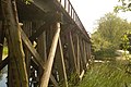
 Large Railway Trestle on the Rail Trail - panoramio.jpg 3,008 × 2,000; 2.89 MB
-
 Medical evacuation after car accident Kawartha Lakes Ontario.jpg 3,072 × 2,048; 2.8 MB
-
 Old 35 curve near Lindsay.png 3,062 × 2,434; 21.36 MB
-
 Old Highway 46.png 3,264 × 2,448; 12.23 MB
-
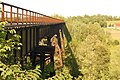
 On the large railway trestle - panoramio.jpg 3,008 × 2,000; 2.85 MB
-
 Ontario 7A.png 236 × 376; 21 KB
-
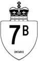 Ontario 7B.png 236 × 376; 21 KB
-
 Orange Corners Trestle.JPG 808 × 607; 145 KB
-
 Removing roof after car accident Kawartha Lakes Ontario.jpg 2,589 × 1,585; 1.51 MB
-
 South Mitchell Lake Causeway, Kirkfield, Ontario - panoramio.jpg 3,968 × 2,232; 2.01 MB
-
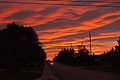 Sunset on Mary St - panoramio.jpg 3,008 × 2,000; 1.33 MB
-
 Trans Canada Trail monument at Emily Park Road - panoramio.jpg 3,008 × 2,000; 2.89 MB
-
 Verulam Rd Bridge - panoramio.jpg 3,008 × 2,000; 3.34 MB


.jpg)

.jpg)
.jpg)
.jpg)
.jpg)
.jpg)


