Category:Trans 11, Utrecht
Jump to navigation
Jump to search
| Object location | | View all coordinates using: OpenStreetMap |
|---|
| Upload media | |||||
| Instance of |
| ||||
|---|---|---|---|---|---|
| Location | Utrecht, Netherlands | ||||
| Street address |
| ||||
| Located on street | |||||
| Heritage designation |
| ||||
 | |||||
|
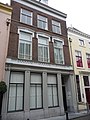
This is a category about rijksmonument number 18360
|
| Address |
|
Media in category "Trans 11, Utrecht"
The following 4 files are in this category, out of 4 total.
-
 Trans 11.JPG 2,592 × 3,456; 4.23 MB
-
 Utrecht - Trans 11 RM18360.JPG 2,350 × 4,476; 777 KB
-
 Utrecht Rijksmonument 18360 Pand Trans 11.JPG 3,240 × 4,320; 4.78 MB
-
 Voorgevel - Utrecht - 20237045 - RCE.jpg 805 × 1,200; 163 KB
