Category:Tram maps of Rhode Island
Jump to navigation
Jump to search
Media in category "Tram maps of Rhode Island"
The following 24 files are in this category, out of 24 total.
-
-
 Electric railway map of eastern New England. LOC 98688386.jpg 7,089 × 10,516; 12.27 MB
-
 Electric railway map of eastern New England. LOC 98688386.tif 7,089 × 10,516; 213.28 MB
-
 1901 Traveler's Map of Eastern New England.png 3,159 × 4,327; 22.59 MB
-
 1905 bird's eye view streetcar map of southern New England.jpg 4,000 × 2,723; 3.08 MB
-
 1907 bird's eye view of trolley routes in New England.jpg 6,672 × 9,580; 17.18 MB
-
 1908 bird's eye view of trolley routes in New England.jpg 4,439 × 6,366; 10.27 MB
-
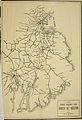
 1908 map of street railways between Boston and Newport.jpg 359 × 899; 114 KB
-
 1908 map of street railways between Boston and Woonsocket.jpg 689 × 523; 75 KB
-
 1908 map of the Newport and Providence Railway.jpg 867 × 1,328; 732 KB
-
 1909 streetcar map of New England.jpg 2,653 × 4,000; 1.66 MB
-
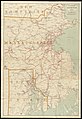
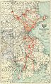
 1910 Rhode Island railroad map.png 2,836 × 3,500; 13.43 MB
-
 1910 Tri-state Trolley Map.jpg 2,864 × 4,740; 3.4 MB
-
 1910s Bay State Street Railway map.png 3,500 × 6,149; 41.66 MB
-
 1911 aerial map of Boston and Northern Street Railway and Old Colony Street Railway.png 3,500 × 6,193; 43.94 MB
-
 1911 Tri-state Trolley Map.png 2,583 × 3,500; 17.01 MB
-
 1912 aerial map of the Bay State Street Railway.png 3,500 × 6,285; 50.46 MB
-
 1916 aerial map of the Bay State Street Railway.png 3,500 × 6,279; 39.4 MB
-
 Birds Eye View of Street Railway Routes in New England, 1904.png 2,392 × 3,500; 20.63 MB
-
 Birds Eye View of Street Railway Routes in New England, 1905.png 3,500 × 5,018; 53.03 MB
-
 By trolley through eastern New England (1904) (14776558855).jpg 2,656 × 3,872; 855 KB
-
 New Haven electric railway subsidiaries.svg 1,400 × 800; 2.29 MB
-
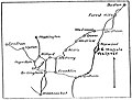
 Norwich and Worcester map.jpg 792 × 550; 138 KB
-
 Shore Line map.JPG 2,013 × 1,983; 624 KB


_(14776558855).jpg)


