Category:Tram maps of Maine
Jump to navigation
Jump to search
Tram maps of Maine
Media in category "Tram maps of Maine"
The following 9 files are in this category, out of 9 total.
-
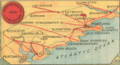
 Map of Electric Railway Lines in Maine c 1907.png 1,164 × 1,528; 1.64 MB
-
 1907 bird's eye view of trolley routes in New England.jpg 6,672 × 9,580; 17.18 MB
-
 1907 map of Atlantic Shore Line Railway and connecting lines.jpg 1,040 × 2,444; 321 KB
-
 1908 bird's eye view of trolley routes in New England.jpg 4,439 × 6,366; 10.27 MB
-
 1908 map of the Atlantic Shore Line Railway.jpg 1,069 × 1,602; 319 KB
-
 1912 map of the Portland Railroad.jpg 946 × 1,687; 422 KB
-
 Birds Eye View of Street Railway Routes in New England, 1904.png 2,392 × 3,500; 20.63 MB
-
 Birds Eye View of Street Railway Routes in New England, 1905.png 3,500 × 5,018; 53.03 MB
-


.png)