Category:Tram maps of Helsinki
Jump to navigation
Jump to search
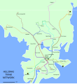
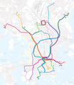
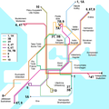
English: Maps of the Helsinki tram network
Suomi: Karttoja Helsingin raitiotieverkosta
Media in category "Tram maps of Helsinki"
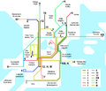
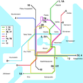
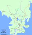
The following 22 files are in this category, out of 22 total.
-
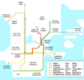 1920 Helsinki tram map.png 1,256 × 1,200; 85 KB
-
 1946 Helsinki tram map.png 1,400 × 1,200; 107 KB
-
 1976 Helsinki tram map.png 1,200 × 1,200; 111 KB
-
 1992 Helsinki tram map.png 1,200 × 1,200; 80 KB
-
 1995 Helsinki tram map.png 1,200 × 1,200; 69 KB
-
 Helsingin raitiotiekartta 1 1932.jpeg 6,440 × 7,304; 4.76 MB
-
 Helsingin-ratikka.png 798 × 983; 128 KB
-
 Helsinki tram lines Sep 2015.png 740 × 809; 141 KB
-
 Helsinki tram lines Sep 2015.svg 744 × 1,052; 70 KB
-
 Helsinki tram lines Sep 2017.png 821 × 899; 177 KB
-
 Helsinki tram lines Sep 2017.svg 740 × 808; 70 KB
-
 Helsinki tram map 2007-05-14 sv.png 1,200 × 1,200; 69 KB
-
 Helsinki tram map 2007-05-14.png 1,200 × 1,200; 67 KB
-
 Helsinki tram map 2008-08-10 sv.png 1,200 × 1,200; 70 KB
-
 Helsinki tram map 2008-08-10.png 1,200 × 1,200; 70 KB
-
 Helsinki tram map 2020.png 1,722 × 1,993; 2.92 MB
-
 Helsinki tram map planned 2010-2025.png 1,869 × 1,390; 127 KB
-
 Helsinki tram map.png 1,200 × 1,200; 98 KB
-
 Hesaskuruna.png 798 × 983; 108 KB
-
 Kruunusillat.png 1,280 × 841; 1.82 MB
-
 Raide-Jokeri.png 3,508 × 2,480; 2.55 MB
-
 Tram route map (41963516964).jpg 3,024 × 4,032; 2.47 MB


.jpg)