Category:Tram maps of Berlin
Jump to navigation
Jump to search
Federal states of Germany:
Media in category "Tram maps of Berlin"
The following 53 files are in this category, out of 53 total.
-
Berlin - Straßenbahn Flexity - Innenaufnahmen (7529069564).jpg 4,096 × 3,072; 2.71 MB
-
Berlin Ostbahnen Karte.png 980 × 908; 2.07 MB
-
Berlin Ostbahnen Streckenausbau Karte.png 980 × 908; 222 KB
-
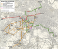
Berlin Tram 88 netzplan.png 1,002 × 430; 63 KB
-
Berlin Tramway December 2022.png 4,219 × 4,548; 10.55 MB
-
Berlin-Charlottenburg-Nord Strassenbahn Jungernheide-Kutschi.png 786 × 766; 763 KB
-
Berlin-Moabit Strassenbahn Turmstrasse-Jungfernheide.png 1,151 × 454; 722 KB
-
Berlin-Schöneweide Station 2024-08.png 1,581 × 962; 1.02 MB
-
Erste Strab in Lio2.svg 875 × 417; 104 KB
-
Friedenstraße Friedricshain Straßenbahn -Juli1936.jpg 1,700 × 867; 889 KB
-
Karte Berliner Dampfstraßenbahn-Konsortium.png 2,032 × 1,791; 4.16 MB
-
Karte Berliner Elektrische Straßenbahnen (BESTAG).jpg 1,636 × 1,789; 2.45 MB
-
Karte der Berlin-Charlottenburger Straßenbahn (BCS).jpg 4,226 × 2,886; 11.03 MB
-
Karte der Straßenbahn Heiligensee.png 662 × 611; 189 KB
-
Karte der Straßenbahn Spandau.png 2,959 × 2,847; 14.86 MB
-
Karte der Straßenbahnen der Stadt Berlin.jpg 5,650 × 4,881; 13.11 MB
-
Karte Flachbahn Berlin.png 2,562 × 2,210; 1.98 MB
-
Karte Friedrichshagener Straßenbahn.png 1,463 × 1,012; 336 KB
-
Karte Neue Pferdebahn Berlin.png 2,095 × 1,562; 1.1 MB
-
Karte Pferdebahn der Gemeinde Französisch-Buchholz.jpg 1,747 × 2,711; 2.8 MB
-
Karte Schmöckwitz-Grünauer Uferbahn.png 2,488 × 2,160; 938 KB
-
Karte Spandau-West–Hennigsdorfer Kleinbahn.jpg 1,904 × 5,663; 10.67 MB
-
Karte Stilllegungen im Streckennetz der BESTAG.png 2,412 × 2,446; 2.82 MB
-
Karte Straßenbahn Adlershof-Altglienicke.png 2,116 × 2,029; 812 KB
-
Karte Straßenbahn der Gemeinde Steglitz.png 2,884 × 1,728; 955 KB
-
Karte Straßenbahn Woltersdorf.png 2,539 × 1,358; 581 KB
-
Karte Städtische Straßenbahn Cöpenick.png 2,385 × 2,880; 1.77 MB
-
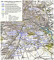
Karte Südliche Berliner Vorortbahn (SBV).jpg 1,818 × 2,018; 5.06 MB
-
Karte Westliche Berliner Vorortbahn.png 4,387 × 3,694; 25.58 MB
-
1881 Strab Strecke.gif 2,560 × 1,254; 152 KB
-
Lindentunnel - Ausführungsplan.jpg 1,169 × 2,030; 1.24 MB
-
Lindentunnel - Vorentwürfe.jpg 1,244 × 1,275; 805 KB
-
Liniennetzplan GBPfE 1881.svg 11,174 × 12,152; 202 KB
-
Liniennetzplan GBS und Nebenbahnen Mai 1914.svg 11,174 × 12,152; 1.39 MB
-
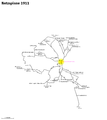
Netzspinne Lindentunnel 1911.png 2,950 × 3,299; 232 KB
-
Netzspinne Lindentunnel 1916.png 2,950 × 3,299; 287 KB
-
Netzspinne Lindentunnel 1938.png 2,950 × 3,299; 229 KB
-
Netzspinne Lindentunnel 1950.png 2,950 × 3,299; 81 KB
-
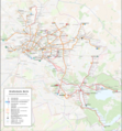
StrabaBln2009.png 1,024 × 846; 196 KB
-
Straßenbahn Berlin Netz August 2024.png 4,219 × 4,548; 9.44 MB
-
Straßenbahn Berlin Netz Dezember 2022.png 4,219 × 4,548; 9.45 MB
-
Straßenbahn Berlin Netz September 2023.png 4,219 × 4,548; 9.45 MB
-
Straßenbahnhaltestelle Dregerhoffstraße-1785.jpg 5,472 × 3,648; 8.95 MB
-
Straßenbahnhaltestelle Lienhardweg-1766.jpg 5,472 × 3,648; 9.06 MB
-
Straßenbahn Berlin Netz 2014.png 4,500 × 4,851; 9.87 MB
-
Straßenbahn Berlin Netz September 2015.png 4,500 × 4,851; 9.36 MB
-
Straßenbahn Groß-Lichterfelde Netzplan.png 3,646 × 2,050; 2.45 MB
-
Straßenbahn Spandau Netzplan.png 7,479 × 7,483; 6.52 MB
-
Teltower Kreisbahnen Netzplan.png 5,917 × 2,389; 9.82 MB
-
The Street railway journal (1900) (14571871197).jpg 1,502 × 2,010; 619 KB
-
U-undStraßenbahnGleisplanBerlinundUmgebung2013.png 20,000 × 14,692; 9.39 MB
-
U-undStraßenbahnGleisplanBerlinundUmgebung2016.png 19,805 × 14,562; 9.37 MB
-
Variantes tram Woltersdorf.svg 1,857 × 709; 1.96 MB


