Category:Trails in Italy
Jump to navigation
Jump to search
- See also: Category:Walking paths in Italy.
Deutsch: Pfade in Italien auch italienischen Wege, Steige, Eselspfade, Maultierpfade
Italiano: Sentiero - Italia
Wikimedia category | |||||
| Upload media | |||||
| Instance of | |||||
|---|---|---|---|---|---|
| |||||
Subcategories
This category has the following 29 subcategories, out of 29 total.
*
.
B
C
H
M
- Trails Monti Lessini (5 F)
P
S
- Sentiero Astaldi (1 F)
- Sentiero Ezio Nicoli (3 F)
- Sentiero Giustino Fortunato (4 F)
V
- Via dei Marsi (17 F)
- Via del latte (6 F)
- Via della Fiaba (22 F)
W
Media in category "Trails in Italy"
The following 80 files are in this category, out of 80 total.
-
 10-2011 paesaggio a Trana - panoramio (3).jpg 1,280 × 853; 762 KB
-

-
 Autumn in a misty forest (Unsplash).jpg 4,000 × 6,000; 5.49 MB
-
 Bike Ride near Ancient Roman Aqueducts (6065537614).jpg 640 × 480; 131 KB
-
 Bunker entrance at the Rilke trail.JPG 3,872 × 2,592; 6.31 MB
-
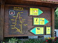
 Cartelli escursionistici thumel.jpg 542 × 600; 106 KB
-
 Charvensod - trail.jpg 3,872 × 2,576; 4.75 MB
-
 Cobbled Steps Trail 587 Corniglia Sep23 A7C 06948.jpg 4,000 × 6,000; 22.87 MB
-
 Dolomiti 07-2010 - panoramio (5).jpg 768 × 1,152; 877 KB
-
 Dolomiti 07-2010 - panoramio (8).jpg 768 × 1,152; 944 KB
-
 Entrata della pineda - panoramio.jpg 1,600 × 1,200; 332 KB
-
 Forcella Nuvolau–Giau Pass trail 01.jpg 5,456 × 3,064; 8.45 MB
-
 Forcella Nuvolau–Giau Pass trail 02.jpg 5,456 × 3,064; 6.47 MB
-
 Forte Fuentes 08-2008 - panoramio.jpg 768 × 1,024; 568 KB
-
 Foto sentiero di montagna Pietra Maura.jpg 1,200 × 1,600; 339 KB
-
 Genoa - trail 2.jpg 3,872 × 2,576; 3.82 MB
-
 Genoa - trail 3.jpg 2,576 × 3,872; 3.4 MB
-
 Genoa - trail.jpg 3,872 × 2,576; 3.38 MB
-
 Genova Borzoli Via Rivassa.jpg 1,865 × 1,661; 983 KB
-
 Genova Molassana mulattiera Creto.jpg 3,648 × 2,736; 2.29 MB
-
 Il sentiero lungo il Santerno - panoramio.jpg 2,592 × 1,944; 3.02 MB
-
 Infopoint Arriach am Alpen Adria Trail.jpg 1,359 × 855; 625 KB
-
 Inside of bunker on Rilke trail.JPG 3,872 × 2,592; 3.94 MB
-
 La strada del Bosco - panoramio.jpg 1,600 × 1,200; 631 KB
-
 Meran 2000 trail on mountain ridge.jpg 10,560 × 3,072; 7.48 MB
-
 Moggessa di Quá Stavoli 2008 1004.JPG 2,592 × 1,944; 1.47 MB
-
 Monte cinto.JPG 2,816 × 2,112; 1.51 MB
-
 Monte Fossa delle Felci (1).jpg 2,736 × 3,648; 4.69 MB
-
 Monte Gemola, sentiero nei pressi del portale di Villa Beatrice d'Este.jpg 2,976 × 3,968; 2.75 MB
-
 Mountain trail.jpg 2,576 × 3,344; 3.42 MB
-
 Mulattiera per "Piazzo" - panoramio.jpg 3,000 × 4,000; 3.89 MB
-
 Parco degli acquedotti 06.JPG 1,600 × 1,071; 469 KB
-
 Parco Stupinigi 10-2011 - panoramio (2).jpg 1,280 × 853; 1.06 MB
-
 Parco Stupinigi 10-2011 - panoramio (3).jpg 1,280 × 853; 978 KB
-
 Parco urbano Camaldoli 3.jpg 1,024 × 768; 179 KB
-
 Parco urbano Giorgio Bassani Ferrara 01.jpg 2,238 × 2,986; 2.18 MB
-
 ParcoDegliAcquedotti (2).JPG 4,000 × 3,000; 4.44 MB
-
 ParcoDegliAcquedotti (3).JPG 4,000 × 3,000; 4.03 MB
-
 ParcoDegliAcquedotti.JPG 4,000 × 3,000; 3.89 MB
-
 ParcodegliAcquedottiRoma (2).JPG 3,000 × 4,000; 4.11 MB
-
 Passeggiata del Crostolo.jpg 2,048 × 1,567; 790 KB
-
 Pieve di Santa Maria della Ciusara immersa nel verde (Bonavigo).jpg 3,434 × 2,577; 1.86 MB
-
 Poggio delle Murciole e Sentiero CAI 50 - panoramio.jpg 2,848 × 2,136; 1.34 MB
-
 Ponte Cardona - Centro Geografico d'Italia.jpg 2,176 × 3,632; 3.88 MB
-
 Punta Fetita, Valle d'Aosta (30806749357).jpg 4,608 × 3,456; 6.5 MB
-
 Riva destra del'Adige sopra Trento.jpg 4,000 × 3,000; 9.73 MB
-
 Sand road.jpg 5,260 × 2,112; 2.91 MB
-
 Saslong2023 RW.jpg 1,973 × 2,601; 1.75 MB
-
 Saslong2023 Zieleinlauf.jpg 2,657 × 4,000; 1.67 MB
-
 Saslong2023 zur Comicihuette.jpg 1,944 × 3,363; 1.61 MB
-
 Segnavia.png 498 × 332; 408 KB
-
 Sentiero 322 ponte cnseria forcella valsorda.png 1,280 × 856; 5.37 MB
-
 Sentiero 50 per il monte Corneta - panoramio (3).jpg 2,848 × 2,136; 1.34 MB
-
 Sentiero che porta al Monte Rusta.jpeg 3,840 × 2,880; 7.76 MB
-
 Sentiero del monte Calva.jpg 2,048 × 1,536; 765 KB
-
 Sentiero del venda.JPG 2,112 × 2,816; 1.42 MB
-
 Sentiero della riserva.jpg 2,048 × 1,536; 691 KB
-
 Sentiero di montagna01.jpg 1,024 × 1,365; 332 KB
-
 Sentiero Frassati.jpg 3,648 × 2,736; 2.56 MB
-
 Sentiero Monte Lozzo 1.jpg 2,448 × 3,264; 4.24 MB
-
 Sentiero Monte Lozzo 2.jpg 2,448 × 3,264; 4.75 MB
-
 Sentiero per Cecani di sotto - panoramio.jpg 2,848 × 2,136; 1.36 MB
-
 Sentiero presso le gole di Celano.jpg 2,592 × 1,936; 1.54 MB
-
 Sentiero Sacra da Chiusa.jpg 640 × 480; 170 KB
-
 Sentiero-Astaldi 2771a.jpg 3,264 × 2,448; 3.87 MB
-
 Strada per Valorsa - panoramio.jpg 2,136 × 2,848; 1.25 MB
-
 Trail 587 Terrace Corniglia Sep23 A7C 06941.jpg 4,000 × 6,000; 17.4 MB
-
 Trail and Massif du Mont-Blanc.jpg 3,872 × 2,576; 3.02 MB
-
 Trail in forest, Italy.jpg 4,771 × 2,030; 3.92 MB
-
 Trail on hill 2.jpg 2,576 × 3,872; 2.86 MB
-
 Trail on hill 3.jpg 3,872 × 2,576; 3.08 MB
-
 Trail on hill.jpg 3,872 × 2,576; 3.37 MB
-
 Trail on mountain.jpg 5,456 × 3,632; 6.23 MB
-
 Valnontey 2.jpg 5,472 × 3,434; 5.7 MB
-
 Vobbia-IMG 0523.JPG 1,920 × 2,560; 2.38 MB
-
 Vulcano Island-Sentiers de randonnée (1).jpg 3,648 × 2,736; 4.65 MB
-
 Vulcano Island-Sentiers de randonnée (2).jpg 3,648 × 2,736; 4.25 MB
-
 Vulcano Island-Sentiers de randonnée (3).jpg 3,648 × 2,736; 4.15 MB
-
 Vulcano Island-Tuf rouge (5).jpg 3,648 × 2,736; 2.16 MB
-
 Vulcano Island-Tuf rouge (9).jpg 3,648 × 2,736; 2.25 MB
.jpg)
_nach_Muggia_(IT).jpg)
.jpg)
.jpg)


.jpg)
.jpg)


.jpg)


.jpg)
.jpg)


.JPG)
.JPG)

.JPG)

.jpg)


.jpg)


.jpg)


.jpg)
.jpg)
.jpg)
.jpg)
.jpg)