Category:Trafford Park
Jump to navigation
Jump to search
area of the Metropolitan Borough of Trafford, Greater Manchester, England  | |||||
| Upload media | |||||
| Instance of | |||||
|---|---|---|---|---|---|
| Location | Trafford, Greater Manchester, North West England, England | ||||
 | |||||
Trafford Park, in Greater Manchester, England
Subcategories
This category has the following 10 subcategories, out of 10 total.
K
P
- Parkway Metrolink station (1 F)
S
- Skyhook, Trafford Park (13 F)
T
- Trafford Park Hotel (15 F)
- Trafford Park TMD (3 F)
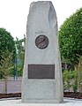
- Trafford Park War Memorial (2 F)
V
- Village Metrolink station (1 F)
Media in category "Trafford Park"
The following 200 files are in this category, out of 249 total.
(previous page) (next page)-
 'Wot's this 'ear mural^' - geograph.org.uk - 4477127.jpg 969 × 1,580; 275 KB
-
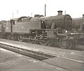 42656 at Trafford Park shed, Manchester - geograph.org.uk - 3729084.jpg 593 × 503; 167 KB
-
 A pile of pallets by Ashburton Road West - geograph.org.uk - 4418607.jpg 6,000 × 4,000; 3.94 MB
-
 A study in grayscale (nearly) - geograph.org.uk - 4477200.jpg 1,064 × 1,580; 188 KB
-
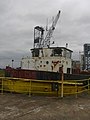 Abandoned Dock complete with Tug - geograph.org.uk - 1466004.jpg 480 × 640; 59 KB
-
 Abandoned Dock Crane - geograph.org.uk - 1466000.jpg 480 × 640; 60 KB
-
 Adidas Group Distribution Centre at Trafford Park - geograph.org.uk - 3099380.jpg 4,000 × 2,248; 4.15 MB
-
 Adidas Group Distribution Centre, Trafford Park - geograph.org.uk - 3098856.jpg 4,000 × 2,248; 1.11 MB
-
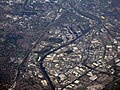
 Aerial photograph of Manchester, Salford and Trafford.jpg 2,048 × 1,536; 3.48 MB
-
 Aerial photograph of Salford and Trafford Park.jpg 2,048 × 1,536; 3.32 MB
-
 Allied Mills and Trafford Hall park - geograph.org.uk - 4477187.jpg 1,280 × 843; 383 KB
-
 Approaching Tenax Circle - geograph.org.uk - 4421124.jpg 6,000 × 4,000; 3.38 MB
-
 Ashburton Road West - Trafford Park - geograph.org.uk - 1972787.jpg 3,264 × 2,448; 1.82 MB
-
 Ashburton Road, Trafford Park - geograph.org.uk - 4479086.jpg 1,280 × 831; 270 KB
-
 B ^ Q Trafford Park - geograph.org.uk - 4419849.jpg 6,000 × 4,000; 4 MB
-
 Barton Dock Road (B5211) - geograph.org.uk - 2586404.jpg 640 × 480; 142 KB
-
 Barton Dock Road (B5211) - geograph.org.uk - 2586412.jpg 640 × 480; 137 KB
-
 Blue plaque, Ford Motor Company - geograph.org.uk - 6054614.jpg 1,280 × 1,215; 1,020 KB
-
 Bowlers Exhibition Centre - geograph.org.uk - 4088163.jpg 3,072 × 1,728; 1.09 MB
-
 Bridge over Tenax Road - geograph.org.uk - 2586385.jpg 1,280 × 960; 544 KB
-
 Bridgewater Canal - geograph.org.uk - 4095264.jpg 3,888 × 2,592; 1.74 MB
-

-
 Bridgewater Canal in Trafford Park - geograph.org.uk - 4479118.jpg 1,280 × 853; 404 KB
-
 Bridgewater Canal in Trafford Park - geograph.org.uk - 4479119.jpg 1,280 × 853; 326 KB
-
 Bridgewater Canal in Trafford Park - geograph.org.uk - 4479133.jpg 1,280 × 839; 355 KB
-
 Bridgewater Canal, Ashburton Road Bridge - geograph.org.uk - 2306464.jpg 1,280 × 960; 669 KB
-
 Bridgewater Canal, Trafford Park - geograph.org.uk - 2306462.jpg 1,280 × 960; 704 KB
-
 Bridgewater Canal, Trafford Park - geograph.org.uk - 2306471.jpg 1,280 × 960; 730 KB
-
 Bridgewater Canal, Trafford Park - geograph.org.uk - 2306473.jpg 1,280 × 960; 748 KB
-
 Bridgewater Canal, Trafford Park - geograph.org.uk - 2306682.jpg 1,280 × 960; 481 KB
-

-

-
 BridgewaterCanalHijskraan.JPG 2,272 × 1,704; 853 KB
-

-
 Cargill chemicals site - geograph.org.uk - 4477195.jpg 1,280 × 854; 205 KB
-
 Cargill chemicals site - geograph.org.uk - 4477201.jpg 1,053 × 1,580; 431 KB
-
 Cargill, Trafford Park - geograph.org.uk - 4421130.jpg 6,000 × 4,000; 5.2 MB
-
 Centenary Bridge and Allied Mills - geograph.org.uk - 4477191.jpg 989 × 1,580; 245 KB
-
 Circle Court near M60 Roundabout - geograph.org.uk - 1974695.jpg 3,264 × 2,448; 1.97 MB
-
 Container terminal by Barton Dock Road - geograph.org.uk - 4421067.jpg 6,000 × 4,000; 7.34 MB
-
 Cracking towers - geograph.org.uk - 4479095.jpg 1,147 × 1,580; 425 KB
-
 Davyhulme Road, Trafford Park - geograph.org.uk - 1130180.jpg 640 × 480; 146 KB
-
 Derelict railway in Trafford Park - geograph.org.uk - 4477145.jpg 1,280 × 853; 379 KB
-
 Disused level crossing on Trafford Park Road - geograph.org.uk - 4477141.jpg 1,280 × 843; 400 KB
-
 Disused level crossing on Trafford Park Road - geograph.org.uk - 4477144.jpg 1,280 × 853; 449 KB
-
 Disused Railway, Trafford Park - geograph.org.uk - 2306680.jpg 1,280 × 960; 710 KB
-
 Electric generation units in Trafford Park - geograph.org.uk - 4479124.jpg 1,280 × 853; 283 KB
-
 Elevator Road - geograph.org.uk - 4477121.jpg 1,053 × 1,580; 384 KB
-
 Eleventh street trafford park 1910.jpg 1,311 × 732; 174 KB
-
 Empty containers piled up - geograph.org.uk - 4421035.jpg 6,000 × 4,000; 7.44 MB
-
 End of the line in more ways then one - geograph.org.uk - 2992965.jpg 640 × 480; 184 KB
-
 End Of The Line, Trafford Park - geograph.org.uk - 1130263.jpg 640 × 480; 202 KB
-
 Entrance to Trafford Park - geograph.org.uk - 1466028.jpg 640 × 540; 74 KB
-
 Europa Way, Trafford Park - geograph.org.uk - 2992969.jpg 640 × 480; 124 KB
-
 Europa Way, Trafford Park - geograph.org.uk - 2992970.jpg 640 × 480; 125 KB
-

-
 Extinct railway at Trafford Park - geograph.org.uk - 5771942.jpg 1,600 × 1,066; 437 KB
-
 Footpath Near Redclyffe Circle - geograph.org.uk - 5688264.jpg 2,784 × 1,568; 2.04 MB
-
 Ford Motor Company at Trafford Park - geograph.org.uk - 6054630.jpg 1,280 × 914; 856 KB
-
 Foundation stone from the Westinghouse factory - geograph.org.uk - 4479148.jpg 1,280 × 850; 504 KB
-
 Freightliner Terminal - geograph.org.uk - 1705573.jpg 1,024 × 768; 111 KB
-
 Gas Holder - Trafford Park - geograph.org.uk - 1974649.jpg 3,264 × 2,448; 1.93 MB
-
 Goods Line towards Trafford Park - geograph.org.uk - 1705587.jpg 1,600 × 1,200; 487 KB
-
 Gorse Hill, canal - geograph.org.uk - 1472563.jpg 640 × 480; 99 KB
-
 Green space on Trafford Wharf Road - geograph.org.uk - 3528416.jpg 800 × 600; 148 KB
-
 Guinness Trading Estate, Trafford Park - geograph.org.uk - 4418596.jpg 6,000 × 4,000; 4.62 MB
-
 Harp Road, Trafford Park - geograph.org.uk - 4477210.jpg 1,280 × 852; 242 KB
-
 Harp Trading Estate - geograph.org.uk - 4477215.jpg 1,280 × 841; 293 KB
-
 Harp Trading Estate, Trafford Park - geograph.org.uk - 2292499.jpg 4,434 × 2,951; 7.29 MB
-
 Harp Trading Estate, Trafford Park - geograph.org.uk - 4418587.jpg 6,000 × 4,000; 4.04 MB
-
 Icopal Limited, Trafford Park.JPG 4,608 × 3,456; 3.34 MB
-
 Industrial landscape, Trafford Park - geograph.org.uk - 2205972.jpg 640 × 480; 55 KB
-
 Industrial landscape, Trafford Park - geograph.org.uk - 2205977.jpg 640 × 480; 51 KB
-
 Industry ! (6803549416).jpg 3,290 × 4,370; 4.24 MB
-
 Industry ! (6803549906).jpg 3,290 × 4,370; 3.73 MB
-
 Industry ! (6949658105).jpg 3,290 × 4,370; 3.19 MB
-
 Industry ! (6949659495).jpg 3,290 × 4,370; 3.46 MB
-
 Industry ! Part of the Cargill Plant, Trafford Park (6803423560).jpg 4,420 × 3,340; 1.4 MB
-
 Industry ! Part of the Cargill Plant, Trafford Park (6803424986).jpg 4,370 × 3,290; 4.82 MB
-
 Industry ! Part of the Cargill Plant, Trafford Park (6949534373).jpg 3,290 × 4,370; 3.81 MB
-
 Industry ! Part of the Cargill Plant, Trafford Park (6949535763).jpg 4,370 × 3,290; 4.92 MB
-
 Industry (8020585451).jpg 4,340 × 2,452; 1.35 MB
-
 Inside Mode Wheel Lock - geograph.org.uk - 142607.jpg 640 × 480; 79 KB
-
-
 Junction of Mosley Road and Village Way - geograph.org.uk - 5314615.jpg 1,024 × 867; 732 KB
-
 Kellogg's - geograph.org.uk - 5360009.jpg 3,456 × 3,683; 1.97 MB
-
 Kendal Road - geograph.org.uk - 1707901.jpg 1,600 × 1,200; 570 KB
-
 Lake view 2 @ Trafford Ecology Park - panoramio.jpg 4,000 × 3,000; 2.55 MB
-
 Lake View Trafford Ecology Park - panoramio.jpg 4,000 × 3,000; 2.52 MB
-
-

-
 Looking towards Trafford Park from the A56 - geograph.org.uk - 1712785.jpg 1,600 × 1,200; 508 KB
-
 Manchester Docks from south circa 1930.jpg 3,008 × 1,392; 334 KB
-
 Manchester Dry Dock - geograph.org.uk - 453189.jpg 640 × 443; 57 KB
-
 Manchester Dry Docks - geograph.org.uk - 377435.jpg 418 × 640; 66 KB
-
 Manchester Dry Docks. - geograph.org.uk - 377466.jpg 640 × 424; 58 KB
-
 Manchester Ship Canal Railway, Barton Dock Road (1).JPG 4,608 × 3,456; 3.65 MB
-
 Manchester Ship Canal Railway, Barton Dock Road (2).JPG 4,608 × 3,456; 3.67 MB
-
 Manchester Ship Canal Railway, Barton Dock Road (3).JPG 4,608 × 3,456; 3.46 MB
-
 Manchester Ship Canal Railway, Barton Dock Road (4).JPG 4,608 × 3,456; 3.41 MB
-
-

-
 Marshall Stevens Memorial Plaque - geograph.org.uk - 4171346.jpg 640 × 480; 298 KB
-
-
 MarshallStevensMemorial.jpg 1,462 × 1,883; 1.7 MB
-
 Mooring anyone^ - geograph.org.uk - 533742.jpg 640 × 477; 70 KB
-
 Mosley Road, Trafford Park - geograph.org.uk - 4477139.jpg 1,280 × 840; 288 KB
-
 Nash Road, Trafford Park - geograph.org.uk - 2303843.jpg 4,592 × 3,056; 5.78 MB
-
 Neglected cycle route by Park Way - geograph.org.uk - 4421062.jpg 6,000 × 4,000; 4.21 MB
-
 New buildings on Marland Way - geograph.org.uk - 1707931.jpg 1,600 × 1,200; 473 KB
-
 New flats next to the canal - geograph.org.uk - 1712782.jpg 1,600 × 1,200; 491 KB
-

-
 Park Road Railway Bridge, Trafford Park - geograph.org.uk - 1130185.jpg 640 × 480; 139 KB
-
 Park Road, Trafford Park - geograph.org.uk - 1130182.jpg 640 × 480; 150 KB
-
 Park Road, Trafford Park - geograph.org.uk - 2618103.jpg 640 × 480; 153 KB
-
 Park Road, Trafford Park - geograph.org.uk - 4479129.jpg 1,280 × 839; 389 KB
-
 Park Way, Trafford Park - geograph.org.uk - 4421103.jpg 6,000 × 4,000; 5.55 MB
-
 Parkway Circle - geograph.org.uk - 1778327.jpg 3,264 × 2,448; 1.35 MB
-
 Parkway Circle - geograph.org.uk - 4421115.jpg 5,697 × 3,798; 4.13 MB
-
 Parkway Flyover - geograph.org.uk - 2586409.jpg 640 × 480; 172 KB
-
 Postboxes on Trafford Wharf Road - geograph.org.uk - 5314573.jpg 1,024 × 871; 925 KB
-
 Railway beside Europa Way, Trafford Park - geograph.org.uk - 3821593.jpg 1,600 × 1,200; 480 KB
-

-
 Railway crosses a roundabout at Trafford Park - geograph.org.uk - 4211862.jpg 1,024 × 768; 173 KB
-
 Railway Line, Barton Dock Road - geograph.org.uk - 2618101.jpg 640 × 480; 205 KB
-
 Railway lines, Trafford Park - geograph.org.uk - 2992948.jpg 640 × 480; 163 KB
-
 Rank Hovis Flour Mill - geograph.org.uk - 3824511.jpg 1,600 × 1,064; 276 KB
-

-
 Rank Hovis Mill - geograph.org.uk - 2684606.jpg 1,280 × 960; 566 KB
-
 Rank Hovis Mill, Elevator Road - geograph.org.uk - 4683698.jpg 480 × 640; 448 KB
-
 Rank Hovis works, Trafford Park - geograph.org.uk - 4477122.jpg 1,280 × 841; 277 KB
-
 Roundabout in Trafford Park - geograph.org.uk - 3528417.jpg 800 × 600; 139 KB
-
 Rydal Road - geograph.org.uk - 1707892.jpg 1,024 × 768; 123 KB
-
 Screwfix outlet at Trafford Park, Manchester, England.jpg 640 × 480; 171 KB
-
 Silent Cargoes - geograph.org.uk - 3823661.jpg 640 × 426; 69 KB
-
 Silent Cargoes, Wharfside Promenade - geograph.org.uk - 2398464.jpg 1,280 × 960; 537 KB
-
 Sky Hook at Trafford Park - geograph.org.uk - 5652554.jpg 1,280 × 1,115; 931 KB
-
 Sky Hook at Trafford Park - geograph.org.uk - 5652556.jpg 1,280 × 2,077; 1.55 MB
-
 Small marina - geograph.org.uk - 1707939.jpg 1,600 × 1,200; 413 KB
-

-
-
 St. Modwen Road - geograph.org.uk - 1766801.jpg 1,024 × 683; 157 KB
-
 St. Modwen Road and branch line - geograph.org.uk - 1766793.jpg 1,024 × 683; 154 KB
-
 Stacked containers at Trafford Park - geograph.org.uk - 2052863.jpg 1,280 × 856; 369 KB
-
 Stacked containers at Trafford Park - geograph.org.uk - 2052939.jpg 1,280 × 856; 243 KB
-
 Stairs among the silos - geograph.org.uk - 4477124.jpg 1,111 × 1,580; 367 KB
-
 Steps - geograph.org.uk - 5765447.jpg 3,018 × 2,167; 1.37 MB
-
 Steps to a railway crossing - geograph.org.uk - 1766739.jpg 1,024 × 683; 125 KB
-
 Stobart-spotter's delight - geograph.org.uk - 4418615.jpg 6,000 × 4,000; 6.49 MB
-
 Taking a right turn - geograph.org.uk - 1500520.jpg 640 × 479; 119 KB
-
 Tank in the middle of a roundabout - geograph.org.uk - 4477207.jpg 1,280 × 846; 333 KB
-
 Tank with a hat - geograph.org.uk - 4477151.jpg 1,280 × 842; 252 KB
-
 Tenax Circle - geograph.org.uk - 1778330.jpg 3,264 × 2,448; 1.35 MB
-
 The Big Ditch Shipping Company Yard - geograph.org.uk - 1465978.jpg 640 × 480; 77 KB
-
 The Bridgewater Canal at Trafford Park - geograph.org.uk - 2050642.jpg 3,564 × 2,471; 3.15 MB
-
 The Bridgewater Canal near the Eurofreight terminal - geograph.org.uk - 2050575.jpg 3,587 × 2,471; 2.71 MB
-
 The end of Clarence Avenue - geograph.org.uk - 2293521.jpg 4,400 × 2,459; 6.71 MB
-
 The end of Trafford Park Road - geograph.org.uk - 4477152.jpg 1,280 × 825; 336 KB
-

-
 The Schoolhouse, Trafford Village - geograph.org.uk - 4479144.jpg 1,280 × 853; 365 KB
-
 The Schoolhouse, Trafford Village - geograph.org.uk - 4479145.jpg 1,280 × 853; 382 KB
-
 The start of Marshall Stevens Way, Trafford Park - geograph.org.uk - 2300068.jpg 4,179 × 2,274; 7.38 MB
-
 The Strip - geograph.org.uk - 4418626.jpg 6,000 × 4,000; 5.12 MB
-
 The Village Inn, Trafford Village - geograph.org.uk - 4479137.jpg 1,280 × 838; 283 KB
-
 The vortex, Waters Meeting - geograph.org.uk - 533745.jpg 640 × 477; 140 KB
-
 Third Avenue shops, Trafford Village - geograph.org.uk - 4476823.jpg 1,280 × 860; 335 KB
-

-
 Three black silos - geograph.org.uk - 4477163.jpg 1,052 × 1,580; 262 KB
-
 Toppled cube with slide - geograph.org.uk - 3823653.jpg 1,600 × 1,064; 493 KB
-

-
 Trafford - geograph.org.uk - 3606014.jpg 3,672 × 2,056; 1.19 MB
-
 Trafford ecology park.jpg 3,498 × 2,322; 1.8 MB
-
 Trafford Park (6621395719).jpg 4,320 × 3,240; 5.6 MB
-
 Trafford Park (6621397275).jpg 2,573 × 4,320; 3.71 MB
-
 Trafford Park (6621422943).jpg 4,320 × 3,240; 4.68 MB
-
 Trafford Park (6621448065).jpg 3,240 × 4,320; 4.62 MB
-
 Trafford Park (6621458873).jpg 3,240 × 4,320; 4.77 MB
-
 Trafford Park (6621469699).jpg 3,240 × 4,320; 5.28 MB
-
 Trafford Park (6621488689).jpg 4,320 × 3,240; 5.22 MB
-
 Trafford Park - geograph.org.uk - 2306686.jpg 1,280 × 960; 907 KB
-
 Trafford Park - geograph.org.uk - 2586387.jpg 640 × 480; 196 KB
-
 Trafford Park - geograph.org.uk - 5360097.jpg 3,456 × 5,184; 1.9 MB
-

-

-
 Trafford Park from the air - geograph.org.uk - 5473631.jpg 640 × 480; 228 KB
-
 Trafford Park from the air - geograph.org.uk - 5473635.jpg 640 × 480; 232 KB
-
 Trafford park marshall stevens monument third avenue.jpg 2,040 × 3,504; 1.27 MB
-
 Trafford Park Mural - geograph.org.uk - 6479216.jpg 1,536 × 2,048; 1.12 MB
-
 Trafford park old entrance lodge.jpg 3,504 × 2,336; 1.18 MB
-
 Trafford park railway.jpg 3,441 × 2,236; 1.66 MB
-
 Trafford Park Telephone Exchange - geograph.org.uk - 5671410.jpg 640 × 480; 422 KB
-

-
 Trafford park third avenue.jpg 3,474 × 2,316; 1.36 MB
-

-
 Trafford Park world freight centre - geograph.org.uk - 5771944.jpg 1,600 × 1,066; 423 KB
-
 Trafford Park, Ashburton Road West - geograph.org.uk - 2306451.jpg 1,280 × 960; 518 KB
-
 Trafford Park, Brenntag - geograph.org.uk - 3275137.jpg 1,024 × 768; 115 KB
-
 Trafford Park, canal - geograph.org.uk - 1472599.jpg 640 × 480; 82 KB
-
 Trafford Park, canal junction - geograph.org.uk - 1472577.jpg 640 × 480; 100 KB
-
 Trafford Park, Elevator Road - geograph.org.uk - 4683701.jpg 640 × 480; 431 KB


_-_geograph.org.uk_-_4477200.jpg)


_-_geograph.org.uk_-_2586404.jpg)
_-_geograph.org.uk_-_2586412.jpg)


.jpg)
.jpg)
.jpg)
.jpg)
.jpg)
.jpg)
.jpg)
.jpg)
.jpg)


.JPG)
.JPG)
.JPG)
.JPG)


_-_geograph.org.uk_-_3364970.jpg)


.jpg)
.jpg)
.jpg)
.jpg)
.jpg)
.jpg)
.jpg)


