Category:Traditional Chinese maps of Japan
Jump to navigation
Jump to search
Countries of Asia: Japan · South Korea
Media in category "Traditional Chinese maps of Japan"
The following 12 files are in this category, out of 12 total.
-
 Chugoku Region Administration Map TC.png 600 × 600; 43 KB
-
 Eight regions of Japan (zh-hant).svg 1,397 × 1,593; 473 KB
-
 JAB (zh-hant).png 1,341 × 870; 484 KB
-
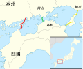
 Japan map hiroshima nagasaki-hant.png 508 × 600; 58 KB
-
 JapanGE20014 (zh-hant).svg 659 × 1,232; 93 KB
-
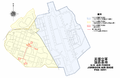
 Kanto Region Administration Map TC.png 600 × 600; 42 KB
-
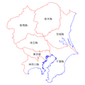
 Kinki Region Administration Map TC.png 600 × 600; 45 KB
-
 Map of Honshu-Shikoku Bridge Project (zh-hant).svg 1,170 × 966; 302 KB
-
 Ordinance designed Cities (zh-hant).svg 595 × 842; 1.59 MB
-
 Regions and Prefectures of Japan (zh-hant).svg 2,480 × 3,175; 258 KB
-
 Shikoku Region Administration Map TC.png 600 × 600; 43 KB
-
 Tohoku Region Administration Map TC.png 600 × 600; 34 KB

.svg)
.png)
.svg)


.svg)
.svg)
.svg)

