Category:Townlands of County Galway
Jump to navigation
Jump to search
Wikimedia category | |||||
| Upload media | |||||
| Instance of | |||||
|---|---|---|---|---|---|
| |||||
Subcategories
This category has the following 133 subcategories, out of 133 total.
A
- Aille, County Galway (5 F)
- Ardnasillagh (2 F)
B
- Ballintleva (11 F)
- Ballybackagh, County Galway (7 F)
- Ballyboy , County Galway (2 F)
- Ballygarriff, County Galway (7 F)
- Ballymoneen, County Galway (6 F)
- Ballynagran, County Galway (5 F)
- Ballynahown North (10 F)
- Ballynahown South (5 F)
- Ballynamanagh West (7 F)
- Banraghbaun South (6 F)
- Bushypark, County Galway (5 F)
C
- Caherfinesker, County Galway (5 F)
- Caherglassaun, County Galway (2 F)
- Cahermore, County Galway (2 F)
- Cahernashilleeny (5 F)
- Caraunduff, County Galway (4 F)
- Caraunkeelwy (1 F)
- Carnmore West (4 F)
- Carrowkilleen, County Galway (3 F)
- Cartronlahan, County Galway (2 F)
- Castle Ellen, County Galway (7 F)
- Castlelambert (6 F)
- Clooniff, County Galway (5 F)
- Clooshgereen, County Galway (6 F)
- Cloran, County Galway (3 F)
- Coldwood (6 F)
- Coolsrahra, County Galway (6 F)
- Cornarona, County Galway (4 F)
- Cossaun, County Galway (4 F)
- Crannagh, County Galway (5 F)
- Cregaclare Demesne (9 F)
- Crumlin, County Galway (6 F)
- Curraveha (2 F)
D
- Deerpark, Athenry (1 F)
- Derrycrih, County Galway (7 F)
- Derrykyle, County Galway (7 F)
- Derryloughaun, County Galway (8 F)
- Derryvokeel, County Galway (3 F)
- Dog Island, County Galway (3 F)
- Drummaveg, County Galway (6 F)
- Duniry, County Galway (6 F)
F
- Finisklin, County Galway (8 F)
- Formaoil, County Galway (16 F)
- Forramoyle, County Galway (7 F)
- Frenchfort, County Galway (11 F)
G
- Garrafrauns (8 F)
- Glenicmurrin, County Galway (6 F)
- Glenmore, County Galway (5 F)
- Glennascaul, County Galway (7 F)
- Gortnaglogh, County Galway (4 F)
- Grange East, County Galway (9 F)
- Grange, County Galway (9 F)
- Grannagh, County Galway (5 F)
K
- Killagoola, County Galway (8 F)
- Kilroe West, County Galway (12 F)
- Kilskeagh, County Galway (6 F)
- Kiniska (2 F)
- Knockadoagh, County Galweay (10 F)
- Knockanranny, County Galway (6 F)
- Knockawuddy, County Galway (3 F)
- Knockbaun (1 F)
- Kylebrack, County Galway (8 F)
L
- Laragh Beg, County Galway (5 F)
- Laughil, County Galway (7 F)
- Lavally, County Galway (4 F)
- Lealetter, County Galway (5 F)
- Lecarrow, County Galway (4 F)
- Lettercallow, County Galway (8 F)
- Letterfir, County Galway (16 F)
- Lettergunnet, County Galway (4 F)
- Lettermuckoo, County Galway (7 F)
- Lissarulla, County Galway (6 F)
- Loughaunbeg, County Galway (9 F)
M
- Minna, County Galway (3 F)
- Mira, County Galway (9 F)
- Moanbaun, County Galway (7 F)
- Moneymore, County Galway (13 F)
- Moneyteige, County Galway (4 F)
- Moy, County Galway (4 F)
- Moyveela, County Galway (6 F)
N
- Newford, County Galway (3 F)
- Newtown, County Galway (10 F)
O
- Oddacres, County Galway (2 F)
- Oranbeg, County Galway (3 F)
P
- Palmerstown, County Galway (12 F)
- Pollagooil (1 F)
- Polleeny, County Galway (5 F)
- Polleha, County Galway (11 F)
- Pollnaclogha, County Galway (8 F)
R
- Rathmorrissy, County Galway (3 F)
- Roskeeda Townland, County Galway (10 F)
- Rusheeny, County Galway (8 F)
S
- Shannaghmore, County Galway (3 F)
- Shannagurraun, County Galway (6 F)
- Shannawoneen, County Galway (6 F)
- Shantallow, County Galway (6 F)
- Slieveaneena, County Galway (7 F)
T
- Tarramud, County Galway (3 F)
- Teeranea, County Galway (5 F)
- Tobberoe, County Galway (6 F)
- Toberbrackan, County Galway (3 F)
- Tooreeny, County Galway (3 F)
- Trosca (2 F)
- Tullaghmore, County Galway (9 F)
U
- Uggool, County Galway (10 F)
Media in category "Townlands of County Galway"
The following 200 files are in this category, out of 225 total.
(previous page) (next page)-
 America, Co. Mayo?! Yes, although actually in Co. Galway... (8515600732).jpg 2,000 × 1,531; 1.18 MB
-
 An Cnoc Theas (Knock South) - geograph.org.uk - 1294251.jpg 640 × 427; 183 KB
-
 An Cnoc Theas (Knock South) - geograph.org.uk - 1294254.jpg 640 × 426; 230 KB
-
 An Cnoc Theas (Knock South) - geograph.org.uk - 1294260.jpg 640 × 426; 210 KB
-

-

-
 Ballycuirke townland sign 2010.jpg 3,648 × 2,736; 2.17 MB
-
 Ballydavid Middle - geograph.org.uk - 1259098.jpg 640 × 428; 193 KB
-

-
 Bluebells - Coole Demesne Townland - geograph.org.uk - 1316124.jpg 640 × 480; 120 KB
-
 Brockagh - geograph.org.uk - 1265250.jpg 640 × 426; 193 KB
-
 Brockagh - geograph.org.uk - 1265255.jpg 640 × 427; 187 KB
-
 Brockagh - geograph.org.uk - 1265273.jpg 640 × 428; 169 KB
-
 Brockagh - geograph.org.uk - 1265281.jpg 640 × 427; 195 KB
-
 Caheradine - geograph.org.uk - 1266148.jpg 640 × 427; 196 KB
-
 Caheradine - geograph.org.uk - 1266152.jpg 640 × 426; 196 KB
-
 Caheradrine - geograph.org.uk - 1266730.jpg 640 × 426; 187 KB
-
 Caheradrine - geograph.org.uk - 1266732.jpg 640 × 425; 192 KB
-
 Caherateemore North - geograph.org.uk - 1258260.jpg 640 × 427; 185 KB
-
 Caherateemore North - geograph.org.uk - 1258269.jpg 640 × 426; 182 KB
-
 Caherateemore South - geograph.org.uk - 1258136.jpg 640 × 426; 200 KB
-
 Caherateemore South - geograph.org.uk - 1258175.jpg 640 × 428; 181 KB
-
 Caherateemore South - geograph.org.uk - 1258181.jpg 640 × 426; 161 KB
-
 Caherbriskaun - geograph.org.uk - 1261081.jpg 640 × 426; 179 KB
-
 Caherbriskaun - geograph.org.uk - 1261085.jpg 640 × 426; 181 KB
-
 Caherbriskaun - geograph.org.uk - 1261136.jpg 640 × 427; 196 KB
-
 Caherbriskaun - geograph.org.uk - 1261144.jpg 640 × 426; 189 KB
-
 Caherbulligin - geograph.org.uk - 1266144.jpg 640 × 426; 191 KB
-
 Cahercrin - geograph.org.uk - 1263287.jpg 640 × 426; 211 KB
-
 Cahercrin - geograph.org.uk - 1263288.jpg 640 × 427; 191 KB
-
 Cahercrin - geograph.org.uk - 1263293.jpg 640 × 426; 182 KB
-
 Cahercrin - geograph.org.uk - 1263297.jpg 640 × 426; 221 KB
-
 Cahercrin - geograph.org.uk - 1263300.jpg 640 × 426; 211 KB
-
 Construction site - Caherdaly Townland - geograph.org.uk - 1319446.jpg 640 × 480; 101 KB
-
 Caherfurvaus - geograph.org.uk - 1263876.jpg 640 × 427; 204 KB
-
 Caherfurvaus - geograph.org.uk - 1263884.jpg 640 × 426; 208 KB
-
 Cahernahoon - geograph.org.uk - 1256625.jpg 640 × 426; 204 KB
-
 Cahernahoon - geograph.org.uk - 1256628.jpg 640 × 427; 184 KB
-
 Cahernahoon - geograph.org.uk - 1256637.jpg 640 × 427; 181 KB
-
 Caorán an Chosáin (Keeraunacussaun) - geograph.org.uk - 1269506.jpg 640 × 426; 207 KB
-
 Caorán an Chosáin (Keeraunacussaun) - geograph.org.uk - 1269511.jpg 640 × 426; 201 KB
-
 Caorán an Chosáin (Keeraunacussaun) - geograph.org.uk - 1269513.jpg 640 × 425; 169 KB
-
 Carheenadiveane - geograph.org.uk - 1263915.jpg 640 × 427; 195 KB
-
 Carheenlea - geograph.org.uk - 1257747.jpg 640 × 426; 200 KB
-
 Carheenlea - geograph.org.uk - 1257757.jpg 640 × 427; 178 KB
-
 Carheenlea - geograph.org.uk - 1258308.jpg 640 × 427; 202 KB
-
 Carheenlea - geograph.org.uk - 1258327.jpg 640 × 427; 160 KB
-
 Carheenlea - geograph.org.uk - 1258333.jpg 640 × 426; 193 KB
-
 Carnaun - geograph.org.uk - 1259539.jpg 640 × 427; 195 KB
-
 Carnaun - geograph.org.uk - 1259544.jpg 640 × 426; 168 KB
-
 Carnaun - geograph.org.uk - 1259547.jpg 640 × 426; 180 KB
-
 Carnmore - geograph.org.uk - 1261612.jpg 640 × 427; 196 KB
-
 Carnmore - geograph.org.uk - 1261615.jpg 640 × 426; 211 KB
-
 Carnmore - geograph.org.uk - 1261621.jpg 640 × 425; 188 KB
-
 Carnmore East - geograph.org.uk - 1257959.jpg 640 × 426; 208 KB
-
 Carnmore East - geograph.org.uk - 1261672.jpg 640 × 426; 206 KB
-
 Carrownrooaun - geograph.org.uk - 1256671.jpg 640 × 427; 214 KB
-
 Carrowreagh East - geograph.org.uk - 1257639.jpg 640 × 426; 170 KB
-
 Carrowreagh East - geograph.org.uk - 1257641.jpg 640 × 428; 210 KB
-
 Carrowreagh East - geograph.org.uk - 1257646.jpg 640 × 426; 179 KB
-
 Carrowreagh West - geograph.org.uk - 1257662.jpg 640 × 427; 145 KB
-
 Carrowreagh West - geograph.org.uk - 1257665.jpg 640 × 428; 169 KB
-
 Carrowreagh West - geograph.org.uk - 1257668.jpg 640 × 426; 191 KB
-
 Castleturvin - geograph.org.uk - 1262790.jpg 640 × 426; 207 KB
-
 Claidhdeach (Clydagh) - geograph.org.uk - 1289802.jpg 640 × 426; 200 KB
-
 Claidhdeach (Clydagh) - geograph.org.uk - 1289808.jpg 640 × 426; 201 KB
-
 Cloondonoghoe - geograph.org.uk - 1263889.jpg 640 × 427; 190 KB
-
 Cloondonoghoe - geograph.org.uk - 1263893.jpg 640 × 426; 220 KB
-
 Cnoc an Tí (Knockatee) - geograph.org.uk - 1271325.jpg 640 × 426; 186 KB
-
 Cnoc ar Easair (Knockarasser) - geograph.org.uk - 1271733.jpg 640 × 426; 186 KB
-
 Cnoc ar Easair (Knockarasser) - geograph.org.uk - 1271736.jpg 640 × 426; 200 KB
-
 Cnoc ar Easair (Knockarasser) - geograph.org.uk - 1288064.jpg 640 × 428; 183 KB
-
 Cnoc ar Easair (Knockarasser) - geograph.org.uk - 1288068.jpg 640 × 428; 206 KB
-
 Cnoc ar Easair (Knockarasser) - geograph.org.uk - 1288070.jpg 640 × 428; 207 KB
-
 Cnoc ar Easair (Knockarasser) - geograph.org.uk - 1288072.jpg 640 × 428; 205 KB
-
 Cnoc Garbh (Knockgarve) - geograph.org.uk - 1271690.jpg 640 × 427; 195 KB
-
 Cnoc Garbh (Knockgarve) - geograph.org.uk - 1271693.jpg 640 × 427; 199 KB
-
 Cnoc na Cathrach (Knocknacarragh) - geograph.org.uk - 1252352.jpg 640 × 428; 177 KB
-
 Cnoc Sheanadh Mhacha (Knockshannavagh) - geograph.org.uk - 1269566.jpg 640 × 426; 214 KB
-
 Coill Bhruachlain (Kylebroghlan) - geograph.org.uk - 1267557.jpg 640 × 427; 164 KB
-
 Coill Bhruachlain (Kylebroghlan) - geograph.org.uk - 1267563.jpg 640 × 428; 177 KB
-
 Coldwood - geograph.org.uk - 1263961.jpg 640 × 427; 189 KB
-
 Corr Chuillinn (Corcullen) - geograph.org.uk - 1289334.jpg 640 × 426; 153 KB
-
 Corr Chuillinn (Corcullen) - geograph.org.uk - 1289340.jpg 640 × 427; 169 KB
-
 Corr Chuillinn (Corcullen) - geograph.org.uk - 1289343.jpg 640 × 426; 218 KB
-
 Cregcarragh - geograph.org.uk - 1254708.jpg 640 × 426; 179 KB
-
 Cregcarragh - geograph.org.uk - 1254713.jpg 640 × 427; 182 KB
-
 Deerpark - geograph.org.uk - 1257047.jpg 640 × 426; 172 KB
-
 Deerpark - geograph.org.uk - 1257052.jpg 640 × 427; 194 KB
-

-
 Derrydonnell - geograph.org.uk - 1262828.jpg 640 × 426; 170 KB
-
 Derrydonnell Beg - geograph.org.uk - 1264488.jpg 640 × 426; 180 KB
-
 Derrydonnell More - geograph.org.uk - 1262837.jpg 640 × 427; 206 KB
-
 Derrydonnell More - geograph.org.uk - 1262845.jpg 640 × 428; 197 KB
-
 Derrydonnell More - geograph.org.uk - 1262859.jpg 640 × 425; 174 KB
-
 Derrydonnell More - geograph.org.uk - 1262884.jpg 640 × 428; 205 KB
-
 Derrydonnell More - geograph.org.uk - 1262890.jpg 640 × 427; 209 KB
-
 Derrydonnell North - geograph.org.uk - 1262298.jpg 640 × 426; 184 KB
-
 Derrydonnell North - geograph.org.uk - 1262304.jpg 640 × 426; 203 KB
-
 Doire an Fhéich (Derrynea) - geograph.org.uk - 1269492.jpg 640 × 426; 172 KB
-
 Doire an Fhéich (Derrynea) - geograph.org.uk - 1269494.jpg 640 × 426; 191 KB
-
 Doire Uachtair (Derryoughter) - geograph.org.uk - 1288028.jpg 640 × 426; 213 KB
-
 Droim an Mhúcháin (Drimmavohaun) - geograph.org.uk - 1267633.jpg 640 × 428; 183 KB
-
 Droim an Mhúcháin (Drimmavohaun) - geograph.org.uk - 1267638.jpg 640 × 428; 200 KB
-
 Droim an Mhúcháin (Drimmavohaun) - geograph.org.uk - 1267641.jpg 640 × 428; 192 KB
-
 Eadargúil (Addragool) - geograph.org.uk - 1289379.jpg 640 × 427; 242 KB
-
 Eadargúil (Addragool) - geograph.org.uk - 1289382.jpg 640 × 427; 197 KB
-
 Eochaire (Oghery) - geograph.org.uk - 1268068.jpg 640 × 426; 202 KB
-
 Eochaire (Oghery) - geograph.org.uk - 1268130.jpg 640 × 427; 170 KB
-
 Eochaire (Oghery) - geograph.org.uk - 1268137.jpg 640 × 426; 177 KB
-
 Eochaire (Oghery) - geograph.org.uk - 1268141.jpg 640 × 428; 167 KB
-
 Eochaire (Oghery) - geograph.org.uk - 1268152.jpg 640 × 426; 201 KB
-
 Fahymactibbot - geograph.org.uk - 1266199.jpg 640 × 427; 205 KB
-
 Fahysvillage - geograph.org.uk - 1259068.jpg 640 × 426; 173 KB
-
 Fahysvillage - geograph.org.uk - 1259071.jpg 640 × 426; 177 KB
-
 Farravaun - geograph.org.uk - 1258864.jpg 640 × 426; 191 KB
-
 Farravaun - geograph.org.uk - 1258866.jpg 640 × 426; 189 KB
-
 Farravaun - geograph.org.uk - 1258869.jpg 640 × 426; 178 KB
-
 Farravaun - geograph.org.uk - 1258878.jpg 640 × 426; 197 KB
-
 Farravaun - geograph.org.uk - 1258881.jpg 640 × 427; 162 KB
-
 Ferroonagh East - geograph.org.uk - 2436500.jpg 640 × 480; 124 KB
-
 Garraun North - geograph.org.uk - 1267193.jpg 640 × 426; 179 KB
-
 Garraun North - geograph.org.uk - 1267196.jpg 640 × 425; 186 KB
-
 Garraun North - geograph.org.uk - 1267199.jpg 640 × 425; 189 KB
-
 Garraun South - geograph.org.uk - 1267185.jpg 640 × 426; 170 KB
-
 Garraun South - geograph.org.uk - 1267191.jpg 640 × 427; 197 KB
-
 Garraun South - geograph.org.uk - 1267252.jpg 640 × 427; 190 KB
-
 Garraun Upper - geograph.org.uk - 1267083.jpg 640 × 426; 204 KB
-
 Garraun Upper - geograph.org.uk - 1267087.jpg 640 × 427; 190 KB
-
 Garrauncreen - geograph.org.uk - 1257183.jpg 640 × 427; 160 KB
-
 Garrauncreen - geograph.org.uk - 1257186.jpg 640 × 426; 194 KB
-
 Glenbrack - geograph.org.uk - 1252200.jpg 640 × 426; 191 KB
-
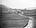
 Fields and village road - geograph.org.uk - 3621217.jpg 640 × 480; 103 KB
-
 Glenrevagh - geograph.org.uk - 1267220.jpg 640 × 426; 184 KB
-
 Gort na Móna (Gortnamona) - geograph.org.uk - 1267704.jpg 640 × 425; 164 KB
-
 Gort na Móna (Gortnamona) - geograph.org.uk - 1267711.jpg 640 × 426; 146 KB
-
 Gortard - geograph.org.uk - 1266738.jpg 640 × 425; 170 KB
-
 Gortard - geograph.org.uk - 1266741.jpg 640 × 426; 186 KB
-
 Gortavaura - geograph.org.uk - 1258792.jpg 640 × 427; 179 KB
-
 Greethill - geograph.org.uk - 1262802.jpg 640 × 426; 188 KB
-
 Greethill - geograph.org.uk - 1262815.jpg 640 × 427; 212 KB
-

-
 Islandmore - geograph.org.uk - 1254702.jpg 640 × 426; 194 KB
-
 Islandmore - geograph.org.uk - 1254704.jpg 640 × 426; 206 KB
-
 Kilcaimin - geograph.org.uk - 1267089.jpg 640 × 426; 183 KB
-
 Kilcaimin - geograph.org.uk - 1267095.jpg 640 × 426; 170 KB
-
 Kiltullagh - geograph.org.uk - 1267246.jpg 640 × 427; 185 KB
-
 Knockatoor - geograph.org.uk - 1263305.jpg 640 × 427; 202 KB
-
 Knockatoor - geograph.org.uk - 1263307.jpg 640 × 428; 176 KB
-
 Knockdoebeg - geograph.org.uk - 1255329.jpg 640 × 426; 229 KB
-
 Knockdoebeg East - geograph.org.uk - 1256606.jpg 640 × 428; 172 KB
-
 Knockdoebeg East - geograph.org.uk - 1256614.jpg 640 × 427; 224 KB
-
 Knockdoebeg West - geograph.org.uk - 1255334.jpg 640 × 427; 164 KB
-
 Knockdoebeg West - geograph.org.uk - 1255337.jpg 640 × 426; 155 KB
-
 Lackagh More - geograph.org.uk - 1257107.jpg 640 × 426; 207 KB
-
 Lackagh More - geograph.org.uk - 1257115.jpg 640 × 427; 186 KB
-
 Lackaghbeg - geograph.org.uk - 1255260.jpg 640 × 428; 186 KB
-
 Lackaghbeg - geograph.org.uk - 1255265.jpg 640 × 426; 183 KB
-
 Lackaghbeg - geograph.org.uk - 1255269.jpg 640 × 426; 177 KB
-
 Laragh More - geograph.org.uk - 1257675.jpg 640 × 426; 181 KB
-
 Laragh More - geograph.org.uk - 1257682.jpg 640 × 427; 183 KB
-

-
 Lecarrow South - geograph.org.uk - 1251964.jpg 640 × 426; 207 KB
-
 Leitir Meas (Lettermas) - geograph.org.uk - 1270735.jpg 640 × 427; 173 KB
-
 Leitir Meas (Lettermas) - geograph.org.uk - 1270736.jpg 640 × 426; 201 KB
-
 Leitir Peíc (Letterpeak) - geograph.org.uk - 1270695.jpg 640 × 426; 208 KB
-
 Leitir Peíc (Letterpeak) - geograph.org.uk - 1270703.jpg 640 × 427; 206 KB
-
 Lisduff - geograph.org.uk - 1251985.jpg 640 × 427; 196 KB
-
 Lisheenavalla - geograph.org.uk - 1257768.jpg 640 × 426; 194 KB
-
 Lisheenavalla - geograph.org.uk - 1257771.jpg 640 × 427; 190 KB
-
 Lisheenkyle East - geograph.org.uk - 1261114.jpg 640 × 426; 172 KB
-
 Lisheenkyle East - geograph.org.uk - 1261123.jpg 640 × 427; 193 KB
-
 Lisheenkyle East - geograph.org.uk - 1261127.jpg 640 × 427; 170 KB
-
 Log an Chaorthainn (Luggakeeraun) - geograph.org.uk - 1292177.jpg 640 × 426; 213 KB
-
 Log an Chaorthainn (Luggakeeraun) - geograph.org.uk - 1292182.jpg 640 × 427; 200 KB
-

-

-

-
 Moneyduff - geograph.org.uk - 1267168.jpg 640 × 426; 197 KB
-
 Mountain North - geograph.org.uk - 1259085.jpg 640 × 427; 170 KB
-
 Moyveela - geograph.org.uk - 1262876.jpg 640 × 426; 168 KB
-
 Moyveela - geograph.org.uk - 1266619.jpg 640 × 426; 169 KB
-
 Mulpit - geograph.org.uk - 1262742.jpg 640 × 426; 194 KB
-
 Na Doiriú Theas (Derroogh South) - geograph.org.uk - 1296579.jpg 640 × 426; 220 KB
-
 Na Doiriú Theas (Derroogh South) - geograph.org.uk - 1296588.jpg 640 × 426; 190 KB
-
 Na Doiriú Theas (Derroogh South) - geograph.org.uk - 1296594.jpg 640 × 426; 188 KB
-
 Na Doiriú Theas (Derroogh South) - geograph.org.uk - 1296598.jpg 640 × 426; 202 KB
-
 Old pier - Lettercaumus Townland - geograph.org.uk - 3113284.jpg 640 × 427; 69 KB
-
 Park - geograph.org.uk - 1259081.jpg 640 × 426; 176 KB
-
 Parkgarve - geograph.org.uk - 1257711.jpg 640 × 426; 190 KB
-
 Parkgarve - geograph.org.uk - 1257715.jpg 640 × 425; 172 KB
-
 Pasture - Corker Kiltartan Townland - geograph.org.uk - 1316127.jpg 640 × 480; 69 KB
-
 Peakroe - geograph.org.uk - 1258096.jpg 640 × 428; 186 KB
-
 Pollnabanny - geograph.org.uk - 1263311.jpg 640 × 426; 187 KB
-
 Pollnabanny - geograph.org.uk - 1263314.jpg 640 × 427; 198 KB
-
 Pollnagroagh - geograph.org.uk - 1259484.jpg 640 × 426; 177 KB
-
 Rathfee - geograph.org.uk - 1258282.jpg 640 × 426; 176 KB
-
 Rathfee - geograph.org.uk - 1258289.jpg 640 × 428; 203 KB
-
 Rathfee - geograph.org.uk - 1258291.jpg 640 × 426; 202 KB
-
 Rathfee - geograph.org.uk - 1258297.jpg 640 × 426; 189 KB
.jpg)
_-_geograph.org.uk_-_1294251.jpg)
_-_geograph.org.uk_-_1294254.jpg)
_-_geograph.org.uk_-_1294260.jpg)


_-_geograph.org.uk_-_1269506.jpg)
_-_geograph.org.uk_-_1269511.jpg)
_-_geograph.org.uk_-_1269513.jpg)


_-_geograph.org.uk_-_1289802.jpg)
_-_geograph.org.uk_-_1289808.jpg)


_-_geograph.org.uk_-_1271325.jpg)
_-_geograph.org.uk_-_1271733.jpg)
_-_geograph.org.uk_-_1271736.jpg)
_-_geograph.org.uk_-_1288064.jpg)
_-_geograph.org.uk_-_1288068.jpg)
_-_geograph.org.uk_-_1288070.jpg)
_-_geograph.org.uk_-_1288072.jpg)
_-_geograph.org.uk_-_1271690.jpg)
_-_geograph.org.uk_-_1271693.jpg)
_-_geograph.org.uk_-_1252352.jpg)
_-_geograph.org.uk_-_1269566.jpg)
_-_geograph.org.uk_-_1267557.jpg)
_-_geograph.org.uk_-_1267563.jpg)

_-_geograph.org.uk_-_1289334.jpg)
_-_geograph.org.uk_-_1289340.jpg)
_-_geograph.org.uk_-_1289343.jpg)


_-_geograph.org.uk_-_1269492.jpg)
_-_geograph.org.uk_-_1269494.jpg)
_-_geograph.org.uk_-_1288028.jpg)
_-_geograph.org.uk_-_1267633.jpg)
_-_geograph.org.uk_-_1267638.jpg)
_-_geograph.org.uk_-_1267641.jpg)
_-_geograph.org.uk_-_1289379.jpg)
_-_geograph.org.uk_-_1289382.jpg)
_-_geograph.org.uk_-_1268068.jpg)
_-_geograph.org.uk_-_1268130.jpg)
_-_geograph.org.uk_-_1268137.jpg)
_-_geograph.org.uk_-_1268141.jpg)
_-_geograph.org.uk_-_1268152.jpg)


_-_geograph.org.uk_-_1267704.jpg)
_-_geograph.org.uk_-_1267711.jpg)


_-_geograph.org.uk_-_1270735.jpg)
_-_geograph.org.uk_-_1270736.jpg)
_-_geograph.org.uk_-_1270695.jpg)
_-_geograph.org.uk_-_1270703.jpg)


_-_geograph.org.uk_-_1292177.jpg)
_-_geograph.org.uk_-_1292182.jpg)


_-_geograph.org.uk_-_1296579.jpg)
_-_geograph.org.uk_-_1296588.jpg)
_-_geograph.org.uk_-_1296594.jpg)
_-_geograph.org.uk_-_1296598.jpg)


