Category:Town walls of Bremgarten
Jump to navigation
Jump to search
| Object location | | View all coordinates using: OpenStreetMap |
|---|
buildings in Bremgarten in the canton of Aargau, Switzerland  | |||||
| Upload media | |||||
| Instance of | |||||
|---|---|---|---|---|---|
| Part of | |||||
| Location | Bremgarten, Bremgarten District, Aargau, Switzerland | ||||
| Street address |
| ||||
| Heritage designation | |||||
 | |||||
Subcategories
This category has the following 3 subcategories, out of 3 total.
Media in category "Town walls of Bremgarten"
The following 11 files are in this category, out of 11 total.
-
 Bremgarten Bollhaus 02.jpg 2,816 × 2,112; 967 KB
-
 Bremgarten gedeckte Brücke.JPG 2,048 × 1,536; 1.48 MB
-
 Bremgarten Hermannsturm 1407.jpg 2,112 × 2,816; 1.05 MB
-
 Bremgarten Hexenturm 14. Jh.jpg 2,112 × 2,816; 1.32 MB
-
 Bremgarten Hexenturm.jpg 1,464 × 2,740; 910 KB
-
 Bremgarten Holzbrücke über die Reuss 05.JPG 3,444 × 2,586; 1.86 MB
-
 Bremgarten Katzentrum Bijou.jpg 2,112 × 2,816; 1.91 MB
-
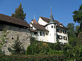 Bremgarten Schloessli Mauer.jpg 1,200 × 900; 323 KB
-
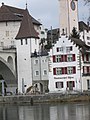
 Bremgarten Stadtmauer Hermannsturm.jpg 2,816 × 2,112; 1.4 MB
-
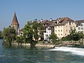 Bremgarten Unterstadt.jpg 1,200 × 900; 241 KB
-
 IMG 1202 alte Farb Hermannsturm.jpg 2,816 × 2,112; 967 KB


