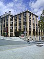
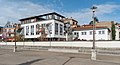
Category:Town hall of Thiers
Jump to navigation
Jump to search
| Object location | | View all coordinates using: OpenStreetMap |
|---|
town hall in Puy-de-Dôme, France   | |||||
| Upload media | |||||
| Instance of | |||||
|---|---|---|---|---|---|
| Location | Thiers, Puy-de-Dôme, Auvergne-Rhône-Alpes, Metropolitan France, France | ||||
| Street address |
| ||||
| Owned by | |||||
| Operator | |||||
 | |||||
Media in category "Town hall of Thiers"
The following 6 files are in this category, out of 6 total.
-
 Ancienne mairie de Thiers.jpg 1,066 × 1,649; 500 KB
-
 Hôtel de ville de Thiers.jpg 3,264 × 1,836; 2.05 MB
-
 Mairie de Thiers.jpg 2,880 × 2,160; 5.09 MB
-
 Thiers Mairie.JPG 1,200 × 1,600; 323 KB
-
 Town hall of Thiers (1).jpg 5,976 × 3,255; 11.78 MB
-
 Town hall of Thiers (2).jpg 3,211 × 4,686; 9.44 MB


.jpg)
.jpg)