Category:Town hall of Saint-Lager
Jump to navigation
Jump to search
| Object location | | View all coordinates using: OpenStreetMap |
|---|
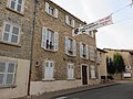
town hall located in Rhône department, France _-_2022-10-31_-_5.jpg) | |||||
| Upload media | |||||
| Instance of |
| ||||
|---|---|---|---|---|---|
| Location | Saint-Lager, Rhône, Auvergne-Rhône-Alpes, Metropolitan France, France | ||||
| Street address |
| ||||
| Has use | |||||
| Owned by | |||||
| Operator | |||||
 | |||||
Media in category "Town hall of Saint-Lager"
The following 7 files are in this category, out of 7 total.
-
 Mairie - Saint-Lager (FR69) - 2022-10-31 - 1.jpg 4,032 × 3,024; 3.51 MB
-
 Mairie - Saint-Lager (FR69) - 2022-10-31 - 2.jpg 4,032 × 3,024; 3.56 MB
-
 Mairie - Saint-Lager (FR69) - 2022-10-31 - 3.jpg 5,976 × 4,756; 27.72 MB
-
 Mairie - Saint-Lager (FR69) - 2022-10-31 - 4.jpg 4,032 × 3,024; 3.77 MB
-
 Mairie - Saint-Lager (FR69) - 2022-10-31 - 5.jpg 4,032 × 3,024; 3.59 MB
-
 Saint-Lager - Mairie (août 2018).jpg 4,608 × 3,456; 4.25 MB
-
 Saint-Lager - Mairie 2 (août 2018).jpg 4,608 × 3,456; 3.83 MB
_-_2022-10-31_-_1.jpg)
_-_2022-10-31_-_2.jpg)
_-_2022-10-31_-_3.jpg)
_-_2022-10-31_-_4.jpg)
.jpg)
.jpg)