Category:Town hall of Rungis
Jump to navigation
Jump to search
| Object location | | View all coordinates using: OpenStreetMap |
|---|
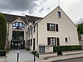
building in Rungis, France  | |||||
| Upload media | |||||
| Instance of | |||||
|---|---|---|---|---|---|
| Location | Rungis, Val-de-Marne, Île-de-France, Metropolitan France, France | ||||
| Street address |
| ||||
| Located on street | |||||
| Owned by | |||||
| Operator | |||||
 | |||||
Media in category "Town hall of Rungis"
The following 4 files are in this category, out of 4 total.
-
 Hôtel ville Rungis 1.jpg 4,032 × 3,024; 4.19 MB
-
 Hôtel ville Rungis 2.jpg 3,024 × 4,032; 4.42 MB
-
 Hôtel ville Rungis 3.jpg 4,032 × 3,024; 3.75 MB
-
 Mairie de Rungis.jpg 2,048 × 1,367; 833 KB


