Category:Town hall of Paris 18e arrondissement
Jump to navigation
Jump to search
|
Paris 1 • 2 • 3 • 4 • 5 • 6 • 7 • 8 • 9 • 10 • 11 • 12 • 13 • 14 • 15 • 16 • 17 • 18 • 19 • 20 |
| Object location | | View all coordinates using: OpenStreetMap |
|---|
district town hall in Paris, France _-_2022-01-29_-_1.jpg)   | |||||
| Upload media | |||||
| Instance of |
| ||||
|---|---|---|---|---|---|
| Location | Paris, Grand Paris, France | ||||
| Street address |
| ||||
| Located on street | |||||
| Architect | |||||
| Has use |
| ||||
| Significant event |
| ||||
| Replaces |
| ||||
| official website | |||||
 | |||||
Subcategories
This category has only the following subcategory.
Media in category "Town hall of Paris 18e arrondissement"
The following 34 files are in this category, out of 34 total.
-
 336 - PARIS - La Mairie du XVIIIe Arrondissement, CP1519.jpg 3,000 × 1,919; 1.57 MB
-
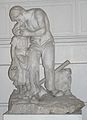 Jules Pendariès Le Paysan.jpg 2,100 × 2,895; 1.34 MB
-
 Justice de Paix (15183696294).jpg 3,329 × 4,749; 3.08 MB
-
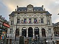
 Mairie 18. Arrondissement (Paris) 1.jpg 3,714 × 2,953; 3.21 MB
-
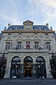
 Mairie 18. Arrondissement (Paris) 2.jpg 3,763 × 2,936; 3.83 MB
-
 Mairie 18e arrondissement Paris 1.jpg 5,302 × 4,471; 18.95 MB
-
 Mairie 18e arrondissement Paris 2.jpg 3,456 × 5,184; 5.17 MB
-
 Mairie 18e arrondissement Paris 3.jpg 4,942 × 4,078; 8.95 MB
-
 Mairie 18e arrondissement Paris 4.jpg 5,184 × 3,456; 6.6 MB
-
 Mairie 18e arrondissement Paris 5.jpg 5,012 × 4,360; 16.64 MB
-
 Mairie 18e arrondissement Paris 6.jpg 4,032 × 3,024; 4.25 MB
-
 Mairie 18e arrondissement Paris 7.jpg 4,032 × 3,024; 4.63 MB
-
 Mairie du 18e arrondissement de Paris Entrée Bibliothèque municipale 2019 1.jpg 2,592 × 3,872; 3.43 MB
-
 Mairie du 18e arrondissement de Paris Entrée Bibliothèque municipale 2019 2.jpg 2,592 × 3,872; 3.75 MB
-
 Mairie du 18e arrondissement de Paris Entrée Justice de Paix 2019.jpg 2,592 × 3,872; 3.42 MB
-
 Mairie du 18e arrondissement de Paris Façade Rue Duc 2019.jpg 3,872 × 2,592; 3.59 MB
-
 Mairie du 18e arrondissement de Paris.jpg 4,543 × 3,648; 3.86 MB
-
 Mairie XVIII2.jpg 1,000 × 753; 127 KB
-
 Mairie XVIIIe Arrondissement - Paris XVIII (FR75) - 2022-01-29 - 1.jpg 5,250 × 4,999; 21.3 MB
-

-
 Panneau 18e Mairie du XVIIIe arrondissement.jpg 1,366 × 2,048; 1.29 MB
-
 Paris 18 City hall, Paris 26 December 2016.jpg 3,648 × 5,472; 9.64 MB
-
 Paris Mairie du 18e188.JPG 2,592 × 3,888; 1.96 MB
-
 Paris Mairie du 18e190.JPG 3,888 × 2,592; 3.53 MB
-
 Paris Mairie du 18e191.JPG 3,888 × 2,592; 3.3 MB
-
 Paris Mairie du 18e198.JPG 3,888 × 2,592; 3.49 MB
-
 Paris Mairie du 18e199.JPG 2,592 × 3,888; 2.3 MB
-
 Paris mairie du 18e203.JPG 3,888 × 2,592; 2.93 MB
-
 Paris Mairie du 18e208.JPG 3,888 × 2,592; 2.84 MB
-
 Paris Mairie du 18e210.JPG 2,592 × 3,888; 2.78 MB
-
 ParisMairie18ème retouchée.jpg 1,944 × 2,592; 479 KB
-
 ParisMairie18ème.jpg 1,944 × 2,592; 691 KB
-
 Théodore Rivière Paris.jpg 1,917 × 2,431; 1.56 MB
-
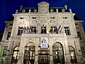 Town hall of Paris 18e arrondissement at night.jpg 3,950 × 2,962; 10.16 MB


.jpg)
_1.jpg)
_2.jpg)


(2).jpg)


