Category:Town hall of Monétay-sur-Allier
Jump to navigation
Jump to search
| Object location | | View all coordinates using: OpenStreetMap |
|---|
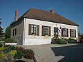
town hall located in Allier department, France  | |||||
| Upload media | |||||
| Instance of |
| ||||
|---|---|---|---|---|---|
| Location | Monétay-sur-Allier, Allier, Auvergne-Rhône-Alpes, Metropolitan France, France | ||||
| Street address |
| ||||
| Has use | |||||
| Owned by | |||||
| Operator | |||||
 | |||||
Media in category "Town hall of Monétay-sur-Allier"
The following 3 files are in this category, out of 3 total.
-
 Mairie de Monétay-sur-Allier 2018-05-07.JPG 2,816 × 2,112; 1.61 MB
-
 Town hall of Monetay-sur-Allier (1).jpg 4,463 × 3,143; 11.05 MB
-
 Town hall of Monetay-sur-Allier (2).jpg 4,010 × 2,673; 10.04 MB
.jpg)
.jpg)