Category:Town hall of Longueil-Sainte-Marie
Jump to navigation
Jump to search
| Object location | | View all coordinates using: OpenStreetMap |
|---|
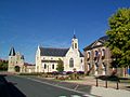
town hall located in Oise department, France ,_mairie,_rue_du_Grand_Ferr%C3%A9.jpg) | |||||
| Upload media | |||||
| Instance of |
| ||||
|---|---|---|---|---|---|
| Location | Longueil-Sainte-Marie, Oise, Hauts-de-France, Metropolitan France, France | ||||
| Street address |
| ||||
| Has use | |||||
| Owned by | |||||
| Operator | |||||
 | |||||
Media in category "Town hall of Longueil-Sainte-Marie"
The following 2 files are in this category, out of 2 total.
-
 Longueil-Sainte-Marie (60), mairie, rue du Grand Ferré.jpg 3,664 × 2,748; 2.15 MB
-
 Longueil-Sainte-Marie (60), manoir, église et mairie.jpg 3,664 × 2,748; 2.11 MB
,_manoir,_%C3%A9glise_et_mairie.jpg)