Category:Town hall of Lavans-lès-Saint-Claude
Jump to navigation
Jump to search
| Object location | | View all coordinates using: OpenStreetMap |
|---|
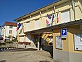
town hall located in Jura department, France .jpg) | |||||
| Upload media | |||||
| Instance of |
| ||||
|---|---|---|---|---|---|
| Location | Lavans-lès-Saint-Claude, Jura, Bourgogne-Franche-Comté, Metropolitan France, France | ||||
| Street address |
| ||||
| Has use | |||||
| Owned by | |||||
| Operator | |||||
 | |||||
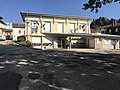
Media in category "Town hall of Lavans-lès-Saint-Claude"
The following 3 files are in this category, out of 3 total.
-
 Lavans-lès-Saint-Claude - Entrée mairie (juil 2018).jpg 3,016 × 4,032; 3.53 MB
-
 Lavans-lès-Saint-Claude - Mairie (juil 2018).jpg 4,032 × 3,016; 3.28 MB
-
 Mairie de Lavans-lès-Saint-Claude.JPG 4,032 × 3,024; 3.86 MB
.jpg)
